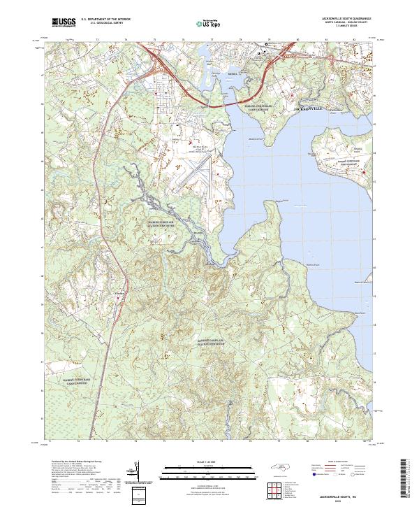
2022 Map of Jacksonville South
USGS Topo · Published 2022About this map
The New River Marine Corps Air Station/McCutcheon Field and the surrounding coastal landscape of Onslow County dominate this 2022 survey. The city of Jacksonville occupies the northern reaches, where Wilson Bay and Stuck Cr meet the New River. The map meticulously documents a region defined by its military installations and veteran honors, including the Montford Point National Cemetery and Coastal Carolina State Veterans Cem located near the river's edge. South of the city, the settlement of Verona sits along the road network leading toward the sprawling marine complex.
Find a feature on this map
141 named features on this map. Tap any name to fly to it.
Don’t see what you’re looking for? This feature index may not catch every label — zoom into the map to look around manually.
Map Details
Editions of this 2022 Jacksonville South Map
This is the sole edition of this map. No revisions or reprints were ever made.
Other maps of this area

1943 · Jacksonville
USGS Topo · 1:62,500

1948 · Maple Hill
USGS Topo · 1:62,500

1948 · New River
USGS Topo · 1:62,500

1948 · Richlands
USGS Topo · 1:62,500

1952 · Camp Lejeune
USGS Topo · 1:24,000

1952 · Jacksonville South
USGS Topo · 1:24,000

1952 · New River Inlet
USGS Topo · 1:24,000

1952 · Sneads Ferry
USGS Topo · 1:24,000

1953 · Beaufort
USGS Topo · 1:250,000

1954 · Beaufort
USGS Topo · 1:250,000
Featured Places
- Jacksonville, NC
- Paradise Park, NC
- Utopia Mobile Home Park, NC
- Plum Point Estates, NC
- Springdale Acres, NC