
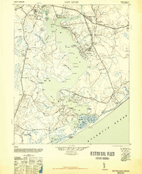
1948 Map of New River
USGS Topo · Published 1948About this map
Marine Base Headquarters and the Marine Barracks anchor this coastal landscape during the late 1940s, a period of significant military transition in Onslow County. The map details the extensive infrastructure supporting the Marine Base, including the Marine Branch of A.C.L.R.R. and the Peters Point Field Glider Base. While the military presence dominates the northern banks of the New River, traditional coastal life remains visible through numerous landings and ferries.
Find a feature on this map
94 named features on this map. Tap any name to fly to it.
Don’t see what you’re looking for? This feature index may not catch every label — zoom into the map to look around manually.
Map Details
Editions of this 1948 New River Map
2 editions found
Other maps of this area

1942 · Spicer Bay
USGS Topo · 1:62,500

1942 · Topsail
USGS Topo · 1:62,500

1942 · Maysville
USGS Topo · 1:62,500

1942 · Swansboro
USGS Topo · 1:62,500

1943 · Jacksonville
USGS Topo · 1:62,500

1948 · Maysville
USGS Topo · 1:62,500

1948 · Maple Hill
USGS Topo · 1:62,500

1948 · Swansboro
USGS Topo · 1:62,500

1948 · Topsail
USGS Topo · 1:62,500

1948 · Richlands
USGS Topo · 1:62,500