
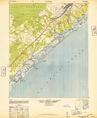
1948 Map of Topsail
USGS Topo · Published 1948About this map
Camp Davis and the surrounding coastal corridor of Pender County are captured here just after the second World War, during a period of transition for this shoreline landscape. The map reveals an intricate network of small waterfront settlements and landings, such as Sears Landing, Nixon Landing, and Sidbury Landing, which defined the local economy before the modern era of beach development. Inland, the massive Holly Shelter Swamp dominates the northwest, its wetlands drained by Thicket Swamp and Trumpeter Swamp. The transportation spine of the region is anchored by the Atlantic Coast Line Railroad, which runs parallel to the Intracoastal Waterway, connecting hubs like Holly Ridge and Hampstead. Notable military footprints include the CCC Camp and the established Military Boundary, reflecting the strategic importance of this stretch of the Atlantic coast during the 1940s.
Find a feature on this map
66 named features on this map. Tap any name to fly to it.
Don’t see what you’re looking for? This feature index may not catch every label — zoom into the map to look around manually.
Map Details
Editions of this 1948 Topsail Map
2 editions found
Other maps of this area

1942 · Spicer Bay
USGS Topo · 1:62,500

1942 · Topsail
USGS Topo · 1:62,500

1942 · Burgaw
USGS Topo · 1:62,500

1942 · Wilmington
USGS Topo · 1:62,500

1947 · Rocky Point
USGS Topo · 1:62,500

1948 · Maple Hill
USGS Topo · 1:62,500

1948 · Wilmington
USGS Topo · 1:62,500

1948 · New River
USGS Topo · 1:62,500

1952 · Spicer Bay
USGS Topo · 1:24,000

1952 · Sneads Ferry
USGS Topo · 1:24,000