Old Maps of Marine Corps Base Camp Lejeune, North Carolina
Explore 74 old maps of Marine Corps Base Camp Lejeune, spanning from 1942 to today. These high-resolution historic maps reveal how streets, neighborhoods, landmarks, and natural features evolved over time — perfect for genealogy, metal detecting, research, and local history exploration.
What you can do with these maps:
- See how Marine Corps Base Camp Lejeune changed over time: Compare historical maps to modern-day views to trace roads, homesites, rail lines & more.
- View detailed metadata: Each map includes creators, publishers, year, scale, and archive source.
- Overlay maps with satellite & LiDAR: Visualize the past alongside modern tools to explore terrain & human change.
- Trusted historical sources: Maps sourced from the USGS, Library of Congress, and other archives.
- Access maps your way: View online, download high-res files, or order prints for personal or research use.
Start exploring old maps of Marine Corps Base Camp Lejeune to uncover forgotten places, hidden landmarks, and the deep history beneath your feet.
Marine Corps Base Camp Lejeune, NC maps
(74)- 1942 Map of Topsail
 1942 Topsail1942 Print · USGSThe Pender County coast was undergoing a military transformation in the early 1940s as infrastructure expanded around Camp Davis. Genealogists and historians can trace dozens of family-named water access points like Howard Landing and Edens Landing along the edge of Topsail Sound.
 - 1942 Map of Swansboro
 1942 Swansboro1942 Print · USGSThe North Carolina coast during the early 1940s reveals a world of intricate waterways and family-named landings before mid-century development. Genealogists and historians can trace old sites like Snead Ferry, Willis Landing, and the inland hub of Whitehouse Forks.
 - 1948 Map of Maple Hill
 1948 Maple Hill1948 Print · USGSSoutheastern North Carolina is mapped here just after the war, showing the deep swamp landscapes of the coastal plain. Genealogists and researchers can trace the roads connecting Maple Hill to Camp Davis and locate rural landmarks like Waltons Store.2 unique versions available
 - 1948 Map of Swansboro
 1948 Swansboro1948 Print · USGSCoastal North Carolina's maritime character is preserved here in the late 1940s, centered on the historic waterfront at Swansboro. Researchers can trace the legacy of tidal commerce through numerous family-named sites like Willis Landing and Great Neck Landing.
 - 1948 Map of Topsail
 1948 Topsail1948 Print · USGSThe Pender County coastline is shown here in the late 1940s, when the maritime economy was centered on small inlets and landings. Researchers can trace the military history of Camp Davis or locate family sites at Edens Landing and Hampstead.2 unique versions available
 - 1948 Map of New River
 1948 New River1948 Print · USGSCoastal Onslow County underwent a massive transformation just after the war as the Marine Corps expanded its footprint along the New River. Researchers can trace early military infrastructure at the Peters Point Field Glider Base alongside civilian landmarks like Sneads Ferry and Mumfords Mill.2 unique versions available
 - 1952 Map of Hubert, 1954 Print
 1952 Hubert1954 Print · USGSThe Onslow County coast appears in the early fifties as a landscape of military reservations and tide-water settlements. Trace old family sites and maritime routes near Swansboro, Piney Grove Ch, and the many docks at Shell Rock Landing.3 unique versions available
 - 1952 Map of Camp Lejeune, 1954 Print
 1952 Camp Lejeune1954 Print · USGSCoastal Onslow County is seen here during the mid-century expansion of the Camp Lejeune Military Reservation. Local historians can trace established communities like Piney Green and Kelluntown alongside early base housing at Midway Park.4 unique versions available
 - 1952 Map of Jacksonville South, 1954 Print
 1952 Jacksonville South1954 Print · USGSCoastal Onslow County is seen here during the post-war expansion of military and civilian infrastructure along the New River. Genealogists and historians can locate Verona, the Georgetown High Sch, and the Peters Point Field Glider Base.4 unique versions available
 - 1952 Map of Browns Inlet, 1955 Print
 1952 Browns Inlet1955 Print · USGSCoastal North Carolina was defined by military training grounds and intricate tidal sounds during the early fifties. Genealogists and maritime historians can trace the paths of the Intracoastal Waterway and name local features like Saunders Island and Shackelfoot Channel.5 unique versions available
 - 1952 Map of New River Inlet, 1955 Print
 1952 New River Inlet1955 Print · USGSCoastal Onslow County is shown in the early fifties during the expansion of the Camp Lejeune Military Reservation. Researchers can trace the mid-century shoreline from New River Inlet past the old settlement at Peru and the docks of Courthouse Bay.4 unique versions available
 - 1952 Map of Sneads Ferry, 1955 Print
 1952 Sneads Ferry1955 Print · USGSThe Onslow County coastline comes alive in this mid-century survey, capturing the maritime character of the Sneads Ferry area before modern development. Genealogists can trace old family sites and rural landmarks like Little Zion Ch, Carrels Chapel, and the river landings at Fulcher and Sandford Landing.5 unique versions available
 - 1953 Map of Beaufort, 1965 Print
 1953 Beaufort1965 Print · USGSThe North Carolina coastline in the mid-fifties reveals an era of massive military expansion alongside traditional maritime life. Genealogists can trace family names and small settlements from Sealevel to Sneads Ferry or locate landmarks like Fort Macon.3 unique versions available
 - 1954 Map of Beaufort
 1954 Beaufort1954 Print · USGSCoastal North Carolina in the mid-fifties reveals a landscape of strategic military installations, sprawling wetlands, and thriving rail towns. Genealogists and historians can trace the foundations of Wilmington, the rural reaches of Duplin County, and shoreline landmarks like Cape Lookout and Carolina Beach.
 - 1970 Map of Holly Ridge, 1973 Print
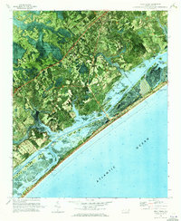 1970 Holly Ridge1973 Print · USGSCoastal Onslow and Pender counties come to life in this early 1970s orthophotomap showing the transition from forest to shore. Researchers can trace family landings like Morris Landing and Sears Landing or study the early layouts of Surf City and Topsail Beach.
 - 1972 Map of Beaufort, 1975 Print
 1972 Beaufort1975 Print · USGSThe North Carolina coast in the early seventies shows a landscape defined by massive military bases and coastal sounds. Trace rural family roots at Sarecta and Catherine Lake or explore the barrier islands of the Cape Lookout National Seashore.
 - 1980 Map of Holly Ridge, 1985 Print
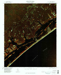 1980 Holly Ridge1985 Print · USGSThe Onslow County coast in the early eighties shows the rhythmic patterns of barrier island life and inland timbering. Genealogists and historians can locate old coastal sites like Morris Landing and Watts Landing along Topsail Sound.
 - 1981 Map of Haws Run
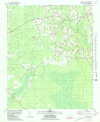 1981 Haws Run1981 Print · USGSCoastal Onslow County is shown in the early eighties as a landscape of rural crossroads and expansive wetlands. Researchers can locate local landmarks like Waltons Store, the Sky Manor Airport, and numerous community churches including Calvary Ch and New Bay Ch.2 unique versions available
 - 1981 Map of Folkstone
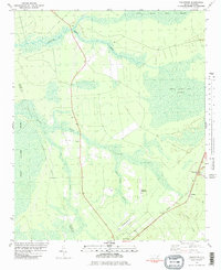 1981 Folkstone1981 Print · USGSCoastal Onslow County is shown here in the early eighties as a landscape shaped by vast wetlands and the railroad. Genealogists and local historians can trace the Seaboard Coast Line through Folkstone or locate an Abandoned Landing Strip near Holly Ridge.2 unique versions available
 - 1984 Map of Wilmington, 1985 Print
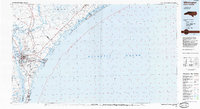 1984 Wilmington1985 Print · USGSThe Lower Cape Fear region is shown here in the mid-1980s as the coastal corridor between Wilmington and the barrier islands experienced significant development. Researchers can trace historic river landings, the winding Intracoastal Waterway, and established communities from Castle Hayne to Topsail Beach.
 - 1986 Map of New River
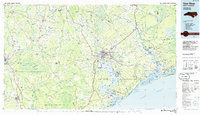 1986 New River1986 Print · USGSCoastal Onslow County in the mid-eighties shows a landscape shaped by military expansion and the preserved wetlands of the Carolina coast. Genealogists and historians can trace the foundations of Jacksonville and small outlying communities like Richlands and Swansboro.
 - 1990 Map of Wilmington
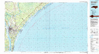 1990 Wilmington1990 Print · USGSThe North Carolina coast in the early nineties reveals a landscape defined by the convergence of the Cape Fear River and the Atlantic shore. Genealogists and historians can trace suburban growth and maritime infrastructure from the inland Kendall Chapel to coastal hubs like Wrightsville Beach and Carolina Beach.
 - 1991 Map of New River
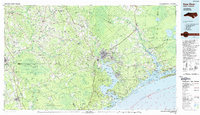 1991 New River1991 Print · USGSCoastal Onslow and Pender counties appear here in the early 1990s as the military and maritime economies matured. Researchers can trace the expansive Camp Lejeune grounds and find rural landings like Fulcher Landing and Sanders Landing.
 - 1997 Map of Holly Ridge, 1999 Print
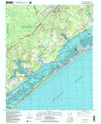 1997 Holly Ridge1999 Print · USGSCoastal North Carolina during the late nineties shows a landscape of barrier island growth and protected inland wetlands. Genealogists can trace family connections through numerous landings like Edens Landing and rural churches such as Stump Sound Ch.
 - 1997 Map of Browns Inlet, 1999 Print
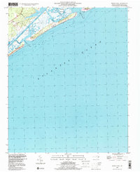 1997 Browns Inlet1999 Print · USGSThe Onslow County coast at the close of the century shows a unique intersection of military training grounds and preserved beach wilderness. Researchers can trace the shifting sands and tidal reaches of Browns Inlet and Bear Island or locate markers along the Intracoastal Waterway.
Showing maps 1-25 of 74
Top cities near Marine Corps Base Camp Lejeune
- Jacksonville historical maps
- Piney Green historical maps
- Half Moon historical maps
- Swansboro historical maps
- Sneads Ferry historical maps
- Surf City historical maps
See more
Top neighborhoods of Marine Corps Base Camp Lejeune
- Duck Creek historical maps
- Courthouse Bay historical maps
- Stones Bay historical maps
- Camp Devil Dog historical maps
Frequently asked questions
- What are the different types of historical maps available for Marine Corps Base Camp Lejeune?
- What is the oldest map of Marine Corps Base Camp Lejeune?
- Where can I purchase historical maps of Marine Corps Base Camp Lejeune for my home or office?
- Where can I download high-res historical maps of Marine Corps Base Camp Lejeune?
- Are there historical topographic maps available for Marine Corps Base Camp Lejeune?
- Is there historical aerial imagery available for Marine Corps Base Camp Lejeune?
- Where are historical maps of Marine Corps Base Camp Lejeune sourced from?