Old Maps of Rutherford County, North Carolina for Metal Detecting
Plan your next treasure hunt with 151 historic maps of Rutherford County. Find old homesites, ghost towns, trails, and gathering spots that may be lost to time — perfect for identifying promising metal detecting locations.
- Locate forgotten sites: Uncover places like long-lost settlements, abandoned rail lines, or gathering spots.
- Plan better hunts: Use map overlays combined with LiDAR or satellite views to narrow in on historically rich areas.
- Made for detectorists: Thousands of hobbyists use these maps to discover relics, coins, and hidden history.
Use these historic maps to boost your research and find new opportunities beneath the surface of Rutherford County.
Rutherford County, NC maps
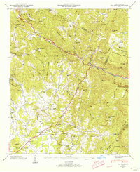
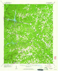
(151)- 1900 Map of Mount Mitchell, 1963 Print
 1900 Mount Mitchell1963 Print · USGSWestern North Carolina at the turn of the century shows a landscape of high peaks and isolated river settlements before the arrival of modern highways. Genealogists and mountain historians can trace early homesteads along the Cane River or follow the Southern RR through Old Fort and Black Mountain.3 unique versions available
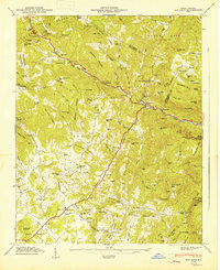
 - 1902 Map of Mount Mitchell, 1937 Print
 1902 Mount Mitchell1937 Print · USGSThe high peaks of Western North Carolina are captured here at the start of the twentieth century, showing the rail and river corridors that shaped the region. Trace early settlements like Burnsville, Montreat, and the winding Southern Railway.3 unique versions available
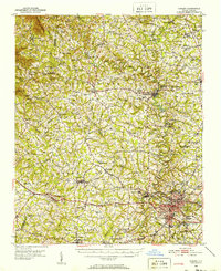
 - 1905 Map of Morganton, 1941 Print
 1905 Morganton1941 Print · USGSThe foothills and high peaks of the Blue Ridge come alive in the early twentieth century, centered on the growing towns of Morganton and Lenoir. Genealogists and historians can trace the early rail corridor of the Southern Railway and locate vanished landmarks like Arneys Store and Rutherford College.2 unique versions available
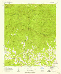
 - 1907 Map of Saluda
 1907 Saluda1907 Print · USGSNorth Carolina's mountain frontier meets the South Carolina foothills in this 1900s survey of the Blue Ridge. Genealogists and researchers can trace the early rail network through Saluda and locate old landmarks like Rockcliff PO and Pleasant Grove Church.3 unique versions available
 - 1909 Map of Gaffney
 1909 Gaffney1909 Print · USGSCherokee County at the turn of the century centers on the growing textile and rail hubs of Gaffney and Blacksburg. Researchers can trace early river transport at Stacy Ferry or locate ancestral roots at Providence Church and the Sarratt School.4 unique versions available
 - 1935 Map of Batcave
 1935 Batcave1935 Print · USGSThe Henderson County highlands come into focus in the mid-1930s as mountain communities like Edneyville organized around small rural hubs. Local researchers can trace family roots through landmarks like Edneyville Cem or search for old homesteads near Blue Ridge Ch and Raven Rock.
 - 1946 Map of Bat Cave, 1957 Print
 1946 Bat Cave1957 Print · USGSHenderson County in the 1940s reveals a network of mountain communities and remote creek valleys. Genealogists and historians can trace family locations near Maxwell Mill, Edneyville Cem, and numerous country churches like Mt Moriah Ch.6 unique versions available
 - 1947 Map of Bat Cave
 1947 Bat Cave1947 Print · USGSHenderson County's mountain communities and river valleys are captured here just after the war. Researchers can locate family landmarks like Edneyville Cem, rural institutions such as St Peters Sch, and local hubs like Gerton.2 unique versions available
 - 1950 Map of Shelby, 1952 Print
 1950 Shelby1952 Print · USGSCleveland County's textile and rail infrastructure is at its peak in the early fifties, centering on the regional hub of Shelby. Genealogists and local historians can trace family roots through numerous country landmarks like Ora Mill, Belwood High Sch, and Double Springs Ch.2 unique versions available
 - 1953 Map of Charlotte, 1968 Print
 1953 Charlotte1968 Print · USGSThe North Carolina Piedmont and South Carolina borderlands are shown in detail during a period of significant growth and reservoir development. Trace the rail corridors of the Southern Railway or find family roots in towns like China Grove, Misenheimer, and Lincolnton.3 unique versions available
 - 1954 Map of Charlotte
 1954 Charlotte1954 Print · USGSThe North Carolina Piedmont in the mid-1950s shows a region of rapid growth and industrial expansion centered around Charlotte. Trace the era's infrastructure through the Southern railroad lines and locate significant landmarks like the Charlotte Naval Ammunition Depot and Lake Norman.2 unique versions available
 - 1955 Map of Knoxville
 1955 Knoxville1955 Print · USGSThe Southern Appalachians and the Smoky Mountains are shown here at a peak of mid-century development and conservation. Genealogists and historians can trace the early road networks connecting Gatlinburg, Waynesville, and the Cherokee Indian Reservation across the high ridges.
 - 1956 Map of Benn Knob, 1958 Print
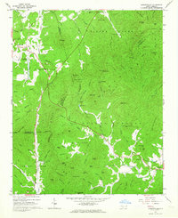
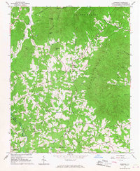
 1956 Benn Knob1958 Print · USGSThe upland borders of Cleveland and Rutherford counties appear here as they were in the mid-1950s, a landscape of high peaks and secluded valleys. Genealogists can trace family footprints at Mt Moriah Ch, Corinth Ch, and the small Moriah Sch.2 unique versions available
 - 1957 Map of Knoxville, 1966 Print
 1957 Knoxville1966 Print · USGSThe Southern Appalachians of Tennessee and North Carolina are mapped here during the mid-twentieth century as new highways reached the high country. Genealogists and historians can trace the topography between Knoxville and Asheville, locating family landmarks near Fontana Lake or along the Blue Ridge Parkway.4 unique versions available
 - 1959 Map of Lake Lure, 1960 Print
 1959 Lake Lure1960 Print · USGSWestern North Carolina’s foothills are captured here in the late fifties, showcasing the early development around Lake Lure and Lake Adger. Local historians can trace old homesteads and community hubs like Shingle Hollow, Mullen Bible Sch, and numerous family-named mountain peaks.2 unique versions available
 - 1959 Map of Cowpens, 1961 Print
 1959 Cowpens1961 Print · USGSThe borderlands of the Carolinas are shown here in the late fifties, featuring a mix of textile mill towns and rural farming communities. Researchers can trace family roots through numerous local landmarks like Cannons Camp Ground, Gaffney Chapel, and Cooley Springs.2 unique versions available
 - 1960 Map of Knoxville
 1960 Knoxville1960 Print · USGSThe Southern Appalachians come alive in the 1950s, showing the intersection of new national park tourism and deep-rooted mountain industry. Trace old rail lines like the Clinchfield RR and find high-altitude landmarks from Mt Le Conte to the Cherokee Indian Reservation.2 unique versions available
 - 1960 Map of Charlotte
 1960 Charlotte1960 Print · USGSMid-century North Carolina and South Carolina meet in this 1960 survey of the Piedmont's industrial and textile heartland. Trace the growth of Charlotte alongside historic landmarks like Kings Mountain National Military Park and the Charlotte Naval Ammunition Depot.2 unique versions available
 - 1962 Map of Charlotte
 1962 Charlotte1962 Print · USGSThe North Carolina Piedmont in the early sixties showcases a landscape transformed by massive reservoirs and industrial growth. Researchers can trace the development of Lake Norman, locate the Charlotte Naval Ammunition Depot, or find family landmarks like Wesley Chapel and Brown & Norcott Mills.
 - 1962 Map of Glenwood, 1964 Print
 1962 Glenwood1964 Print · USGSThe McDowell and Rutherford county line area was a rugged landscape of rail-and-river transport in the early sixties. Genealogists and historians can trace family locations near Thermal City, Brackettown Cem, and old country churches like Laurel Hill Ch.
 - 1962 Map of Dysartsville, 1964 Print
 1962 Dysartsville1964 Print · USGSThe foothills of the South Mountains come alive in the early sixties, showing where Burke, McDowell, and Rutherford counties meet. Genealogists can locate family names and sites like Logans Store, Fortune Cem, and Missionary Ch.3 unique versions available
 - 1962 Map of Marion, 1964 Print
 1962 Marion1964 Print · USGSMcDowell County life in the early sixties centers on the rail junction at Marion and the rising peaks of the Blue Ridge. Genealogists and historians can trace community roots through Carson Chapel, Zion Hill Cem, and the old Pleasant Gardens School.2 unique versions available
 - 1964 Map of Knoxville
 1964 Knoxville1964 Print · USGSThe Southern Appalachians and Great Smokies are captured here during the mid-sixties, showing the rugged borderlands of Tennessee and North Carolina. Researchers can trace historic mountain routes like U S 441, the expanse of Pisgah National Forest, and the growing footprints of Asheville and Knoxville.
 - 1965 Map of Sunshine, 1967 Print
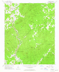
 1965 Sunshine1967 Print · USGSRutherford County in the mid-sixties reveals a landscape of ridge-top churches and small creek-side settlements between the South Mountains and Cherry Mountain. Researchers can trace rural life through sites like the Adkins Mine, Washburn, and Mt Lebanon Ch.
 - 1966 Map of Rutherfordton North, 1968 Print
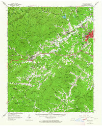
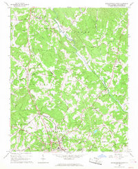 1966 Rutherfordton North1968 Print · USGSRutherford County's rural heartland is captured here in the mid-sixties as small communities like Gilkey and Union Mills maintained their distinct identities. Researchers can trace family roots through numerous sites including Round Hill Sch, Brittain Ch, and Liberty Hill Cem.
Showing maps 1-25 of 151
Top cities of Rutherford County
- Forest City historical maps
- Rutherfordton historical maps
- Spindale historical maps
- Lake Lure historical maps
- Ellenboro historical maps
- Ruth historical maps
See more
Frequently asked questions
- What are the different types of historical maps available for Rutherford County?
- What is the oldest map of Rutherford County?
- Where can I purchase historical maps of Rutherford County for my home or office?
- Where can I download high-res historical maps of Rutherford County?
- Are there historical topographic maps available for Rutherford County?
- Is there historical aerial imagery available for Rutherford County?
- Where are historical maps of Rutherford County sourced from?