Old Maps of O R King, Wake County for Genealogy
Trace your family roots with 23 historic maps of O R King. These high-res maps reveal old neighborhoods, homesites, landmarks, and streets — helping you uncover where your ancestors lived and how the area evolved over time.
- Explore historic neighborhoods: Identify where your relatives may have lived in the 1800s or 1900s.
- Compare maps over time: Trace the changes in streets, buildings, and landmarks for multi-generational research.
- Perfect for genealogy & ancestry research: Used by family historians and researchers to map out lineage and migration.
These maps are an incredible resource for exploring your personal connection to O R King's past.
O R King, Wake County maps
(23)- 1943 Map of Durham South
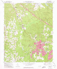
 1943 Durham South1943 Print · USGSDurham and its southern reaches are captured here in the early 1940s, showing a tobacco-and-rail landscape at its peak. Genealogists and local historians can trace legacy sites like Beechwood Cem, Lowes Grove, and Roger Grove Ch.2 unique versions available
 - 1943 Map of Raleigh
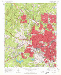
 1943 Raleigh1943 Print · USGSRaleigh and its surrounding Wake County townships are captured here in the early 1940s as a bustling nexus of rail and industry. Genealogists can trace family names through rural landmarks like Lassiters Mill, Method, and numerous country churches like Mt Bethel Church.2 unique versions available
 - 1951 Map of Raleigh, 1952 Print
 1951 Raleigh1952 Print · USGSMid-century Raleigh and its surrounding rural townships are shown here as the capital city expanded toward the Neuse River. Genealogists can trace family-named schools and crossroads like Lovely Hill Sch, Six Forks, and the historic mill at Lassiters Mill.3 unique versions available
 - 1951 Map of Durham South, 1953 Print
 1951 Durham South1953 Print · USGSThe mid-century landscape south of Durham shows a region on the cusp of modernization as the airport and highway networks began to expand. Genealogists and historians can locate rural landmarks such as Pearsontown, Lowes Grove, and Holland Chapel among the busy rail corridors of the Norfolk Southern.3 unique versions available
 - 1953 Map of Raleigh, 1965 Print
 1953 Raleigh1965 Print · USGSCentral North Carolina in the early sixties shows a landscape of growing towns and military hubs before the full expansion of the interstate system. Genealogists can trace family footprints across the Piedmont through Wake Forest, Siler City, and the large Fort Bragg Military Reservation.4 unique versions available
 - 1954 Map of Raleigh
 1954 Raleigh1954 Print · USGSThe North Carolina Piedmont and Sandhills are captured in the mid-fifties during a period of steady regional growth. Genealogists and historians can trace the development of towns like Siler City or locate landmarks such as Falls of Neuse and Camp Mackall.
 - 1968 Map of Raleigh West, 1972 Print
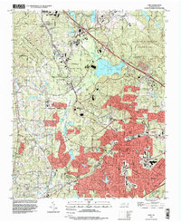
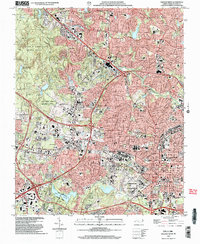
 1968 Raleigh West1972 Print · USGSRaleigh in the late sixties reveals a city in rapid transition between its traditional downtown core and expanding suburban neighborhoods. Genealogists and historians can trace institutional landmarks like North Carolina State University alongside local settlements like Method and Asbury.6 unique versions available
 - 1973 Map of Cary, 1975 Print
 1973 Cary1975 Print · USGSCary and its neighboring communities are shown during a decade of growth as the Research Triangle region expanded in the early seventies. Genealogists and historians can locate family landmarks such as Hill Crest Cem, Christa Sanctified Holy Ch, and the rural crossing at Morrisville.5 unique versions available
 - 1984 Map of Raleigh, 1985 Print
 1984 Raleigh1985 Print · USGSThe North Carolina Research Triangle is shown during a decade of rapid growth, from the sprawl of Raleigh to the expanding waters of Falls Lake. Genealogists and historians can trace rail lines like the Seaboard Coast Line or locate landmark sites like Dorothea Dix State Hospital and Fuquay-Varina.
 - 1990 Map of Raleigh, 1991 Print
 1990 Raleigh1991 Print · USGSGreater Raleigh and the Research Triangle entered a period of significant suburban growth during the 1990s. Researchers can trace the development of towns like Fuquay-Varina and Wake Forest or locate landmarks such as the State Prison and Harris Reservoir.2 unique versions available
 - 1993 Map of Cary, 1999 Print
 1993 Cary1999 Print · USGSThe Research Triangle is shown in its era of peak expansion, transitioning from quiet rural communities to a major regional hub. Genealogists and historians can trace local landmarks like Shiloh Ch, Carpenter, and the old Durham and Southern rail line.
 - 1993 Map of Raleigh West, 1999 Print
 1993 Raleigh West1999 Print · USGSRaleigh and Cary are shown during a period of rapid westward expansion in the early nineties. Researchers can trace the layout of North Carolina State University and find historic landmarks like the State Capitol and Dorothea Dix State Hospital.
 - 2002 Map of Raleigh West, 2004 Print
 2002 Raleigh West2004 Print · USGSIn the early 2000s, West Raleigh was a landscape of significant academic and state institutions alongside expanding suburbs. Trace the footprints of North Carolina State University, the historic community of Method, and the grounds of Dorothea Dix State Hospital.
 - 2010 Map of Cary, 2010 Print
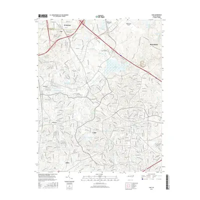
 2010 Cary2010 Print · USGSCovers O R King, including Raleigh, Durham, and other nearby areas
 - 2010 Map of Raleigh West, 2010 Print
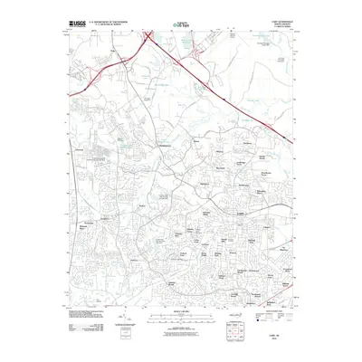
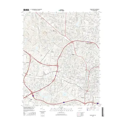
 2010 Raleigh West2010 Print · USGSCovers O R King, including Raleigh, Cary, and other nearby areas
 - 2013 Map of Cary, 2013 Print
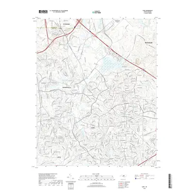
 2013 Cary2013 Print · USGSCovers O R King, including Raleigh, Durham, and other nearby areas
 - 2013 Map of Raleigh West, 2013 Print
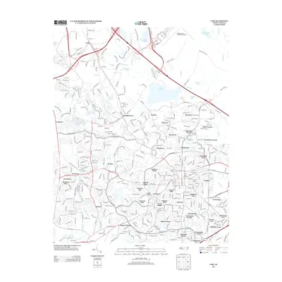
 2013 Raleigh West2013 Print · USGSCovers O R King, including Raleigh, Cary, and other nearby areas
 - 2016 Map of Cary, 2016 Print
 2016 Cary2016 Print · USGSCovers O R King, including Raleigh, Durham, and other nearby areas
 - 2016 Map of Raleigh West, 2016 Print
 2016 Raleigh West2016 Print · USGSCovers O R King, including Raleigh, Cary, and other nearby areas
 - 2019 Map of Cary, 2019 Print
 2019 Cary2019 Print · USGSCovers O R King, including Raleigh, Durham, and other nearby areas
 - 2019 Map of Raleigh West, 2019 Print
 2019 Raleigh West2019 Print · USGSCovers O R King, including Raleigh, Cary, and other nearby areas
 - 2022 Map of Cary, 2022 Print
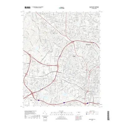
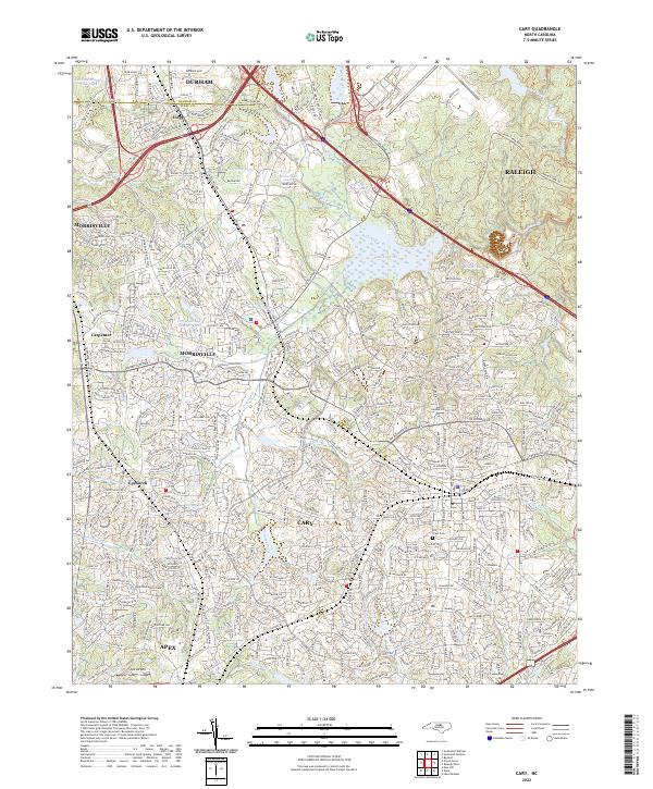 2022 Cary2022 Print · USGSThe North Carolina Research Triangle is captured here during its modern expansion, showing the intersecting growth of Cary, Morrisville, and Apex. Researchers can trace suburban development around Lake Crabtree and find local landmarks like Hill Crest Cem and Carpenter.
 - 2022 Map of Raleigh West, 2022 Print
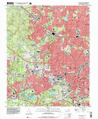
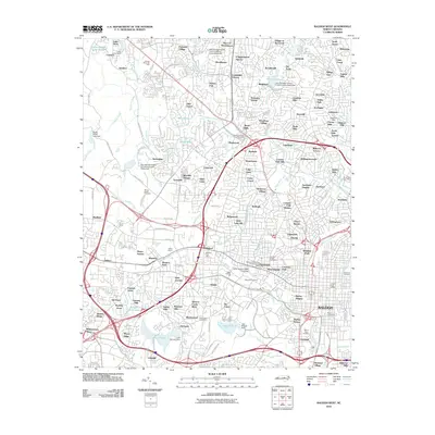
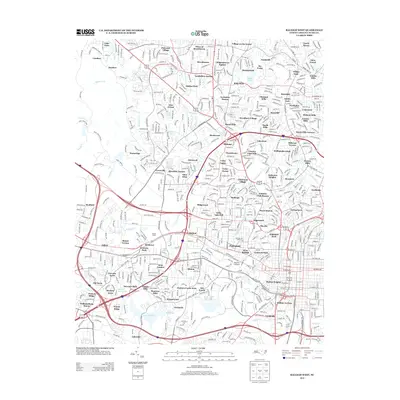
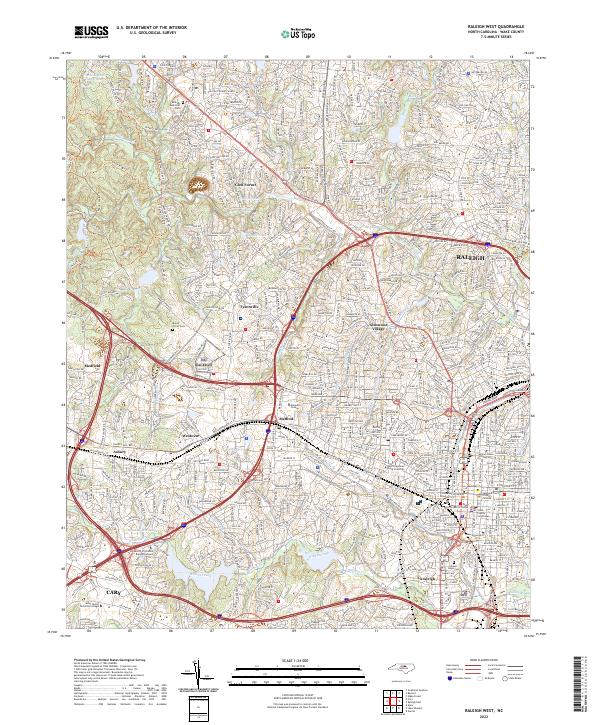 2022 Raleigh West2022 Print · USGSRaleigh and Cary are shown at a peak of modern growth in this Wake County survey. Researchers can trace historic neighborhoods and landmarks like Method, Mount Olivet Cem, and the sprawling campus of North Carolina State University.
End of results
Showing maps 1-23 of 23
Frequently asked questions
- What are the different types of historical maps available for O R King?
- What is the oldest map of O R King?
- Where can I purchase historical maps of O R King for my home or office?
- Where can I download high-res historical maps of O R King?
- Are there historical topographic maps available for O R King?
- Is there historical aerial imagery available for O R King?
- Where are historical maps of O R King sourced from?