
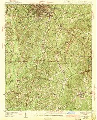
1943 Map of Durham South
USGS Topo · Published 1943About this map
The city of Durham serves as the industrial and urban anchor in this mid-century survey, surrounded by a dense network of rural townships like Cedar Fork and White Oak. The landscape is defined by the convergence of major transit lines, including the Southern Railway and the Seaboard Air Line, which facilitated the movement of tobacco and textiles through the region. Rural life outside the city center is marked by several family-named landmarks and community centers such as Bland, Lowes Grove, and Morrisville.
Find a feature on this map
84 named features on this map. Tap any name to fly to it.
Don’t see what you’re looking for? This feature index may not catch every label — zoom into the map to look around manually.
Map Details
Editions of this 1943 Durham South Map
2 editions found
Other maps of this area

1943 · Raleigh
USGS Topo · 1:62,500

1943 · Creedmoor
USGS Topo · 1:62,500

1944 · Creedmoor
USGS Topo · 1:62,500

1946 · Chapel Hill
USGS Topo · 1:24,000

1947 · Chapel Hill
USGS Topo · 1:31,680

1951 · Raleigh
USGS Topo · 1:62,500

1951 · Farrington
USGS Topo · 1:24,000

1951 · Durham South
USGS Topo · 1:62,500

1951 · Durham North
USGS Topo · 1:62,500

1953 · Raleigh
USGS Topo · 1:250,000