Old Maps of Wilson County, North Carolina
Explore 110 old maps of Wilson County, spanning from 1902 to today. These high-resolution historic maps reveal how streets, neighborhoods, landmarks, and natural features evolved over time — perfect for genealogy, metal detecting, research, and local history exploration.
What you can do with these maps:
- See how Wilson County changed over time: Compare historical maps to modern-day views to trace roads, homesites, rail lines & more.
- View detailed metadata: Each map includes creators, publishers, year, scale, and archive source.
- Overlay maps with satellite & LiDAR: Visualize the past alongside modern tools to explore terrain & human change.
- Trusted historical sources: Maps sourced from the USGS, Library of Congress, and other archives.
- Access maps your way: View online, download high-res files, or order prints for personal or research use.
Start exploring old maps of Wilson County to uncover forgotten places, hidden landmarks, and the deep history beneath your feet.
Wilson County, NC maps
(110)- 1902 Map of Kenly
 1902 Kenly1902 Print · USGSCoastal plain settlements in Johnston and Wilson Counties flourished along the rail lines during the early nineteen-hundreds. Genealogists can locate family landmarks like Moores Crossroads and Hares Crossroads or trace the Atlantic Coast Line through Kenly and Micro.2 unique versions available
 - 1902 Map of Rocky Mount, 1965 Print
 1902 Rocky Mount1965 Print · USGSThe coastal plain of North Carolina comes alive in this early survey of the rail and river corridors between Nashville and Rocky Mount. Genealogists can trace early landmarks like Snells Crossroads, the Rocky Mount Mills, and Elm City.
 - 1902 Map of Spring Hope, 1965 Print
 1902 Spring Hope1965 Print · USGSNash and Franklin Counties are seen here at the turn of the century as a landscape of river-bend settlements and railroad progress. Researchers can trace ancestral roots through family-named landmarks like Lamm Crossroads, Lee Chapel, and Pine Ridge Schoolhouse.
 - 1902 Map of Tarboro, 1968 Print
 1902 Tarboro1968 Print · USGSEdgecombe County at the dawn of the twentieth century was a landscape defined by the winding Tar River and the expansion of the Atlantic Coast Line. Genealogists can trace family names at Bullocks Crossroads, locate the old Steamboat Route, or explore early settlements like Pinetops and Princeville.
 - 1903 Map of Kenly
 1903 Kenly1903 Print · USGSCoastal plain settlements and crossroads thrive along the rail corridors of Johnston and Wilson counties at the dawn of the twentieth century. Genealogists can locate family-named sites like Hornes Mill and Barnes Store or trace the early paths through Beulahtown and Kenly.2 unique versions available
 - 1903 Map of Tarboro, 1935 Print
 1903 Tarboro1935 Print · USGSCoastal plain life in Edgecombe County at the opening of the century centered on river commerce and emerging rail lines. You can trace early family sites and rural junctions like Wiggins Crossroads, the Steamboat Route on the river, and the mill works along Sasnett Mill Swamp.2 unique versions available
 - 1904 Map of Falkland, 1936 Print
 1904 Falkland1936 Print · USGSCoastal plain life at the turn of the century centered on river landings and swamp-side settlements across Pitt and Greene counties. Genealogists and historians can trace family roots at Fountain P.O., the mills at Harris Millpond, and river traffic at Dupree Ldg.3 unique versions available
 - 1904 Map of Rocky Mount, 1942 Print
 1904 Rocky Mount1942 Print · USGSThe Tar River and the rail hubs of eastern North Carolina come alive in this early twentieth-century survey. Genealogists and local historians can trace the growth of Rocky Mount and Nashville, or locate vanished industrial landmarks like the Upper Falls Rocky Mount Mills and Finch Mill.
 - 1904 Map of Springhope, 1942 Print
 1904 Springhope1942 Print · USGSNash County at the turn of the century shows a rural landscape connected by the Atlantic Coast Line R. R. and the winding Tar River. Researchers can trace ancestral locations at Lamm Crossroads, Whiteoak Church, and the Pine Ridge Schoolhouse.
 - 1904 Map of Wilson, 1942 Print
 1904 Wilson1942 Print · USGSCoastal plain settlements and tobacco-country rail lines emerge in this turn-of-the-century look at eastern North Carolina. Genealogists and historians can trace the early footprints of Wilson, Stantonsburg, and Eureka alongside the Atlantic Coast Line railroad.3 unique versions available
 - 1953 Map of Rocky Mount, 1964 Print
 1953 Rocky Mount1964 Print · USGSEastern North Carolina in the mid-fifties is defined by its deep river basins and the vast wetlands of the Tidewater. Genealogists can trace family roots through hubs like Kinston and New Bern or explore the wilderness of Pettigrew State Park and Lake Mattamuskeet.4 unique versions available
 - 1953 Map of Raleigh, 1965 Print
 1953 Raleigh1965 Print · USGSCentral North Carolina in the early sixties shows a landscape of growing towns and military hubs before the full expansion of the interstate system. Genealogists can trace family footprints across the Piedmont through Wake Forest, Siler City, and the large Fort Bragg Military Reservation.4 unique versions available
 - 1954 Map of Rocky Mount
 1954 Rocky Mount1954 Print · USGSEastern North Carolina is mapped in the mid-fifties, showing a landscape of sounds, swamps, and steam-era rail lines. Genealogists can trace the rural road networks and rail spurs connecting towns like Tarboro, Greenville, and the remote Columbia.
 - 1954 Map of Raleigh
 1954 Raleigh1954 Print · USGSThe North Carolina Piedmont and Sandhills are captured in the mid-fifties during a period of steady regional growth. Genealogists and historians can trace the development of towns like Siler City or locate landmarks such as Falls of Neuse and Camp Mackall.
 - 1977 Map of Winstead Crossroads
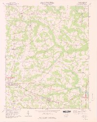
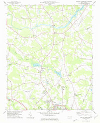 1977 Winstead Crossroads1977 Print · USGSCoastal Plain farmland and growing aviation hubs meet at the Nash and Wilson county line during the late seventies. Researchers can trace the heritage of rural communities through local landmarks like Winstead Crossroads, Finch Mill, and Tar River Sch.
 - 1977 Map of Elm City
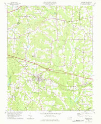
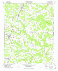 1977 Elm City1977 Print · USGSCoastal plain agriculture and rail transport meet in the late 1970s at the junction of Nash, Wilson, and Edgecombe counties. Researchers can trace historic family landmarks and rural nodes like Elm City, Bridgersville, and Pleasant Hope Ch.
 - 1978 Map of Lucama
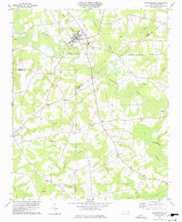
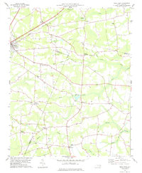
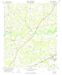 1978 Lucama1978 Print · USGSCoastal plain farming and railroad commerce define this part of Wilson County in the late seventies. Genealogists can trace family roots through dozens of local cemeteries and churches like Nobles Chapel or explore settlements at Rock Ridge and Lucama.
 - 1978 Map of Fremont
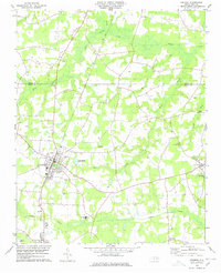 1978 Fremont1978 Print · USGSFremont and the surrounding Wayne County wetlands are shown in detail during the late seventies as the region maintained its rural character. Researchers can trace family roots at New Daniels Chapel, Mt Nelson Ch, and the schools of Norwayne Sch and Aycock High Sch.
 - 1978 Map of Bailey
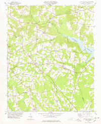
 1978 Bailey1978 Print · USGSThe Nash and Wilson County border comes alive in the late 1970s, showing a landscape of small farming communities and swampy lowlands. You can trace family history through numerous rural cemeteries and landmark churches like Floods Chapel and Mitchells Chapel.3 unique versions available
 - 1978 Map of Middlesex
 1978 Middlesex1978 Print · USGSCoastal plain farmland and tobacco-country crossroads define this corner of Nash County in the late 1970s. Trace family roots and local history through numerous country churches like St Bethel Church and community centers like Social Plains or Middlesex.
 - 1978 Map of Stantonsburg
 1978 Stantonsburg1978 Print · USGSStantonsburg and the rural crossroads of Wilson and Wayne counties are captured in the late 1970s before modern development. Genealogists and historians can trace family-named sites like Applewhite or visit community landmarks including St Lukes Ch and Union Grove Ch.
 - 1978 Map of Stancils Chapel
 1978 Stancils Chapel1978 Print · USGSThe tri-county border of Johnston, Wilson, and Nash counties in the late seventies reveals a landscape of traditional crossroads and rural congregations. Trace family roots at Stilleys Crossroads or through local landmarks like Antioch Ch and the Buckhorn Reservoir.
 - 1978 Map of Kenly West
 1978 Kenly West1978 Print · USGSThe rural landscape of Johnston County is captured here in the late seventies, showing a network of railroad towns and farming crossroads. Researchers can trace local heritage through landmarks like Lowell Mill, Oak Grove Inn, and churches such as Bethany Ch.
 - 1978 Map of Saratoga
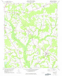 1978 Saratoga1978 Print · USGSSaratoga and the Wilson County countryside are captured here in the late seventies, showing a landscape defined by deep swamps and rural crossroads. Genealogists and local historians can locate many family landmarks, from Drivers Store to rural congregations like Zimmerman Chapel and Barnes Chapel.
 - 1978 Map of Kenly East
 1978 Kenly East1978 Print · USGSCoastal plain agriculture and rail-side industry meet in this late 1970s survey of the Johnston and Wayne County borders. Genealogists can locate family burial sites, rural parishes like Daniels Chapel, and old milling sites at Sasser Millpond and Newsom Millpond.
Showing maps 1-25 of 110
Top cities of Wilson County
- Wilson historical maps
- Elm City historical maps
- Lucama historical maps
- Stantonsburg historical maps
- Black Creek historical maps
- Saratoga historical maps
See more
Frequently asked questions
- What are the different types of historical maps available for Wilson County?
- What is the oldest map of Wilson County?
- Where can I purchase historical maps of Wilson County for my home or office?
- Where can I download high-res historical maps of Wilson County?
- Are there historical topographic maps available for Wilson County?
- Is there historical aerial imagery available for Wilson County?
- Where are historical maps of Wilson County sourced from?