Old Maps of Stanton, North Dakota
Explore 10 old maps of Stanton, spanning from 1948 to today. These high-resolution historic maps reveal how streets, neighborhoods, landmarks, and natural features evolved over time — perfect for genealogy, metal detecting, research, and local history exploration.
What you can do with these maps:
- See how Stanton changed over time: Compare historical maps to modern-day views to trace roads, homesites, rail lines & more.
- View detailed metadata: Each map includes creators, publishers, year, scale, and archive source.
- Overlay maps with satellite & LiDAR: Visualize the past alongside modern tools to explore terrain & human change.
- Trusted historical sources: Maps sourced from the USGS, Library of Congress, and other archives.
- Access maps your way: View online, download high-res files, or order prints for personal or research use.
Start exploring old maps of Stanton to uncover forgotten places, hidden landmarks, and the deep history beneath your feet.
Stanton, ND maps
(10)- 1948 Map of Stanton, 1962 Print
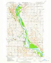 1948 Stanton1962 Print · USGSMid-century Mercer and McLean Counties are shown during the transformation of the Missouri River valley. Genealogists can locate family-named landmarks like Williams Sch, the Stanton Cem, and the historic Ft Clark (Site) near the Knife River confluence.
 - 1949 Map of Stanton
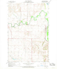
 1949 Stanton1949 Print · USGSThe Missouri River valley stands at the brink of transformation in the late 1940s as the massive Garrison Dam project begins near Riverdale. Researchers can trace the original river course and numerous family-named schools like Baisch Sch and Matton Sch alongside the Northern Pacific rail line.
 - 1954 Map of McClusky, 1968 Print
 1954 McClusky1968 Print · USGSCentral North Dakota was undergoing a profound transformation in the fifties as the newly formed Lake Sakakawea reshaped the Missouri River valley. Genealogists and historians can trace rail-town development along the Soo Line and locate historic markers like Garrison Dam or the Lewis and Clark Trail.3 unique versions available
 - 1958 Map of McClusky
 1958 McClusky1958 Print · USGSCentral North Dakota was undergoing a profound change in the late fifties as the Garrison Reservoir filled behind its massive new dam. Trace the early layout of Riverdale, the Lewis and Clark Trail, and the vanishing rail stops of the Northern Pacific.
 - 1968 Map of Stanton, 1969 Print
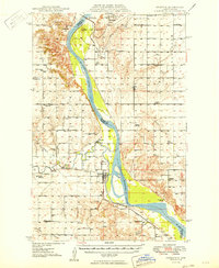
 1968 Stanton1969 Print · USGSThe Missouri and Knife River confluence in the late 1960s highlights the river-and-rail economy of Mercer County. Genealogists and historians can trace the Northern Pacific tracks through Stanton and locate family sites like Zion Cem or the Stanton Cem.2 unique versions available
 - 2011 Map of Stanton, 2011 Print
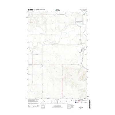
 2011 Stanton2011 Print · USGSCovers Stanton, including McLean County, Mercer County, and other nearby areas
 - 2014 Map of Stanton, 2014 Print
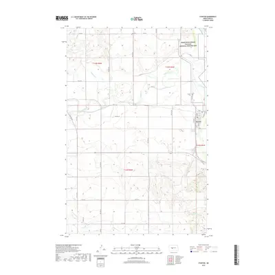
 2014 Stanton2014 Print · USGSCovers Stanton, including McLean County, Mercer County, and other nearby areas
 - 2018 Map of Stanton, 2018 Print
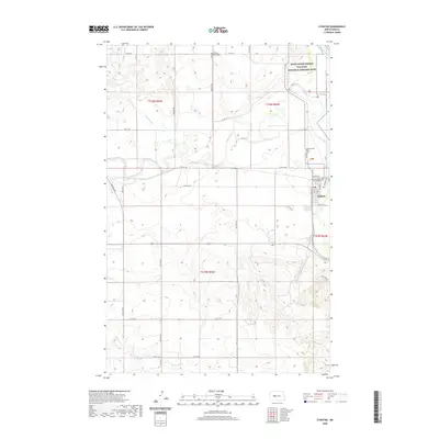
 2018 Stanton2018 Print · USGSCovers Stanton, including McLean County, Mercer County, and other nearby areas
 - 2020 Map of Stanton, 2020 Print
 2020 Stanton2020 Print · USGSCovers Stanton, including McLean County, Mercer County, and other nearby areas
 - 2024 Map of Stanton, 2024 Print
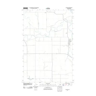
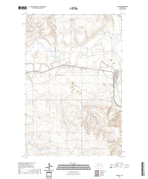 2024 Stanton2024 Print · USGSThe riverfront town of Stanton is captured here in the early twenty-first century as the administrative heart of Mercer County. Researchers can trace local landmarks like the Mercer County Courthouse, the Stanton Cem, and the Knife River Indian Villages National Historic Site.
End of results
Showing maps 1-10 of 10
Top cities near Stanton
- Hazen historical maps
- Center historical maps
- Riverdale historical maps
- Pick City historical maps
- Coleharbor historical maps
Frequently asked questions
- What are the different types of historical maps available for Stanton?
- What is the oldest map of Stanton?
- Where can I purchase historical maps of Stanton for my home or office?
- Where can I download high-res historical maps of Stanton?
- Are there historical topographic maps available for Stanton?
- Is there historical aerial imagery available for Stanton?
- Where are historical maps of Stanton sourced from?