Old Maps of North Dakota
Explore 9,312 old maps of North Dakota, spanning from 1894 to today. These high-resolution historic maps reveal how streets, neighborhoods, landmarks, and natural features evolved over time — perfect for genealogy, metal detecting, research, and local history exploration.
What you can do with these maps:
- See how North Dakota changed over time: Compare historical maps to modern-day views to trace roads, homesites, rail lines & more.
- View detailed metadata: Each map includes creators, publishers, year, scale, and archive source.
- Overlay maps with satellite & LiDAR: Visualize the past alongside modern tools to explore terrain & human change.
- Trusted historical sources: Maps sourced from the USGS, Library of Congress, and other archives.
- Access maps your way: View online, download high-res files, or order prints for personal or research use.
Start exploring old maps of North Dakota to uncover forgotten places, hidden landmarks, and the deep history beneath your feet.
North Dakota maps
(9,312)- 1894 Map of Monango
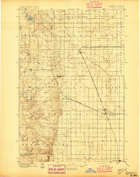
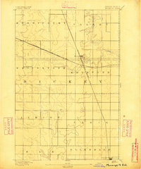 1894 Monango1894 Print · USGSSouthern North Dakota was a landscape of pioneering railroads and new township boundaries in the early 1890s. Genealogists and historians can trace the early rail junctions at Monango or locate landholdings within the districts of Whitestone and Keystone.
 - 1894 Map of La Moure
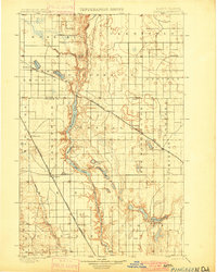
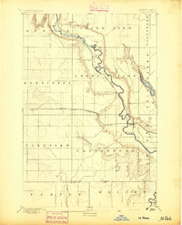 1894 La Moure1894 Print · USGSSoutheastern North Dakota's prairie landscape is captured here during the railroad boom of the late nineteenth century. Trace the early development of Lamoure and Grand Rapids along the James River and the converging tracks of the Northern Pacific Railroad.
 - 1894 Map of Ellendale
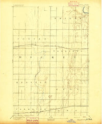
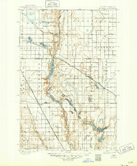
 1894 Ellendale1894 Print · USGSDakota Territory transitions into new states in the late nineteenth century as the rail-and-river economy takes root. Genealogists can trace early township structures across Wheatland and Osceola, or locate residents near Frederick along the Chicago Milwaukee and St. Paul Railway.
 - 1894 Map of Hecla
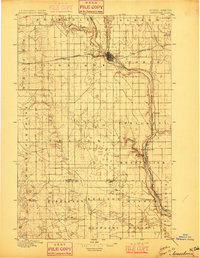
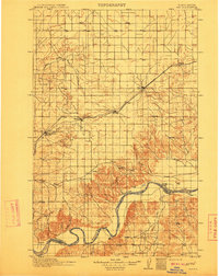
 1894 Hecla1894 Print · USGSThe northern Dakota plains are captured here in the 1890s as the rail and river determined the pulse of new settlements. Genealogists and historians can trace the early township grids and rail stops like Hecla, Houghton, and the frontier hamlet of Detroit.4 unique versions available
 - 1894 Map of Savo
 1894 Savo1894 Print · USGSThe Dakota borderlands come into focus in the early 1890s, capturing the early township organization and rail development of the prairie. Genealogists and historians can trace the paths of the Maple River and the C. M. & St. P. R. R. through Frederick and Oneota.
 - 1894 Map of Fullerton
 1894 Fullerton1894 Print · USGSNorth Dakota's southern prairie was a landscape of new townships and expanding railroads in the late nineteenth century. Genealogists and historians can trace the early footprints of Fullerton and Yorktown or the original route of the Maple River.2 unique versions available
 - 1894 Map of Oakes
 1894 Oakes1894 Print · USGSSoutheast North Dakota at the close of the nineteenth century is revealed as a burgeoning rail hub centered on the James River Valley. Genealogists can locate early homesteading era settlements like Port Emma, Glover, and the bustling junction at Oakes.2 unique versions available
 - 1895 Map of Lamoure
 1895 Lamoure1895 Print · USGSSoutheastern North Dakota was a landscape of rapid rail expansion and river-based settlement in the mid-1890s. Genealogists and historians can trace the early foundations of towns like Lamoure, Oakes, and Grand Rapids along the winding James River.2 unique versions available
 - 1895 Map of Fargo, 1954 Print
 1895 Fargo1954 Print · USGSThe Red River Valley thrived as a rail and agricultural frontier during the 1890s, where North Dakota and Minnesota meet. Genealogists can trace family roots through pioneer settlements and rail stops like Kurtz (Elmer Sta.), Wild Rice, and Christine.3 unique versions available
 - 1895 Map of Casselton, 1961 Print
 1895 Casselton1961 Print · USGSNorth Dakota's Red River Valley rail network is in full bloom in the 1890s, with towns emerging at every major junction. Trace early post offices and depots at Chaffee P.O., Embden, and Ripon along the Northern Pacific R. R.
 - 1896 Map of Columbia
 1896 Columbia1896 Print · USGSSettlement along the upper James River valley flourished in the 1890s as railroads expanded through the Dakota Territory. Trace the rail-fed growth of Columbia and Hecla alongside the waters of Sand Lake and Lake Columbia.3 unique versions available
 - 1896 Map of Jamestown
 1896 Jamestown1896 Print · USGSJamestown and the surrounding prairie were rapidly developing at the close of the nineteenth century as the railroad transformed the territory. Genealogists and historians can trace the early rail stops and river settlements like Eldridge, Ypsilanti, and Adrian.3 unique versions available
 - 1896 Map of Edgeley
 1896 Edgeley1896 Print · USGSDakota Territory had only recently achieved statehood when these rail lines began carving through the prairie. Genealogists can trace the early foundations of Edgeley, Kulm, and Ellendale alongside rural townships like Whitestone and Glenmore.2 unique versions available
 - 1897 Map of Fargo
 1897 Fargo1897 Print · USGSThe Red River Valley at the close of the nineteenth century was a bustling intersection of rail lines and river commerce. Genealogists and historians can trace the early footprints of Fargo and Moorhead, or find smaller depots like Kurtz (Elmer Sta.) and Wild Rice.12 unique versions available
 - 1897 Map of Tower
 1897 Tower1897 Print · USGSIn the late nineteenth century, the expansion of the northern plains centered on the intersection of the Sheyenne River and the arriving railroads. Genealogists and historians can trace early township plats and rail-stop settlements like Valley City, Fingal, and Enderlin.3 unique versions available
 - 1897 Map of Eckelson
 1897 Eckelson1897 Print · USGSEastern North Dakota in the late nineteenth century was a land defined by the iron rail and a network of glacial lakes. Genealogists can trace early homesteads and rail stops near Valley City, Sanborn, and the isolated post office at Svea.3 unique versions available
 - 1897 Map of Casselton
 1897 Casselton1897 Print · USGSCass County’s agricultural heartland is captured here in the 1890s, when new rail lines were defining the North Dakota prairie. Genealogists can trace family locations near early hubs like Casselton, the Chaffee P.O. settlement, and the banks of the Maple River.3 unique versions available
 - 1899 Map of Ellendale
 1899 Ellendale1899 Print · USGSNorth Dakota and South Dakota borderlands come into focus at the close of the nineteenth century as the railroad transforms the prairie. Genealogists and historians can trace the early growth of Ellendale and Leola along with vanished stops like Alpha and Delhi.2 unique versions available
 - 1900 Map of Pingree
 1900 Pingree1900 Print · USGSStutsman and Foster counties come alive in the final years of the nineteenth century as railroads began to stitch together the vast prairie. Researchers can trace the early rail stops at Pingree, Kensal, and Buchanan alongside the waters of Jim Lake and Spiritwood Lake.2 unique versions available
 - 1900 Map of Pingree, 1949 Print
 1900 Pingree1949 Print · USGSNorth Dakota's prairie landscape was being rapidly transformed by rail and river at the end of the 19th century. Researchers can trace early township development and rail stops like Pingree, Kensal, and Buchanan along the James River and Arrowwood Lake.
 - 1904 Map of Wahpeton
 1904 Wahpeton1904 Print · USGSThe Red River Valley at the start of the century was a landscape of burgeoning rail towns and river commerce along the Minnesota border. Genealogists can trace early homesteads and transport hubs between Wahpeton and Breckenridge, or follow the rail lines through Hankinson and Abercrombie.2 unique versions available
 - 1907 Map of Bismarck
 1907 Bismarck1907 Print · USGSThe Missouri River corridor at the turn of the century shows North Dakota's capital and rail hubs in their formative years. Researchers can trace early land divisions and transport routes like the Fort Yates Stage Road and landmarks such as Fort Lincoln or St Anthony.2 unique versions available
 - 1907 Map of Wyndmere
 1907 Wyndmere1907 Print · USGSRichland and Sargent counties are seen here in the early 1900s during the height of the prairie railroad boom. Genealogists and historians can trace the paths of five different rail lines serving early towns like Milnor, Wyndmere, and Sandoun Mc Leod P O.2 unique versions available
 - 1909 Map of Glendive
 1909 Glendive1909 Print · USGSThe confluence of the Missouri and Yellowstone rivers in the first decade of the twentieth century shows a region of scattered ranches and emerging river towns. Genealogists can trace family landmarks like Cavanaughs Ranch or Nortons Ranch and find early resource sites like the Coal Mine.
 - 1911 Map of Ray
 1911 Ray1911 Print · USGSNorthwest North Dakota at the height of the homesteading era reveals a landscape defined by the iron rails and the wide Missouri. Genealogists and researchers can trace the early rail stops like Wheelock and Epping or locate river landmarks such as Nesson Ferry and Banks.2 unique versions available
Showing maps 1-25 of 9,312
Top cities of North Dakota
- Fargo historical maps
- Bismarck historical maps
- Grand Forks historical maps
- West Fargo historical maps
- Minot historical maps
- Williston historical maps
See more
Top counties of North Dakota
- Cass County historical maps
- Burleigh County historical maps
- Ward County historical maps
- Grand Forks County historical maps
- Williams County historical maps
- Stark County historical maps
See more
Frequently asked questions
- What are the different types of historical maps available for North Dakota?
- What is the oldest map of North Dakota?
- Where can I purchase historical maps of North Dakota for my home or office?
- Where can I download high-res historical maps of North Dakota?
- Are there historical topographic maps available for North Dakota?
- Is there historical aerial imagery available for North Dakota?
- Where are historical maps of North Dakota sourced from?