1940s Maps of North Dakota
Explore 158 historic maps of North Dakota from the 1940s. These maps offer a rare glimpse into what life looked like during the 1940s — showing old roads, neighborhoods, homes, and landmarks that have changed or disappeared over time.
Whether you're researching your family's past, planning a metal detecting trip, or studying how North Dakota's landscape evolved across the 1940s, these high-resolution maps are a powerful tool for exploring the history of this region.
- Focus on a specific era: All maps on this page are from the 1940s, giving you a focused view of this time period.
- See what’s changed: Compare century-old streets, trails, and buildings to today's modern landscape using overlays and satellite layers.
- Research with precision: Use these maps for genealogy, historical research, land use analysis, or educational projects.
- View, download, or print: Maps are fully viewable online in high resolution, and can be downloaded or printed for your own records.
Start exploring North Dakota's history through authentic maps from the 1940s. This is your window into the past.
North Dakota maps
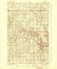
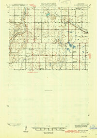
(158)- 1940 Map of Aylmer
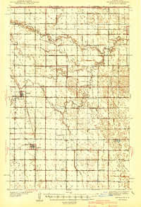
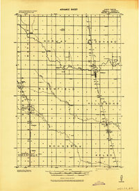
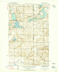
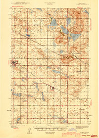 1940 Aylmer1940 Print · USGSPierce and Sheridan Counties come into focus just before the war, showing the peak of the North Dakota rail-and-prairie economy. Genealogists can pinpoint exact locations for family landmarks like Hillsdale Ch, White Sch, and Martin Cem.3 unique versions available
 - 1941 Map of Drayton
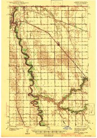
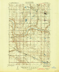
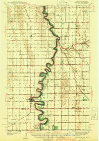 1941 Drayton1941 Print · USGSThe Red River of the North snakes across the border of North Dakota and Minnesota during the late 1930s. Genealogists and historians can trace rail-side towns like Bowesmont and Drayton, or locate rural landmarks such as Skjeberg Ch and the Airway Beacon.2 unique versions available
 - 1941 Map of Glasston
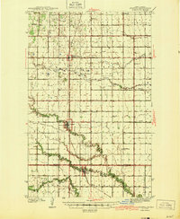
 1941 Glasston1941 Print · USGSThe Red River Valley's agricultural heartland is documented here just before the mid-century, showing a landscape defined by rail-side elevators and rural townships. Researchers can trace family roots through numerous country schools like Quam Sch and landmarks such as the Norwegian Cem near Sugar Siding.
 - 1941 Map of Selz
 1941 Selz1941 Print · USGSPierce and Wells Counties are shown in the late thirties as a landscape of rural school districts and bustling rail towns. Genealogists can locate family landmarks such as the Sheyenne River Academy, St Anthony Cem, and dozens of numbered country schools.2 unique versions available
 - 1941 Map of Cavalier
 1941 Cavalier1941 Print · USGSPembina County sits on the international border during the late 1930s, showing a landscape defined by the Great Northern rail lines and meandering rivers. Researchers can trace the exact locations of numerous vanished rural schoolhouses like Crosby Sch and family landmarks such as Horrigan Ridge.
 - 1941 Map of Bathgate
 1941 Bathgate1941 Print · USGSNortheastern North Dakota's borderlands are captured here in the late 1930s, showing a landscape defined by meandering rivers and a dense network of rural schoolhouses. Genealogists can locate family-named landmarks like Geroux Bridge Sch, Murphy Sch, and the Bathgate Cem.
 - 1941 Map of Pembina
 1941 Pembina1941 Print · USGSThe Red River valley at the Canadian border comes alive in this pre-war survey of the North Dakota-Minnesota line. Genealogists can trace family roots through numerous rural landmarks like the Icelandic Cem, North Star Ch, and the Fleece Sch.2 unique versions available
 - 1942 Map of Lake Upsilon
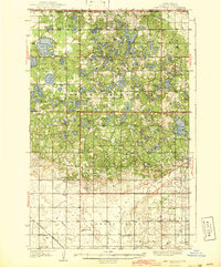 1942 Lake Upsilon1942 Print · USGSThe North Dakota borderlands and the Turtle Mountain Indian Reservation are captured here in the late 1930s. Genealogists and local historians can locate early landmarks like Belcourt Indian Agency, Lakeview Cem, and several parish churches.
 - 1942 Map of McVille
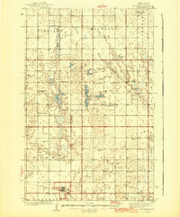 1942 McVille1942 Print · USGSNorth Dakota's prairie townships were still defined by remote schoolhouses and country churches in the years before the war. You can trace the rural foundations of McVille or locate family roots at Hamlin Cem and Central Farmers Union Hall.2 unique versions available
 - 1943 Map of Kelso
 1943 Kelso1943 Print · USGSTraill County agriculture and rail transit are captured here in the era before major highway expansion. Genealogists and local historians can locate early township schools, rural churches, and the distinct rail stops at Hillsboro, Blanchard, and Taft.
 - 1943 Map of Grafton
 1943 Grafton1943 Print · USGSWalsh County farming communities are caught in transition during this mid-century period as the rail network still dictated local commerce. Genealogists and historians can trace the exact locations of rural Schools, Cemeteries, and early rail stops like Cashel, Voss, and Herriot.
 - 1943 Map of Walhalla
 1943 Walhalla1943 Print · USGSSettlement along the international border is captured here during the 1940s, centered on the railroad corridor. Genealogists can locate family sites near Walhalla, the rural schoolhouses of Beaulieu, or the Bay Center Church.
 - 1943 Map of Maddock, 1963 Print
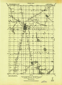
 1943 Maddock1963 Print · USGSBenson and Wells counties are shown in detail during the 1940s, when the prairie was dotted with localized school districts and rural parishes. Genealogists can trace family footprints at North Viking Cem or find the sites of East Fram Sch No 4 and Heimdal.
 - 1944 Map of Heart Butte
 1944 Heart Butte1944 Print · USGSThe rural expanses of Grant and Morton Counties are shown here just before the mid-century, defined by a network of one-room schoolhouses and remote farmsteads. Researchers can trace early family ties at St Joseph Ch or locate the local Lignite Mine along the Heart River.
 - 1944 Map of Crystal
 1944 Crystal1944 Print · USGSPembina and Walsh Counties during the early 1940s show a landscape of rail-reliant prairie towns and numerous one-room schoolhouses. Genealogists can locate family-named landmarks like Scheving Sch and Fisher Sch or the rural St Johns Ch.
 - 1944 Map of Brantford, 1963 Print
 1944 Brantford1963 Print · USGSEddy and Foster Counties appear here during the mid-1940s, showing a prairie landscape shaped by the Great Northern railroad and the James River. Researchers can locate numerous rural schoolhouses and church sites like Kvernes Ch and Columbia Sch.
 - 1945 Map of Maddock
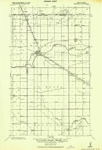
 1945 Maddock1945 Print · USGSBenson and Wells counties in the mid-1940s are defined by a robust network of prairie towns and competing rail lines. Researchers can trace rural life through numerous landmark schools and churches, from Maddock and Heimdal to Klara Church and East Fram School No 4.
 - 1945 Map of Manfred
 1945 Manfred1945 Print · USGSWells County prairie life is captured here at the end of the Second World War, showing a landscape of section-line roads and rural school districts. Genealogists can locate family landmarks like St Peters Ch, Manfred Sch No 3, and the village of Manfred.
 - 1945 Map of Pelican Lake, 1955 Print
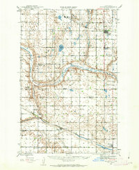
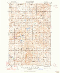 1945 Pelican Lake1955 Print · USGSSheridan and McLean Counties in the mid-1940s reveal a landscape of prairie potholes and tightly-knit rural school districts. Genealogists can trace family footprints through numerous local schoolhouses and landmarks like Our Savior Cem and Immanuel Ch.3 unique versions available
 - 1946 Map of Brantford
 1946 Brantford1946 Print · USGSCentral North Dakota’s prairie landscape is captured here in the mid-1940s, showing a rural economy tied to the Great Northern rail line. Genealogists can trace family footprints through numerous township schools and landmarks like Kvernes Ch or the Grace City Cem.2 unique versions available
 - 1946 Map of Sheyenne Lake
 1946 Sheyenne Lake1946 Print · USGSSheridan and Wells counties are captured here in the mid-1940s, revealing a dense rural network of prairie schoolhouses and churches. Family historians can trace landmarks like St Emanuel Gemeinde Cem, Sheyenne Lake, and numerous local schools including Pioneer Sch No 1.
 - 1946 Map of Brush Lake, 1955 Print
 1946 Brush Lake1955 Print · USGSThe Montana and North Dakota borderlands come alive in the mid-1940s, showing a landscape of prairie potholes and remote homesteads. Genealogists can locate the St Olaf Cem and rural landmarks like Brush Lake Resort or Liberty Sch.3 unique versions available
 - 1947 Map of Pelican Lake
 1947 Pelican Lake1947 Print · USGSSheridan and McLean Counties in the mid-1940s are characterized by an intricate network of rural school districts and prairie lakes. Genealogists can trace family roots through numerous local landmarks like Immanuel Ch, Our Savior Cem, and Wise Sch No 1.
 - 1947 Map of Turtle Lake
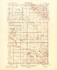
 1947 Turtle Lake1947 Print · USGSMcLean County is captured here in the mid-1940s, showing a prairie landscape where the railroad and rural school districts defined the community. Genealogists can locate family landmarks like Medicine Hill Cem and numerous schoolhouses including Palmborg Sch No 1 and Aurena Sch No 1.
 - 1947 Map of Lincoln Valley
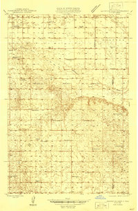
 1947 Lincoln Valley1947 Print · USGSSheridan and Wells Counties are shown in the late 1940s, a time when the North Dakota prairie was dotted with local school districts. Researchers can trace the exact locations of many rural schoolhouses and churches, including Lincoln Valley, Advent Ch, and Skogmo Cem.
Showing maps 1-25 of 158
Top cities of North Dakota
- Fargo historical maps
- Bismarck historical maps
- Grand Forks historical maps
- West Fargo historical maps
- Minot historical maps
- Williston historical maps
See more
Top counties of North Dakota
- Cass County historical maps
- Burleigh County historical maps
- Ward County historical maps
- Grand Forks County historical maps
- Williams County historical maps
- Stark County historical maps
See more
Frequently asked questions
- What are the different types of historical maps available for North Dakota?
- What is the oldest map of North Dakota?
- Where can I purchase historical maps of North Dakota for my home or office?
- Where can I download high-res historical maps of North Dakota?
- Are there historical topographic maps available for North Dakota?
- Is there historical aerial imagery available for North Dakota?
- Where are historical maps of North Dakota sourced from?