Old Maps of Stutsman County, North Dakota
Explore 354 old maps of Stutsman County, spanning from 1896 to today. These high-resolution historic maps reveal how streets, neighborhoods, landmarks, and natural features evolved over time — perfect for genealogy, metal detecting, research, and local history exploration.
What you can do with these maps:
- See how Stutsman County changed over time: Compare historical maps to modern-day views to trace roads, homesites, rail lines & more.
- View detailed metadata: Each map includes creators, publishers, year, scale, and archive source.
- Overlay maps with satellite & LiDAR: Visualize the past alongside modern tools to explore terrain & human change.
- Trusted historical sources: Maps sourced from the USGS, Library of Congress, and other archives.
- Access maps your way: View online, download high-res files, or order prints for personal or research use.
Start exploring old maps of Stutsman County to uncover forgotten places, hidden landmarks, and the deep history beneath your feet.
Stutsman County, ND maps
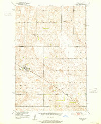
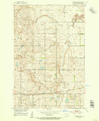
(354)- 1896 Map of Jamestown
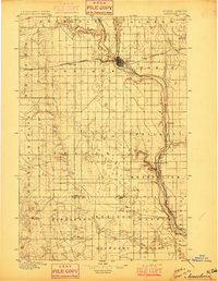 1896 Jamestown1896 Print · USGSJamestown and the surrounding prairie were rapidly developing at the close of the nineteenth century as the railroad transformed the territory. Genealogists and historians can trace the early rail stops and river settlements like Eldridge, Ypsilanti, and Adrian.3 unique versions available
 - 1897 Map of Eckelson
 1897 Eckelson1897 Print · USGSEastern North Dakota in the late nineteenth century was a land defined by the iron rail and a network of glacial lakes. Genealogists can trace early homesteads and rail stops near Valley City, Sanborn, and the isolated post office at Svea.3 unique versions available
 - 1900 Map of Pingree
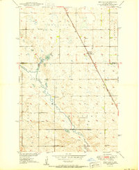
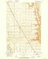
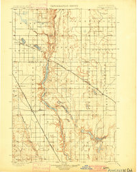 1900 Pingree1900 Print · USGSStutsman and Foster counties come alive in the final years of the nineteenth century as railroads began to stitch together the vast prairie. Researchers can trace the early rail stops at Pingree, Kensal, and Buchanan alongside the waters of Jim Lake and Spiritwood Lake.2 unique versions available
 - 1900 Map of Pingree, 1949 Print
 1900 Pingree1949 Print · USGSNorth Dakota's prairie landscape was being rapidly transformed by rail and river at the end of the 19th century. Researchers can trace early township development and rail stops like Pingree, Kensal, and Buchanan along the James River and Arrowwood Lake.
 - 1948 Map of Carrington
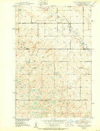
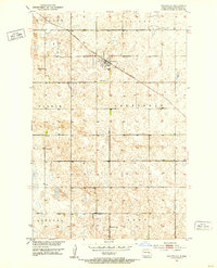
 1948 Carrington1948 Print · USGSCarrington and the surrounding Foster County prairies are captured here in the late 1940s at a peak of rail-based agriculture. Genealogists and local historians can locate dozens of numbered country schools, such as School No 1 and School No 4, and trace the path of the Northern Pacific railroad.
 - 1950 Map of Melville
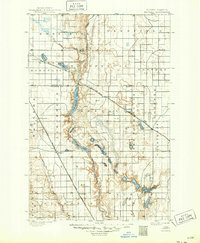
 1950 Melville1950 Print · USGSThe North Dakota prairie near the Foster and Stutsman County line is captured here just after the war. Local historians can trace the rural school system through School No 1 and School No 3, alongside the Northern Pacific rail siding at Melville.2 unique versions available
 - 1950 Map of Carrington SW
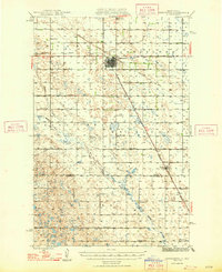
 1950 Carrington SW1950 Print · USGSMid-century Stutsman County is defined here by its rural schoolhouses and the winding course of Pipestem Creek. Genealogists and local historians can locate early family landmarks like Pleasant Valley Ch, Calvary Cem, and the high point at Mount Moriah.2 unique versions available
 - 1950 Map of Buchanan, 1978 Print
 1950 Buchanan1978 Print · USGSMid-century Stutsman County comes alive on this prairie survey, showing the agricultural heartbeat of the region. Researchers can trace the rail-oriented growth of Buchanan and locate early landmarks like School No 1 and the Cem near the Jim River Valley.
 - 1950 Map of Fried, 1978 Print
 1950 Fried1978 Print · USGSStutsman County prairie life is documented here during the mid-century, before the consolidation of rural school districts. Genealogists and local historians can locate early landmarks like Fried, Blue Lake, and the numbered sites of School No 1 and School No 2.
 - 1951 Map of Jamestown
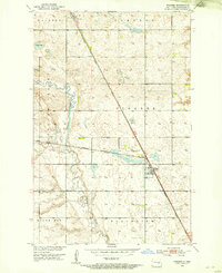
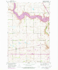
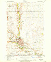 1951 Jamestown1951 Print · USGSJamestown serves as a busy rail and educational hub in the early 1950s, centered on the winding James River valley. Researchers can trace local genealogy and land use through features like Jamestown College, McGinnis Cem, and rural outposts such as Parkhurst.
 - 1951 Map of Fried
 1951 Fried1951 Print · USGSStutsman County's rural landscape is captured here in the early fifties, following the course of the James River and its broad valley. Genealogists and local historians can locate the community of Fried and the specific locations of School No 1 and School No 2.
 - 1951 Map of Arrowwood Lake
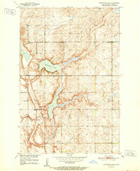
 1951 Arrowwood Lake1951 Print · USGSStutsman County, North Dakota, is captured here in the early fifties during the active development of the Missouri River Basin. Genealogists and historians can trace the fading rural school system through School No 2 (Abandoned) and locate the Refuge Headquarters along Arrowwood Lake.
 - 1951 Map of Spiritwood Lake
 1951 Spiritwood Lake1951 Print · USGSThe North Dakota prairie near Jamestown comes into focus in the early 1950s, showing a landscape of glacial lakes and township grids. Genealogists and local historians can locate early rural landmarks like School No 1 and trace the winding path of Sevenmile Coulee near Spiritwood Lake.
 - 1951 Map of Kensal, 1952 Print
 1951 Kensal1952 Print · USGSThe North Dakota prairie around the mid-century shows a landscape of distributed rural schoolhouses and rail-dependent settlements. Genealogists and local historians can locate Kensal, St Johns Cem, and several local schools like McKinley Sch No 2.
 - 1951 Map of Pingree, 1953 Print
 1951 Pingree1953 Print · USGSStutsman County prairie life is captured here in the early fifties, following the path of the Northern Pacific railroad through the heart of the region. Genealogists and local historians can locate Rest Cem, the rural Foothills Sch, and the early footprints of Pingree and Edmunds.
 - 1951 Map of Courtenay, 1953 Print
 1951 Courtenay1953 Print · USGSStutsman County's agricultural heartland is documented here in the early fifties, centered on the rail-side settlement of Courtenay. Researchers can pinpoint family history across several townships or locate rural landmarks like School No 1 and the Courtenay Cem.
 - 1951 Map of Bordulac SW, 1953 Print
 1951 Bordulac SW1953 Print · USGSNorth Dakota's prairie landscape is captured here in the early fifties, showing the rural crossroads of Stutsman and Foster Counties. Researchers can trace early transport routes like the Northern Pacific railroad and locate local landmarks such as Millers Spur and Arrowwood Sch.
 - 1951 Map of Kensal SE, 1953 Print
 1951 Kensal SE1953 Print · USGSThe rural townships of Stutsman County are captured here in the early fifties, documenting the agricultural grid and township school system. Researchers can locate local landmarks like the Eastman Cem, School No 3, and the Corinne Sch.2 unique versions available
 - 1951 Map of Eldridge SE, 1954 Print
 1951 Eldridge SE1954 Print · USGSThe Stutsman County prairie is captured here in the early fifties, showing the rural township structures of Lippert and Sydney. Genealogists and historians can trace the Midland Continental rail line and locate rural landmarks like School No 2.
 - 1951 Map of Eldridge NW, 1954 Print
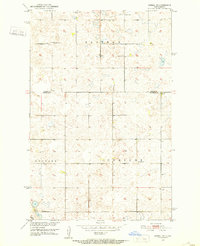
 1951 Eldridge NW1954 Print · USGSThe Stutsman County prairie in the early fifties was defined by the iron rails of the Northern Pacific and the vast expanse of the Minneapolis Flats. Researchers can trace old township boundaries like Windsor and Lippert or locate the site of School No 2.2 unique versions available
 - 1952 Map of Buchanan
 1952 Buchanan1952 Print · USGSMid-century Stutsman County is defined here by the intersection of the Northern Pacific railroad and the vast James River Valley. Genealogists and historians can locate the rural School No 1, the local Cem cemetery, and the grain-stop settlement of Buchanan.
 - 1952 Map of Eldridge
 1952 Eldridge1952 Print · USGSStutsman County is captured here during a period of transition as the Missouri River Basin project reshaped local waterways. Genealogists and historians can trace the foundations of the Eldridge community, from the Eldridge Cem to old rural landmarks like Woodbury School No 5.2 unique versions available
 - 1952 Map of Jim Lake
 1952 Jim Lake1952 Print · USGSStutsman County prairie and wetlands are documented here in the early fifties, following the path of the James River. Researchers can locate specific rural landmarks like School No 1, the Lookout Tower, and the Spillway within the Arrowwood National Wildlife Refuge.
 - 1952 Map of Courtenay NW
 1952 Courtenay NW1952 Print · USGSThe prairie of Stutsman County is shown here in the early fifties, mapped as a network of rural townships and school districts. Researchers can find numbered schoolhouses and local burial sites like St James Cem and Zion Cem near the Rudolph Lake shoreline.
 - 1952 Map of Homer, 1954 Print
 1952 Homer1954 Print · USGSStutsman County's prairie landscape is captured here in the early fifties, defined by the winding James River and the rural rail network. Genealogists and local historians can trace family locations near Kloze, the State Hospital Cem, and several numbered country schoolhouses.
Showing maps 1-25 of 354
Top cities of Stutsman County
- Jamestown historical maps
- Bloom historical maps
- Homer historical maps
- Medina historical maps
- Fried historical maps
- Streeter historical maps
See more
Frequently asked questions
- What are the different types of historical maps available for Stutsman County?
- What is the oldest map of Stutsman County?
- Where can I purchase historical maps of Stutsman County for my home or office?
- Where can I download high-res historical maps of Stutsman County?
- Are there historical topographic maps available for Stutsman County?
- Is there historical aerial imagery available for Stutsman County?
- Where are historical maps of Stutsman County sourced from?