
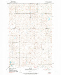
1951 Map of Kensal SE
USGS Topo · Published 1953About this map
Eastman and Corinne townships define the landscape of this 1951 survey, reflecting the rural township structure of Stutsman County at mid-century. The map, produced as part of the Department of the Interior’s program for the Missouri River Basin, documents a sparse but organized agricultural settlement pattern dominated by section-line roads and small communal hubs. Educational life for local families is marked by School No 3, School No 2, and the Corinne Sch. These rural schoolhouses, along with the Eastman Cem, serve as primary landmarks for genealogists tracing families in the area. Industrial activity is limited to a single Gravel Pit located near the boundary between Nogosek and Corinne, while the terrain itself is characterized by numerous small depressions and seasonal wetlands typical of this North Dakota prairie region.
Find a feature on this map
9 named features on this map. Tap any name to fly to it.
Don’t see what you’re looking for? This feature index may not catch every label — zoom into the map to look around manually.
Map Details
Editions of this 1951 Kensal SE Map
2 editions found
Other maps of this area

1900 · Pingree
USGS Topo · 1:125,000

1951 · Kensal
USGS Topo · 1:24,000

1951 · Kensal NW
USGS Topo · 1:24,000

1951 · Courtenay
USGS Topo · 1:24,000

1951 · Glenfield
USGS Topo · 1:24,000

1952 · Courtenay NW
USGS Topo · 1:24,000

1952 · New Rockford
USGS Topo · 1:250,000

1956 · New Rockford
USGS Topo · 1:250,000

1961 · Sutton
USGS Topo · 1:24,000

1961 · Wimbledon
USGS Topo · 1:24,000