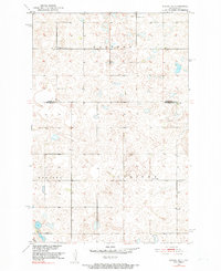
1951 Map of Kensal SE
USGS Topo · Published 1982About this map
Eastman, Nogosek, and Corinne townships define the landscape of this section of North Dakota, situated along the border of Foster and Stutsman Counties. Surveyed in the early 1950s, the terrain is characterized by a dense network of glacial prairie potholes and small depressions, reflecting the agricultural and drainage patterns of the Missouri River Basin development era. Educational and community hubs are represented by several local landmarks, including the Corinne Sch and numbered rural schoolhouses such as School No 2 and School No 3. These structures, alongside the Eastman Cem in the north, mark the social center of a dispersed farming population. The map provides a precise view of the section lines and unimproved dirt roads that governed movement across this prairie landscape before modern infrastructure developments.
Find a feature on this map
8 named features on this map. Tap any name to fly to it.
Don’t see what you’re looking for? This feature index may not catch every label — zoom into the map to look around manually.
Map Details
Editions of this 1951 Kensal SE Map
2 editions found
Other maps of this area

1900 · Pingree
USGS Topo · 1:125,000

1951 · Kensal
USGS Topo · 1:24,000

1951 · Kensal NW
USGS Topo · 1:24,000

1951 · Courtenay
USGS Topo · 1:24,000

1951 · Kensal SE
USGS Topo · 1:24,000

1951 · Glenfield
USGS Topo · 1:24,000

1952 · Courtenay NW
USGS Topo · 1:24,000

1952 · New Rockford
USGS Topo · 1:250,000

1956 · New Rockford
USGS Topo · 1:250,000

1961 · Sutton
USGS Topo · 1:24,000