1980s Maps of Stutsman County, North Dakota
Explore 7 historic maps of Stutsman County from the 1980s. These maps offer a rare glimpse into what life looked like during the 1980s — showing old roads, neighborhoods, homes, and landmarks that have changed or disappeared over time.
Whether you're researching your family's past, planning a metal detecting trip, or studying how Stutsman County's landscape evolved across the 1980s, these high-resolution maps are a powerful tool for exploring the history of this region.
- Focus on a specific era: All maps on this page are from the 1980s, giving you a focused view of this time period.
- See what’s changed: Compare century-old streets, trails, and buildings to today's modern landscape using overlays and satellite layers.
- Research with precision: Use these maps for genealogy, historical research, land use analysis, or educational projects.
- View, download, or print: Maps are fully viewable online in high resolution, and can be downloaded or printed for your own records.
Start exploring Stutsman County's history through authentic maps from the 1980s. This is your window into the past.
Stutsman County, ND maps
(7)- 1983 Map of Streeter
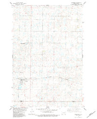 1983 Streeter1983 Print · USGSStreeter and the surrounding North Dakota prairie townships are documented here during the early eighties. Researchers can trace local lineage at Streeter City Cemetery or follow the Burlington Northern rail line through Germania.
 - 1983 Map of Gackle North
 1983 Gackle North1983 Print · USGSGackle and the surrounding prairie pothole region are shown here in the late 1970s and early 1980s as the rail-line economy persisted. Local historians can trace the boundaries of Bloomenfield and Germania or locate the Streeter Cem and Townhall.
 - 1983 Map of Streeter NW
 1983 Streeter NW1983 Print · USGSStutsman and Kidder Counties appear here in the early eighties as a vast network of prairie potholes and conservation lands. Researchers can trace the boundaries of Newbury and Streeter while locating Streeter Memorial State Park.
 - 1983 Map of Gackle NE, 1984 Print
 1983 Gackle NE1984 Print · USGSStutsman and Logan counties appear here in the early 1980s as a quiet patchwork of prairie wetlands and civil townships. Genealogists and researchers can trace township boundaries like Sinclair and Alexander or locate the Seventh Day Adventist Cem.
 - 1985 Map of Cooperstown
 1985 Cooperstown1985 Print · USGSGriggs and Barnes Counties are seen here in the mid-eighties, a period where the prairie economy centered on rail lines and river reservoirs. Genealogists and local historians can trace family locations near Wimbledon, Hannaford, and Spiritwood Lake or locate the Fish Hatchery and Gaging Station along the Sheyenne River.2 unique versions available
 - 1985 Map of Steele, 1994 Print
 1985 Steele1994 Print · USGSCentral North Dakota’s prairie pothole region is showcased here in the mid-1980s, revealing a landscape of vital wetlands and rail-dependent towns. Researchers can trace family ties and land use near Steele, Napoleon, and the many waterfowl production areas like Slade National Wildlife Refuge.
 - 1986 Map of Jamestown
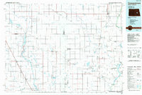
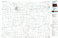 1986 Jamestown1986 Print · USGSThe eastern North Dakota prairie comes into focus in the mid-eighties, centered on the rail and river hubs of Jamestown and Valley City. You can trace the Burlington Northern line through historic stops like Eckelson, Sanborn, and Spiritwood while exploring vast wildlife refuges and local landmarks.2 unique versions available
End of results
Showing maps 1-7 of 7
Top cities of Stutsman County
- Jamestown historical maps
- Bloom historical maps
- Homer historical maps
- Medina historical maps
- Fried historical maps
- Streeter historical maps
See more
Frequently asked questions
- What are the different types of historical maps available for Stutsman County?
- What is the oldest map of Stutsman County?
- Where can I purchase historical maps of Stutsman County for my home or office?
- Where can I download high-res historical maps of Stutsman County?
- Are there historical topographic maps available for Stutsman County?
- Is there historical aerial imagery available for Stutsman County?
- Where are historical maps of Stutsman County sourced from?