1970s Maps of Stutsman County, North Dakota
Explore 12 historic maps of Stutsman County from the 1970s. These maps offer a rare glimpse into what life looked like during the 1970s — showing old roads, neighborhoods, homes, and landmarks that have changed or disappeared over time.
Whether you're researching your family's past, planning a metal detecting trip, or studying how Stutsman County's landscape evolved across the 1970s, these high-resolution maps are a powerful tool for exploring the history of this region.
- Focus on a specific era: All maps on this page are from the 1970s, giving you a focused view of this time period.
- See what’s changed: Compare century-old streets, trails, and buildings to today's modern landscape using overlays and satellite layers.
- Research with precision: Use these maps for genealogy, historical research, land use analysis, or educational projects.
- View, download, or print: Maps are fully viewable online in high resolution, and can be downloaded or printed for your own records.
Start exploring Stutsman County's history through authentic maps from the 1970s. This is your window into the past.
Stutsman County, ND maps
(12)- 1970 Map of Clementsville, 1973 Print
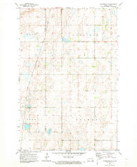 1970 Clementsville1973 Print · USGSNorth Dakota's prairie landscape near the border of Stutsman Co and Barnes Co is captured here during the early seventies. You can trace the shifting rail economy through the Soo Line corridor and the small settlements of Clementsville and Durupt.
 - 1970 Map of Spiritwood, 1973 Print
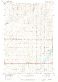 1970 Spiritwood1973 Print · USGSThe North Dakota prairie at the start of the 1970s shows a landscape defined by the Burlington Northern railroad and large glacial lakes. Genealogists and local historians can trace the small sidings of Spiritwood and Urbana or locate family lands near Goose Lake.
 - 1970 Map of Marion NW, 1973 Print
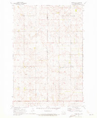 1970 Marion NW1973 Print · USGSThe rural prairie landscape at the tri-county corner of Stutsman, Barnes, and La Moure counties appears here in the early seventies. Genealogists and local historians can locate North Marion Ch, the neighboring Cem, and rural sections in Greenland and Saratoga.
 - 1970 Map of Eckelson SW, 1973 Print
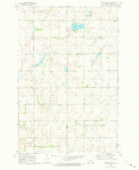 1970 Eckelson SW1973 Print · USGSThe rural prairie border of Stutsman and Barnes counties comes into focus during the early 1970s. Researchers can trace the section lines of Winfield and Ypsilanti or locate the local Townhall and the protected Mud Lake wetlands.
 - 1971 Map of New Rockford, 1974 Print
 1971 New Rockford1974 Print · USGSCentral North Dakota was a landscape of wildlife refuges and rail-linked agricultural towns in the early seventies. Genealogists and local historians can trace the development of the Fort Totten Indian Reservation and locate old railway points like Maddock, Hamal, and Kloten.
 - 1972 Map of Woodworth, 1974 Print
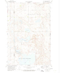
 1972 Woodworth1974 Print · USGSWoodworth and the surrounding prairie pothole wetlands of Stutsman County are captured here in the early 1970s. Genealogists and local historians can trace the Burlington Northern rail line and locate landmarks like Gem Cem or the shores of Barnes Lake.2 unique versions available
 - 1972 Map of Lake Louise, 1974 Print
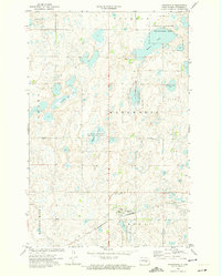
 1972 Lake Louise1974 Print · USGSStutsman County is depicted during the early 1970s as a vital corridor for prairie conservation and rail transport. Researchers can trace the extensive boundaries of the Chase Lake National Wildlife Refuge and locate rural landmarks like the Townhall and the Burlington Northern line.2 unique versions available
 - 1972 Map of Pearl Lake, 1974 Print
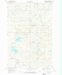 1972 Pearl Lake1974 Print · USGSStutsman County is captured here in the early 1970s, showcasing a prairie landscape of glacial lakes and waterfowl conservation. Genealogists and historians can trace the Burlington Northern rail line or locate specific tracts of the National Waterfowl Production Area near Pearl Lake.2 unique versions available
 - 1972 Map of Woodworth NW, 1974 Print
 1972 Woodworth NW1974 Print · USGSThe prairie pothole country of Stutsman County is seen here in the early 1970s, where wetlands and small farms dot the landscape. Genealogists can trace property in Marston Moor and Pettibone along the Burlington Northern rail line.
 - 1975 Map of Medina SW, 1978 Print
 1975 Medina SW1978 Print · USGSThe Missouri Coteau prairie of the mid-seventies is captured here along the Stutsman and Kidder county line. Genealogists and local historians can locate Crystal Springs, several rural schools, and the Lake George National Wildlife Refuge.
 - 1978 Map of Sykeston SW, 1979 Print
 1978 Sykeston SW1979 Print · USGSNorth Dakota's prairie pothole region comes to life in this late-seventies survey of the tri-county border lands. Researchers can trace rural life through landmarks like Townhall, New Home Ch, and the preserved wetlands of the National Waterfowl Production Area.
 - 1978 Map of Hawks Nest, 1979 Print
 1978 Hawks Nest1979 Print · USGSIn the late seventies, this portion of Stutsman County remained a quiet agricultural landscape dominated by glacial prairie potholes. Genealogists and local historians can locate the Lunde Ch and Cem, as well as the community Townhall and family landmarks like Hawks Nest.
End of results
Showing maps 1-12 of 12
Top cities of Stutsman County
- Jamestown historical maps
- Bloom historical maps
- Homer historical maps
- Medina historical maps
- Fried historical maps
- Streeter historical maps
See more
Frequently asked questions
- What are the different types of historical maps available for Stutsman County?
- What is the oldest map of Stutsman County?
- Where can I purchase historical maps of Stutsman County for my home or office?
- Where can I download high-res historical maps of Stutsman County?
- Are there historical topographic maps available for Stutsman County?
- Is there historical aerial imagery available for Stutsman County?
- Where are historical maps of Stutsman County sourced from?