
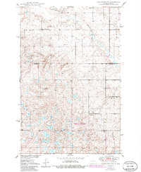
1950 Map of Carrington SW
USGS Topo · Published 1950About this map
Pipestem Creek and its tributary Little Pipestem Cr meander through this landscape on the border of Foster and Stutsman counties. The terrain, marked by glacial depressions and local rises such as Mount Moriah, supported a network of rural school districts at the mid-century, including School No 8, School No 2, School No 1, and School No 4. This agricultural region in central North Dakota shows a highly structured section-line road system that connects isolated farmsteads and local landmarks like the Windmill in the northern townships. Religious and social life centered on sites like Pleasant Valley Ch and the nearby Calvary Cem. Industrial activity is minimal, represented by a small Gravel Pit, while the presence of Russell Lake in the northeast corner provides one of the few large standing water bodies among the prairie potholes.
Find a feature on this map
17 named features on this map. Tap any name to fly to it.
Don’t see what you’re looking for? This feature index may not catch every label — zoom into the map to look around manually.
Map Details
Editions of this 1950 Carrington SW Map
2 editions found
Other maps of this area

1948 · Carrington
USGS Topo · 1:62,500

1950 · Carrington East
USGS Topo · 1:24,000

1950 · Melville
USGS Topo · 1:24,000

1950 · Carrington West
USGS Topo · 1:24,000

1951 · Dover
USGS Topo · 1:24,000

1952 · New Rockford
USGS Topo · 1:250,000

1956 · New Rockford
USGS Topo · 1:250,000
1958 · Vashti
USGS Topo · 1:24,000

1958 · Goldwin
USGS Topo · 1:24,000

1971 · New Rockford
USGS Topo · 1:250,000