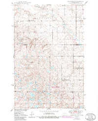
1950 Map of Carrington SW
USGS Topo · Published 1986About this map
Pipestem Creek and Little Pipestem Cr meander through this northern Stutsman County landscape, which is defined by a dense network of glacial potholes and small lakes. In the mid-20th century, the rural character of the area was anchored by distributed community landmarks such as Pleasant Valley Ch and Calvary Cem. Educational needs for the farming families in Longview and Glacier townships were met by a numbered system of local schoolhouses, including School No 1, School No 2, and School No 3.
Find a feature on this map
18 named features on this map. Tap any name to fly to it.
Don’t see what you’re looking for? This feature index may not catch every label — zoom into the map to look around manually.
Map Details
Editions of this 1950 Carrington SW Map
2 editions found
Other maps of this area

1948 · Carrington
USGS Topo · 1:62,500

1950 · Carrington East
USGS Topo · 1:24,000

1950 · Melville
USGS Topo · 1:24,000

1950 · Carrington SW
USGS Topo · 1:24,000

1950 · Carrington West
USGS Topo · 1:24,000

1951 · Dover
USGS Topo · 1:24,000

1952 · New Rockford
USGS Topo · 1:250,000

1956 · New Rockford
USGS Topo · 1:250,000
1958 · Vashti
USGS Topo · 1:24,000

1958 · Goldwin
USGS Topo · 1:24,000