
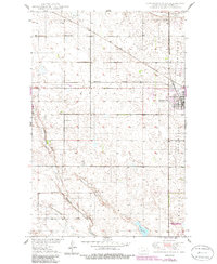
1950 Map of Carrington West
USGS Topo · Published 1950About this map
The prairie landscape of Foster County is defined by the intersection of major rail lines and the winding course of Pipestem Creek. At the time of this 1949 topographic study, the Carrington townsite serves as a regional hub, supported by the Minneapolis St Paul and Sault Ste Marie and the Northern Pacific railroads. The map reveals a highly organized rural grid, where numbered schools like School No 1 and School No 3 served the outlying farming community alongside landmarks like the Town Hall and the Landing Field. To the south and west, the terrain is dotted with small potholes and larger water bodies like Scotts Slough and Russell Lake. Genealogists will find the exact locations of the Carrington Cem and Longview Cem clearly marked among the sections of Longview and Wyard townships.
Find a feature on this map
20 named features on this map. Tap any name to fly to it.
Don’t see what you’re looking for? This feature index may not catch every label — zoom into the map to look around manually.
Map Details
Editions of this 1950 Carrington West Map
2 editions found
Other maps of this area

1948 · New Rockford
USGS Topo · 1:62,500

1948 · Cathay
USGS Topo · 1:62,500

1948 · Carrington
USGS Topo · 1:62,500

1949 · Cathay SE
USGS Topo · 1:24,000

1950 · Carrington East
USGS Topo · 1:24,000

1950 · Melville
USGS Topo · 1:24,000
1950 · New Rockford SE
USGS Topo · 1:24,000

1950 · Barlow
USGS Topo · 1:24,000

1950 · Carrington SW
USGS Topo · 1:24,000

1951 · Dover
USGS Topo · 1:24,000