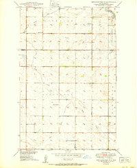
1950 Map of New Rockford SE
USGS Topo · Published 1950About this map
Pleasant Prairie dominates the eastern landscape of this Foster and Eddy County borderland, captured just as the mid-century development of the Missouri River Basin was underway. The area is defined by a complex network of seasonal water and prairie depressions, notably the winding James River and the expansive Estabrook Slough. The land is organized into systematic townships such as Superior and Carrington, where the footprint of rural education is still clearly visible. Local landmarks including Estabrook Sch, School No 2, and School No 4 reflect the distribution of homesteading families across the plains. Drainage patterns are articulated through named features like Schwoebel Slough, Kelly Creek, and Scotts Creek, providing a detailed look at the hydrology of the region before modern agricultural land-leveling altered many of these natural basins.
Find a feature on this map
14 named features on this map. Tap any name to fly to it.
Don’t see what you’re looking for? This feature index may not catch every label — zoom into the map to look around manually.
Map Details
Editions of this 1950 New Rockford SE Map
This is the sole edition of this map. No revisions or reprints were ever made.
Other maps of this area

1900 · Pingree
USGS Topo · 1:125,000

1944 · Brantford
USGS Topo · 1:62,500

1946 · Brantford
USGS Topo · 1:62,500

1948 · New Rockford
USGS Topo · 1:62,500

1948 · Carrington
USGS Topo · 1:62,500

1950 · Carrington East
USGS Topo · 1:24,000

1950 · New Rockford
USGS Topo · 1:24,000

1950 · New Rockford NE
USGS Topo · 1:24,000

1950 · Brantford NW
USGS Topo · 1:24,000

1950 · Brantford
USGS Topo · 1:24,000