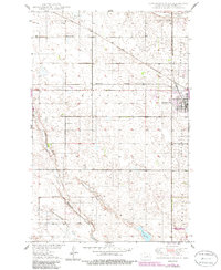
1950 Map of Carrington West
USGS Topo · Published 1986About this map
Carrington serves as the focal point of this mid-century survey of Foster County, where the plains are defined by glacial depressions and vital water sources like Scotts Slough and Russell Lake. The town's infrastructure at this time included a Municipal Airport and a prominent Trailer Park near the Burlington Northern railroad lines. The surrounding prairie is dotted with institutional markers of rural life, such as School No 1, School No 2, and a local Town Hall, reflecting a landscape of small, dispersed communities within the townships of Wyard and Longview.
Find a feature on this map
17 named features on this map. Tap any name to fly to it.
Don’t see what you’re looking for? This feature index may not catch every label — zoom into the map to look around manually.
Map Details
Editions of this 1950 Carrington West Map
2 editions found
Other maps of this area

1948 · New Rockford
USGS Topo · 1:62,500

1948 · Cathay
USGS Topo · 1:62,500

1948 · Carrington
USGS Topo · 1:62,500

1949 · Cathay SE
USGS Topo · 1:24,000

1950 · Carrington East
USGS Topo · 1:24,000

1950 · Melville
USGS Topo · 1:24,000
1950 · New Rockford SE
USGS Topo · 1:24,000

1950 · Barlow
USGS Topo · 1:24,000

1950 · Carrington SW
USGS Topo · 1:24,000

1950 · Carrington West
USGS Topo · 1:24,000