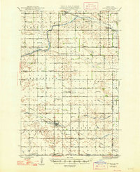
1948 Map of Cathay
USGS Topo · Published 1948About this map
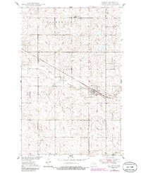
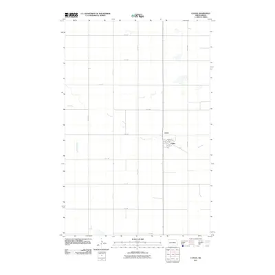
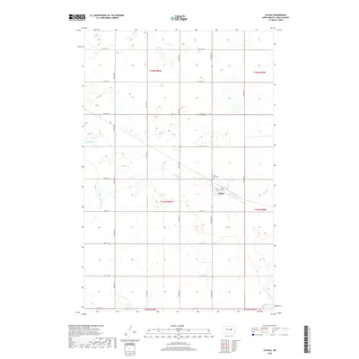
The agrarian landscape of Wells and Foster counties is captured here in the mid-1940s, revealing a grid of township boundaries and scattered rural schoolhouses that once served these prairie communities. The Great Northern railroad passes through Bremen and Munster in the north, while the Minneapolis St Paul and Sault Ste Marie line anchors the town of Cathay in the south. This rail-dependent economy is further illustrated by Lemert Sta on the southeastern edge. Local heritage is preserved through numerous denominational landmarks, including the German Baptist Ch, Norwegian Lutheran Ch, and St Josephs Ch. Natural drainage is provided by the James River as it winds through Hamburg and Bremen townships, while Rocky Run and Pipestem Creek carve through the southern sections near Lake View Cem.
Find a feature on this map
32 named features on this map. Tap any name to fly to it.
Don’t see what you’re looking for? This feature index may not catch every label — zoom into the map to look around manually.
Map Details
Editions of this 1948 Cathay Map
2 editions found
Historical Maps of Munster Through Time
7 maps found