
1948 Map of Fessenden
USGS Topo · Published 1948About this map
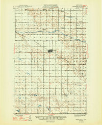
The James River meanders across the northern plains of Wells County, shaping the agricultural landscape of central North Dakota in the mid-1940s. The regional hub of Fessenden serves as a focal point, situated along the Minneapolis St Paul and Sault Ste Marie railroad line. The map reveals a dense network of early 20th-century rural infrastructure, specifically the high concentration of township schools like Bloomington Sch No 1 and Oshkosh Sch, which reflect the decentralized education system of the era.
Find a feature on this map
33 named features on this map. Tap any name to fly to it.
Don’t see what you’re looking for? This feature index may not catch every label — zoom into the map to look around manually.
Map Details
Editions of this 1948 Fessenden Map
2 editions found
Other maps of this area

1932 · Flora
USGS Topo · 1:62,500

1941 · Selz
USGS Topo · 1:62,500

1943 · Maddock
USGS Topo · 1:62,500

1945 · Maddock
USGS Topo · 1:62,500

1945 · Manfred
USGS Topo · 1:62,500

1948 · Cathay
USGS Topo · 1:62,500

1948 · Manfred
USGS Topo · 1:62,500

1948 · Bremen
USGS Topo · 1:24,000

1949 · Bremen
USGS Topo · 1:24,000

1949 · Cathay
USGS Topo · 1:24,000