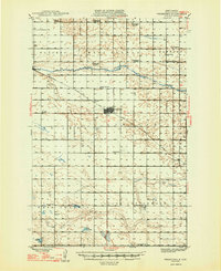
1948 Map of Fessenden
USGS Topo · Published 1948About this map
Fessenden serves as the central hub of Wells County on this survey, where the Minneapolis St Paul and Sault Ste Marie railroad tracks intersect the local road grid. The landscape is characterized by a dense network of township-based rural schools and family-linked cemeteries, reflecting the established agricultural community of the mid-1940s. Many of these institutions, such as St Anna Sch No 1 and Cottonwood Sch, were vital social anchors for the surrounding farmsteads.
Find a feature on this map
36 named features on this map. Tap any name to fly to it.
Don’t see what you’re looking for? This feature index may not catch every label — zoom into the map to look around manually.
Map Details
Editions of this 1948 Fessenden Map
2 editions found
Other maps of this area

1932 · Flora
USGS Topo · 1:62,500

1941 · Selz
USGS Topo · 1:62,500

1943 · Maddock
USGS Topo · 1:62,500

1945 · Maddock
USGS Topo · 1:62,500

1945 · Manfred
USGS Topo · 1:62,500

1948 · Cathay
USGS Topo · 1:62,500

1948 · Fessenden
USGS Topo · 1:62,500

1948 · Manfred
USGS Topo · 1:62,500

1948 · Bremen
USGS Topo · 1:24,000

1949 · Bremen
USGS Topo · 1:24,000