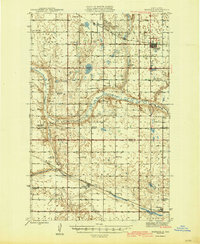
1945 Map of Maddock
USGS Topo · Published 1945About this map
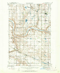
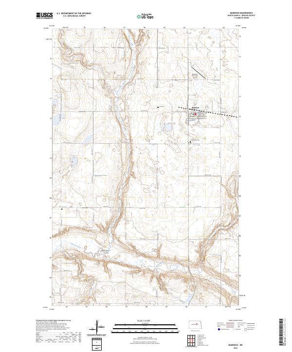
The Sheyenne River meanders through the heart of the North Dakota prairie, carving a winding path through the Aurora and Viking townships during the mid-1940s. This survey, conducted under the direction of Governor Fred G. Aandahl, documents a landscape defined by its rural infrastructure, where two major rail lines dictate the local economy. The Great Northern railroad services the southern settlements of Heimdal and Hamberg, while the Northern Pacific line connects Maddock and Hesper to the north. This era reveals a dense network of country schools, including Rich Valley School and East Fram School No 4, reflecting a time when the township system supported numerous local school districts. Numerous rural churches like Klara Church and Bethania Church serve as landmarks for genealogists tracing family roots in Benson and Wells counties.
Find a feature on this map
38 named features on this map. Tap any name to fly to it.
Don’t see what you’re looking for? This feature index may not catch every label — zoom into the map to look around manually.
Map Details
Editions of this 1945 Maddock Map
This is the sole edition of this map. No revisions or reprints were ever made.
Historical Maps of Maddock Through Time
8 maps found