Old Maps of Grand Forks County, North Dakota
Explore 272 old maps of Grand Forks County, spanning from 1919 to today. These high-resolution historic maps reveal how streets, neighborhoods, landmarks, and natural features evolved over time — perfect for genealogy, metal detecting, research, and local history exploration.
What you can do with these maps:
- See how Grand Forks County changed over time: Compare historical maps to modern-day views to trace roads, homesites, rail lines & more.
- View detailed metadata: Each map includes creators, publishers, year, scale, and archive source.
- Overlay maps with satellite & LiDAR: Visualize the past alongside modern tools to explore terrain & human change.
- Trusted historical sources: Maps sourced from the USGS, Library of Congress, and other archives.
- Access maps your way: View online, download high-res files, or order prints for personal or research use.
Start exploring old maps of Grand Forks County to uncover forgotten places, hidden landmarks, and the deep history beneath your feet.
Grand Forks County, ND maps
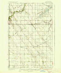
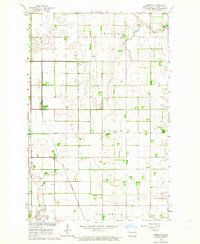
(272)- 1919 Map of Eldred
 1919 Eldred1919 Print · USGSThe Red River Valley at the end of the Great War shows a landscape of grain elevators and riverfront settlements. Genealogists can locate family landmarks across Vineland, Sidney, and Hubbard, including Station Eldred and the Climax tall Elevator.
 - 1926 Map of Ardoch, 1944 Print
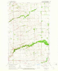
 1926 Ardoch1944 Print · USGSWalsh and Grand Forks Counties at the peak of the rail era show a landscape shaped by steam and drainage. Trace the routes of three major railroads through Ardoch, find country schools, and locate early crossings like Public Xing.-865 and the Cem. near Forest River.
 - 1934 Map of Emerado
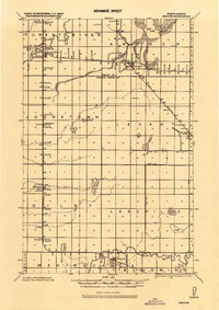
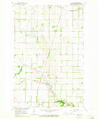
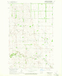
 1934 Emerado1934 Print · USGSThe Red River Valley prairie is captured here in the mid-1930s, showing a landscape of strictly gridded farmsteads and rural townships. Genealogists can trace family connections through numerous local landmarks like Mc Cray Sch, Blooming Town Hall, and the Washington Ch.4 unique versions available
 - 1934 Map of Grand Forks
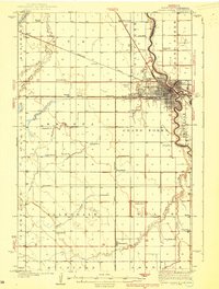
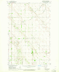
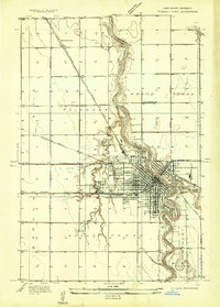 1934 Grand Forks1934 Print · USGSGrand Forks and East Grand Forks appear as a burgeoning rail and river hub in the mid-1930s. Researchers can trace the early footprint of the University of North Dakota or locate local landmarks like the State Elevator and Mill and Schumeier Switch.
 - 1934 Map of Grand Forks
 1934 Grand Forks1934 Print · USGSThe Red River Valley in the mid-1930s shows a landscape of growing river towns and a dense network of rural school districts. Genealogists can trace family connections to the UNIVERSITY OF NORTH DAKOTA, West Walle Ch, or early outposts like Merrifield and Schurmeier.2 unique versions available
 - 1936 Map of Emerado
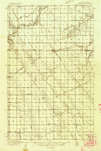
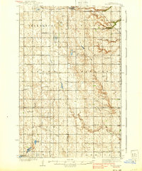
 1936 Emerado1936 Print · USGSGrand Forks County agriculture thrived in the mid-1930s as the railroad and new highways bridged the prairie. Genealogists can locate family-named landmarks and rural hubs like the Blooming Town Hall, Gilbert Sch, and Emerado Evangelical Ch.3 unique versions available
 - 1936 Map of Larimore
 1936 Larimore1936 Print · USGSGrand Forks County agriculture and transit are in full focus during the mid-1930s as the Great Northern railroad connects prairie towns. Genealogists can trace early landmarks like United Lutheran Church & Cem, Shawnee, and over a dozen numbered schools including School No 36.3 unique versions available
 - 1938 Map of Grand Forks
 1938 Grand Forks1938 Print · USGSGrand Forks and East Grand Forks appear as thriving rail hubs in the mid-1930s at the confluence of the Red and Red Lake Rivers. Researchers can trace rural school locations from School No 25 to School No 6 and identify landmarks like the Landing Field and Brenna Ch.3 unique versions available
 - 1939 Map of Niagara
 1939 Niagara1939 Print · USGSThe northern prairie along the Nelson and Grand Forks county line is shown here in the mid-1930s, defined by its glacial terrain and rail-fed towns. Trace the locations of early rural schools and congregations like Lunney Sch, Logan Ch, and Bethel Ch.2 unique versions available
 - 1952 Map of Grand Forks, 1967 Print
 1952 Grand Forks1967 Print · USGSThe Red River Valley in the early fifties is shown here at the height of its rail-and-river agricultural economy. Researchers can locate small-town landmarks like the Pleasant View School, the Immanuel Lutheran Church, and trace the path of the Soo Line Railroad.3 unique versions available
 - 1952 Map of Thief River Falls, 1967 Print
 1952 Thief River Falls1967 Print · USGSThe Red River Valley's agricultural and conservation landscape is captured in the mid-1950s, detailing a web of rail lines and international border crossings. Researchers can trace family roots in towns like Thief River Falls, locate the State School for Blind, and survey landmarks like the Agassiz National Wildlife Refuge.2 unique versions available
 - 1956 Map of Thief River Falls
 1956 Thief River Falls1956 Print · USGSThe Red River Valley in the mid-1950s is captured here as a sprawling network of rail corridors and wildlife refuges along the Canadian border. Trace the vanished transport routes of the Dismantled railroad and Abandoned railroad or locate local landmarks like the Herrick Elevator and State School for Blind.
 - 1956 Map of Grand Forks
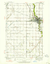
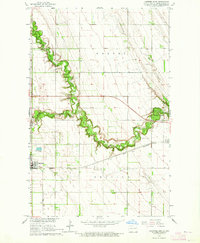
 1956 Grand Forks1956 Print · USGSThe Red River Valley in the mid-fifties is captured here as a thriving corridor of grain elevators and rail-linked towns along the North Dakota and Minnesota border. Researchers can trace historic church sites like Immanuel Lutheran Church, vanished rail stops at Tilde Junction, and the boundaries of the White Earth Indian Reservation.
 - 1957 Map of Thief River Falls
 1957 Thief River Falls1957 Print · USGSThe Red River Valley in the mid-fifties is captured here as a thriving network of rail towns and conservation lands. Genealogists and historians can trace family roots through settlements like Grafton, Pembina, and Hallock, or locate landmarks such as the State School for Blind and the Great Northern RR corridor.
 - 1963 Map of Kelly, 1964 Print
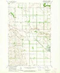
 1963 Kelly1964 Print · USGSGrand Forks was expanding westward during the early sixties as aviation and rail lines shaped the prairie. Genealogists can locate old rural schoolhouses like School No 30 and small rail-side stops including Kelly and Powell.
 - 1963 Map of Orr, 1964 Print
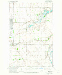
 1963 Orr1964 Print · USGSGrand Forks County is documented here in the early sixties as a region defined by rail and river. You can trace the Great Northern railroad through the settlements of Orr and McCanna or locate local landmarks like Whisky Creek.
 - 1963 Map of Larimore East, 1964 Print
 1963 Larimore East1964 Print · USGSGrand Forks County in the early 1960s shows a landscape of productive prairie organized around the Great Northern railway. Genealogists and local historians can locate the Bellevue Cem, the rural Townhall, and early recreation sites like the Larimore Country Club.2 unique versions available
 - 1963 Map of Niagara SW, 1964 Print
 1963 Niagara SW1964 Print · USGSNelson County's rural townships and glacial landscapes are captured here in the early sixties as agricultural life centered on small local hubs. Genealogists can locate family burial sites at Union Cem or Logan Ch Cem and trace the early roads through Logan Center and Adler.
 - 1963 Map of Inkster NE, 1964 Print
 1963 Inkster NE1964 Print · USGSThe rural border of Walsh and Grand Forks counties comes into focus in this mid-sixties survey of the North Dakota prairie. Genealogists and local researchers can trace the agricultural grid around Strabane and Johnstown or locate the Midway High Sch and Soo Line rail corridor.
 - 1963 Map of Kempton, 1964 Print
 1963 Kempton1964 Print · USGSGrand Forks County appears in the early sixties as a productive grid of agricultural townships shaped by the rail and river. Researchers can trace the path of the Great Northern through Kempton or locate School No 36 and the local Cem.
 - 1963 Map of Fordville SE, 1964 Print
 1963 Fordville SE1964 Print · USGSGrand Forks County was defined by its organized townships and winding waterways in the early sixties. Genealogists and local researchers can locate the Niagara settlement, Niagara Cem, and rural landmarks like School No 122.
 - 1963 Map of Larimore SW, 1964 Print
 1963 Larimore SW1964 Print · USGSGrand Forks County's prairie landscape is captured in the early sixties as the Missouri River Basin development program documented the region. Researchers can trace the winding paths of the Goose River and Little Goose River or locate several local Gravel Pits.
 - 1963 Map of Emerado SE, 1964 Print
 1963 Emerado SE1964 Print · USGSGrand Forks County's prairie townships were meticulously surveyed in the early sixties, capturing the heart of the Red River Valley's agricultural grid. Local researchers can trace old township lines from Oakville to Washington and locate sites like the Townhall and English Coulee.
 - 1963 Map of Larimore West, 1964 Print
 1963 Larimore West1964 Print · USGSGrand Forks County agriculture and rail infrastructure are on full display in the early sixties, centered on the Great Northern crossroads. Genealogists and historians can trace old property lines and locate Bellevue Cem, Hannah Junction, and the rural community of Shawnee.
 - 1963 Map of Emerado, 1964 Print
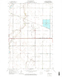
 1963 Emerado1964 Print · USGSThe Red River Valley's transition into the Cold War era is evident here, showing the growth of Grand Forks Air Force Base alongside traditional farming life. Genealogists can locate Emerado Cem and rural landmarks like Oakville Sch or Ascension Ch.2 unique versions available
Showing maps 1-25 of 272
Top cities of Grand Forks County
- Grand Forks historical maps
- Mekinock historical maps
- Larimore historical maps
- Thompson historical maps
- Northwood historical maps
- Emerado historical maps
See more
Frequently asked questions
- What are the different types of historical maps available for Grand Forks County?
- What is the oldest map of Grand Forks County?
- Where can I purchase historical maps of Grand Forks County for my home or office?
- Where can I download high-res historical maps of Grand Forks County?
- Are there historical topographic maps available for Grand Forks County?
- Is there historical aerial imagery available for Grand Forks County?
- Where are historical maps of Grand Forks County sourced from?