
1919 Map of Eldred
USGS Topo · Published 1919About this map
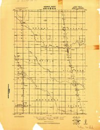
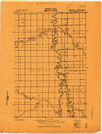
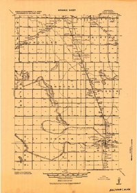
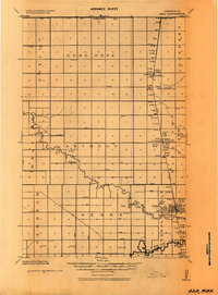
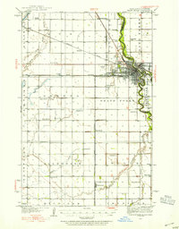
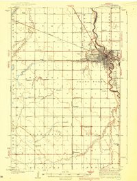
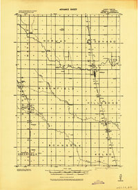
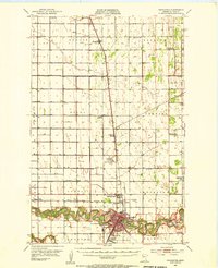
The Red River of the North defines the border between North Dakota and Minnesota, its winding course separating the townships of Americus, Stavanger, and Ervin from their eastern neighbors. Compiled by the Corps of Engineers at the end of the Great War, this survey highlights an agricultural landscape organized around the Great Northern railroad line. Industrial infrastructure is prominent in the small settlements, specifically the Eldred N.E. tall Elevator and Climax tall Elevator, which served as critical collection points for local grain. The map reveals a dense network of drainage ditches and coulees, such as Buffalo Coulee, engineered to manage the flat terrain of the Red River Valley. Small rural hubs like Belmont, Whynot, and Neby are shown alongside numerous district schools, reflecting the early 20th-century settlement pattern before the consolidation of rural communities.
Find a feature on this map
43 named features on this map. Tap any name to fly to it.
Don’t see what you’re looking for? This feature index may not catch every label — zoom into the map to look around manually.
Map Details
Editions of this 1919 Eldred Map
This is the sole edition of this map. No revisions or reprints were ever made.
Other maps of this area
1918 · Kelso
USGS Topo · 1:62,500
1918 · Hendrum
USGS Topo · 1:62,500
1919 · Beltrami
USGS Topo · 1:62,500
1924 · Ada
USGS Topo · 1:62,500
1934 · Grand Forks
USGS Topo · 1:62,500
1938 · Grand Forks
USGS Topo · 1:62,500
1943 · Kelso
USGS Topo · 1:62,500

1952 · Grand Forks
USGS Topo · 1:250,000
1953 · Crookston
USGS Topo · 1:62,500

1956 · Grand Forks
USGS Topo · 1:250,000