
1963 Map of Larimore SW
USGS Topo · Published 1964About this map
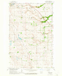
Goose River meanders across this rural expanse of Grand Forks County during the early 1960s, a period when the landscape was heavily defined by the agricultural township boundaries of Larimore, Grace, and Lind. This survey was conducted as part of the Department of the Interior's efforts toward the development of the Missouri River Basin, documenting the drainage patterns of the Little Goose River and its various tributaries. The terrain is notably marked by numerous Gravel Pits and isolated Gravel Pit operations, reflecting the local extraction industry that supported road building and infrastructure in this portion of the Red River Valley region. Beyond the watercourses and section lines, the map reveals a sparsely populated prairie environment where land use was primarily dedicated to large-scale farming and resource management.
Find a feature on this map
7 named features on this map. Tap any name to fly to it.
Don’t see what you’re looking for? This feature index may not catch every label — zoom into the map to look around manually.
Map Details
Editions of this 1963 Larimore SW Map
This is the sole edition of this map. No revisions or reprints were ever made.
Other maps of this area

1936 · Larimore
USGS Topo · 1:62,500

1939 · Niagara
USGS Topo · 1:62,500

1952 · Grand Forks
USGS Topo · 1:250,000

1956 · Grand Forks
USGS Topo · 1:250,000

1963 · Larimore East
USGS Topo · 1:24,000

1963 · Kempton
USGS Topo · 1:24,000

1963 · Larimore West
USGS Topo · 1:24,000
1963 · Niagara
USGS Topo · 1:24,000

1963 · Logan Center
USGS Topo · 1:24,000

1966 · Grand Forks
USGS Topo · 1:250,000