1960s Maps of Grand Forks County, North Dakota
Explore 30 historic maps of Grand Forks County from the 1960s. These maps offer a rare glimpse into what life looked like during the 1960s — showing old roads, neighborhoods, homes, and landmarks that have changed or disappeared over time.
Whether you're researching your family's past, planning a metal detecting trip, or studying how Grand Forks County's landscape evolved across the 1960s, these high-resolution maps are a powerful tool for exploring the history of this region.
- Focus on a specific era: All maps on this page are from the 1960s, giving you a focused view of this time period.
- See what’s changed: Compare century-old streets, trails, and buildings to today's modern landscape using overlays and satellite layers.
- Research with precision: Use these maps for genealogy, historical research, land use analysis, or educational projects.
- View, download, or print: Maps are fully viewable online in high resolution, and can be downloaded or printed for your own records.
Start exploring Grand Forks County's history through authentic maps from the 1960s. This is your window into the past.
Grand Forks County, ND maps
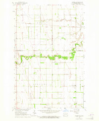
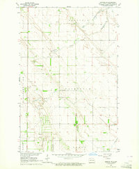
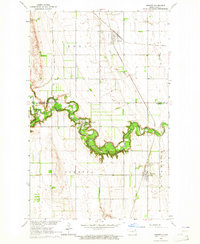
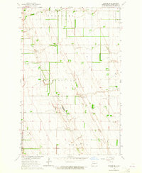
(30)- 1963 Map of Kelly, 1964 Print
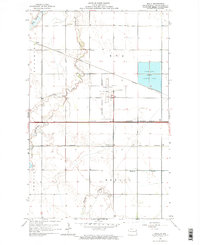 1963 Kelly1964 Print · USGSGrand Forks was expanding westward during the early sixties as aviation and rail lines shaped the prairie. Genealogists can locate old rural schoolhouses like School No 30 and small rail-side stops including Kelly and Powell.
 - 1963 Map of Orr, 1964 Print
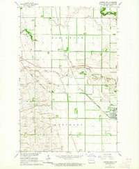
 1963 Orr1964 Print · USGSGrand Forks County is documented here in the early sixties as a region defined by rail and river. You can trace the Great Northern railroad through the settlements of Orr and McCanna or locate local landmarks like Whisky Creek.
 - 1963 Map of Larimore East, 1964 Print
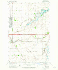
 1963 Larimore East1964 Print · USGSGrand Forks County in the early 1960s shows a landscape of productive prairie organized around the Great Northern railway. Genealogists and local historians can locate the Bellevue Cem, the rural Townhall, and early recreation sites like the Larimore Country Club.2 unique versions available
 - 1963 Map of Niagara SW, 1964 Print
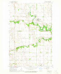
 1963 Niagara SW1964 Print · USGSNelson County's rural townships and glacial landscapes are captured here in the early sixties as agricultural life centered on small local hubs. Genealogists can locate family burial sites at Union Cem or Logan Ch Cem and trace the early roads through Logan Center and Adler.
 - 1963 Map of Inkster NE, 1964 Print
 1963 Inkster NE1964 Print · USGSThe rural border of Walsh and Grand Forks counties comes into focus in this mid-sixties survey of the North Dakota prairie. Genealogists and local researchers can trace the agricultural grid around Strabane and Johnstown or locate the Midway High Sch and Soo Line rail corridor.
 - 1963 Map of Kempton, 1964 Print
 1963 Kempton1964 Print · USGSGrand Forks County appears in the early sixties as a productive grid of agricultural townships shaped by the rail and river. Researchers can trace the path of the Great Northern through Kempton or locate School No 36 and the local Cem.
 - 1963 Map of Fordville SE, 1964 Print
 1963 Fordville SE1964 Print · USGSGrand Forks County was defined by its organized townships and winding waterways in the early sixties. Genealogists and local researchers can locate the Niagara settlement, Niagara Cem, and rural landmarks like School No 122.
 - 1963 Map of Larimore SW, 1964 Print
 1963 Larimore SW1964 Print · USGSGrand Forks County's prairie landscape is captured in the early sixties as the Missouri River Basin development program documented the region. Researchers can trace the winding paths of the Goose River and Little Goose River or locate several local Gravel Pits.
 - 1963 Map of Emerado SE, 1964 Print
 1963 Emerado SE1964 Print · USGSGrand Forks County's prairie townships were meticulously surveyed in the early sixties, capturing the heart of the Red River Valley's agricultural grid. Local researchers can trace old township lines from Oakville to Washington and locate sites like the Townhall and English Coulee.
 - 1963 Map of Larimore West, 1964 Print
 1963 Larimore West1964 Print · USGSGrand Forks County agriculture and rail infrastructure are on full display in the early sixties, centered on the Great Northern crossroads. Genealogists and historians can trace old property lines and locate Bellevue Cem, Hannah Junction, and the rural community of Shawnee.
 - 1963 Map of Emerado, 1964 Print
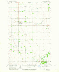
 1963 Emerado1964 Print · USGSThe Red River Valley's transition into the Cold War era is evident here, showing the growth of Grand Forks Air Force Base alongside traditional farming life. Genealogists can locate Emerado Cem and rural landmarks like Oakville Sch or Ascension Ch.2 unique versions available
 - 1963 Map of Fordville, 1964 Print
 1963 Fordville1964 Print · USGSFordville and the surrounding Walsh County prairies are captured in the early sixties as the local rail and river network shaped the land. Researchers can trace the Soo Line through town, locate family plots at Oak Grove Cem, or follow the winding South Branch Forest River.2 unique versions available
 - 1963 Map of Inkster, 1964 Print
 1963 Inkster1964 Print · USGSThe eastern North Dakota prairie comes alive in the early sixties as the Forest River winds through fertile agricultural lands. Trace family history and rural development through the Forest River Colony, St Marks Cem, and the rail junction at Inkster.
 - 1963 Map of Emerado SW, 1964 Print
 1963 Emerado SW1964 Print · USGSGrand Forks County agriculture is captured here in the early sixties, showing the transition of the Red River Valley prairie. Researchers can locate family farmsteads and rural centers like Pleasant View Ch or follow the waters of English Coulee.
 - 1963 Map of Forest River, 1964 Print
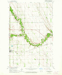
 1963 Forest River1964 Print · USGSWalsh and Grand Forks counties are captured in the early 1960s at the height of the prairie's rail-and-river era. Genealogists and local historians can trace the gridded settlements of Forest River and Johnstown along the Soo Line and Northern Pacific railroads.
 - 1963 Map of Niagara, 1964 Print
 1963 Niagara1964 Print · USGSNiagara and the eastern North Dakota prairie are captured in the early sixties as the rail-and-river economy persisted. Researchers can trace the Great Northern railroad route, find the Bethel Ch Cem, and locate rural landmarks like Larimore Sch No 3.
 - 1963 Map of Inkster SE, 1964 Print
 1963 Inkster SE1964 Print · USGSThe townships of northeastern North Dakota are captured in the early sixties, showing a landscape shaped by section lines and agriculture. Genealogists and local historians can locate the central Townhall and numerous family-held Gravel Pits across Wheatfield and Strabane.
 - 1963 Map of Gilby, 1964 Print
 1963 Gilby1964 Print · USGSGrand Forks County's agricultural heartland is documented here in the early 1960s, centered on the Northern Pacific rail line. Researchers can trace rural landmarks like Prairie Home Cem, St Paul Ch, and the small settlement of Honeyford.
 - 1963 Map of Logan Center, 1965 Print
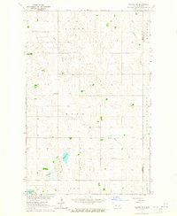
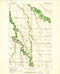
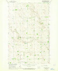 1963 Logan Center1965 Print · USGSGrand Forks County's prairie landscapes are captured here in the early sixties, showing the agricultural and geological foundations of the region. Researchers can locate the Logan Center Cem and trace the winding course of the Little Goose River through the Moraine hills.
 - 1963 Map of Arvilla, 1965 Print
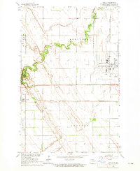 1963 Arvilla1965 Print · USGSGrand Forks County in the early 1960s was a landscape defined by the expansion of the Grand Forks Air Force Base and the Great Northern railroad. Genealogists and historians can trace the settlement of Arvilla and the wooded bends of Turtle River State Park.
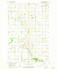
 - 1963 Map of Grand Forks, 1965 Print
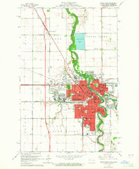 1963 Grand Forks1965 Print · USGSGrand Forks and the Red River Valley are seen here in the early 1960s as the urban footprint expanded around the university. Trace the city's growth through sites like the University of North Dakota, Calspur, and parochial schools such as St Marys Sch.2 unique versions available
 - 1964 Map of Climax NW, 1966 Print
 1964 Climax NW1966 Print · USGSThe Red River Valley in the mid-sixties is captured here as a landscape of tight oxbows and organized farmsteads. Researchers can trace the drainage of the prairie through Buffalo Coulee or locate rural centers like Rosendahl Ch and North Ringsaker Cem.
 - 1964 Map of Bygland, 1966 Print
 1964 Bygland1966 Print · USGSThe Red River Valley in the mid-sixties is captured here as a landscape of grid-patterned farms and winding river bottoms. Genealogists can locate rural landmarks like Bygland Ch, School No 6, and family-named sites like McGrath Landing Strip.
 - 1966 Map of Grand Forks
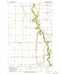
 1966 Grand Forks1966 Print · USGSThe Red River Valley in the mid-sixties shows a landscape shaped by rail-line commerce and complex water management. Genealogists and historians can trace rail-side towns like Emerado and Hunter or locate rural landmarks like the Pleasant View Church.
 - 1966 Map of Oslo NE, 1968 Print
 1966 Oslo NE1968 Print · USGSThe Red River Valley in the mid-sixties shows a landscape of precise township grids and vital rail connections along the Minnesota-North Dakota border. Genealogists can trace rural family sites near Mesopotamia Cem, Oak Park Ch, and the Soo Line rail corridor.
Showing maps 1-25 of 30
Top cities of Grand Forks County
- Grand Forks historical maps
- Mekinock historical maps
- Larimore historical maps
- Thompson historical maps
- Northwood historical maps
- Emerado historical maps
See more
Frequently asked questions
- What are the different types of historical maps available for Grand Forks County?
- What is the oldest map of Grand Forks County?
- Where can I purchase historical maps of Grand Forks County for my home or office?
- Where can I download high-res historical maps of Grand Forks County?
- Are there historical topographic maps available for Grand Forks County?
- Is there historical aerial imagery available for Grand Forks County?
- Where are historical maps of Grand Forks County sourced from?