1990s Maps of North Dakota
Explore 173 historic maps of North Dakota from the 1990s. These maps offer a rare glimpse into what life looked like during the 1990s — showing old roads, neighborhoods, homes, and landmarks that have changed or disappeared over time.
Whether you're researching your family's past, planning a metal detecting trip, or studying how North Dakota's landscape evolved across the 1990s, these high-resolution maps are a powerful tool for exploring the history of this region.
- Focus on a specific era: All maps on this page are from the 1990s, giving you a focused view of this time period.
- See what’s changed: Compare century-old streets, trails, and buildings to today's modern landscape using overlays and satellite layers.
- Research with precision: Use these maps for genealogy, historical research, land use analysis, or educational projects.
- View, download, or print: Maps are fully viewable online in high resolution, and can be downloaded or printed for your own records.
Start exploring North Dakota's history through authentic maps from the 1990s. This is your window into the past.
North Dakota maps
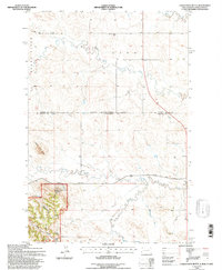
(173)- 1990 Map of Courtenay NW, 1995 Print
 1990 Courtenay NW1995 Print · USGSStutsman County's prairie landscape is captured here in the 1990s, showcasing a region defined by its conservation areas and rural townships. Genealogists can locate family landmarks like St James Cem and Zion Cem near the banks of Rudolph Lake.
 - 1990 Map of Eldridge NW, 1995 Print
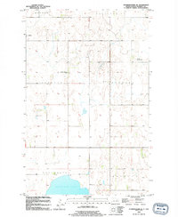
 1990 Eldridge NW1995 Print · USGSStutsman County near the turn of the 1990s remained a landscape of prairie potholes and conservation lands. Genealogists and researchers can trace local hydrology through Deer Lake, Moon Lake, and the National Waterfowl Production Area.
 - 1990 Map of Jamestown, 1995 Print
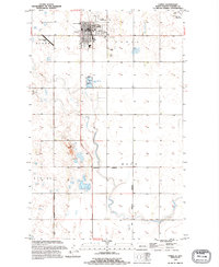
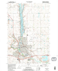 1990 Jamestown1995 Print · USGSJamestown and its surrounding prairie townships are captured here during the mid-nineties as the city expanded along the river forks. Genealogists and researchers can trace family plots in Jamestown Cem, explore the Jamestown College campus, or locate the historic Ft Seward Historic Site.
 - 1990 Map of Jim Lake, 1995 Print
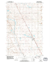
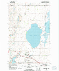
 1990 Jim Lake1995 Print · USGSThe James River valley of Stutsman County is shown here in the 1990s, centered on the vital wetland habitats of the Arrowwood National Wildlife Refuge. Researchers can trace the water levels and boundaries of Jim Lake, Mud Lake, and the surrounding Grasshopper Hills.
 - 1990 Map of Pingree SW, 1995 Print
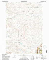
 1990 Pingree SW1995 Print · USGSStutsman County's glaciated prairie is documented here as it appeared in the early nineties, showing a landscape defined by seasonal wetlands and the winding path of Pipestem Creek. Researchers can identify specific landform markers like Round Top and the Gaging Station used for water monitoring.
 - 1990 Map of Fried, 1995 Print
 1990 Fried1995 Print · USGSStutsman County in the 1990s showcases a landscape of prairie potholes and reservoirs during a period of transition for rural agricultural hubs. Genealogists and local historians can locate the Fried Cem and the settlement of Fried, or trace the shoreline of the Jamestown Reservoir.
 - 1990 Map of Eldridge SE, 1995 Print
 1990 Eldridge SE1995 Print · USGSStutsman County prairie lands are documented here in the final decade of the twentieth century, showing a landscape of townships and protected wetlands. Trace the winding course of Beaver Creek or locate preserved lands within the National Waterfowl Production Area.
 - 1990 Map of Eldridge, 1995 Print
 1990 Eldridge1995 Print · USGSStutsman County's prairie landscape comes into focus during the 1990s as modern interstate travel meets historic rail routes. Researchers can trace the rail line of the Minneapolis St Paul and Sault Ste Marie RR and locate the Eldridge Cem near the town of Eldridge.
 - 1990 Map of Homer, 1995 Print
 1990 Homer1995 Print · USGSStutsman County prairie lands are documented here during the 1990s, capturing the rural intersection of four local townships. Genealogists and researchers can trace the State Hospital Cem and the rail-oriented sites of Jamestown Junction and Kloze.
 - 1990 Map of Buchanan, 1995 Print
 1990 Buchanan1995 Print · USGSThe North Dakota prairie near Buchanan is captured here in the final decade of the twentieth century, showing a landscape of small wetlands and organized agriculture. Researchers can trace the local Cem and the eastern reach of the James River Reservoir.
 - 1991 Map of Pingree, 1995 Print
 1991 Pingree1995 Print · USGSThe rural landscapes of Stutsman County are captured here in the early nineties, showcasing the agricultural heart of central North Dakota. Genealogists can locate family landmarks such as Rest Cem and Cem, or trace the course of Pipestem Creek through Edmunds and Pingree.
 - 1991 Map of Eldridge SW, 1995 Print
 1991 Eldridge SW1995 Print · USGSStutsman County at the start of the 1990s reveals a prairie landscape defined by conservation and water. Local researchers can trace the boundaries of Lippert Flats and numerous National Waterfowl Production Areas along Beaver Creek.
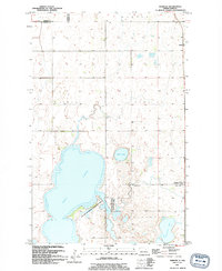
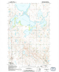
 - 1993 Map of Devils Lake, 1994 Print
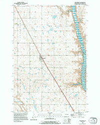
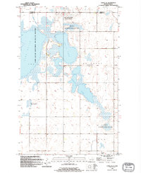
 1993 Devils Lake1994 Print · USGSThe Ramsey County prairie and the shores of Devils Lake are captured here during the 1990s as the region's agricultural and conservation landscapes were maturing. Genealogists and researchers can trace the rail-side growth of Lakota and Michigan or locate family lands near Camp Grafton and the Sullys Hills N W R.
 - 1993 Map of Ladner NE, 1996 Print
 1993 Ladner NE1996 Print · USGSThe North Dakota and South Dakota borderlands come alive in this early nineties survey of ranching country. Genealogists and historians can locate remote outposts like the Grand River Sch and Janvrin Ranch or trace old routes along Bullock Road.
 - 1993 Map of Eagles Nest Butte, 1996 Print
 1993 Eagles Nest Butte1996 Print · USGSThe North Dakota and South Dakota borderlands come into focus in this late twentieth-century record of the high plains. Researchers can trace the ranching history of the area through landmarks like Feist Ranch, the Lone Tree Sch, and Eagles Nest Butte.
 - 1994 Map of Webster
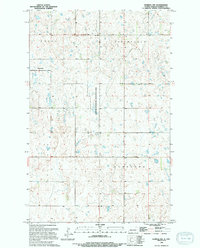
 1994 Webster1994 Print · USGSRamsey County in the mid-nineties reveals a landscape of prairie potholes and small agricultural hubs. Researchers can trace the boundaries of the National Waterfowl Production Area and locate the Webster Cem near the town of Webster.
 - 1994 Map of Sweetwater
 1994 Sweetwater1994 Print · USGSRamsey County's prairie pothole region is captured in the early nineties, showing a landscape defined by its fluctuating water levels and small settlements. Trace the connections between Sweetwater Lake and Storman Lake, or locate the historic site of Sweetwater.
 - 1994 Map of Derrick NW
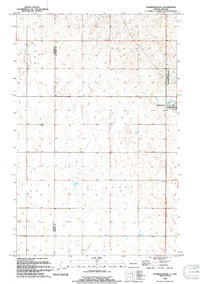
 1994 Derrick NW1994 Print · USGSThe prairie wetlands of Ramsey County are captured in detail during the mid-1990s, revealing a landscape dedicated to conservation. Researchers can trace the boundaries of the National Waterfowl Production Area across the townships of Royal and Overland.
 - 1994 Map of Churchs Ferry
 1994 Churchs Ferry1994 Print · USGSThe northern prairie plains of the 1990s are defined here by the waters of the Chain Lakes and the town of Churchs Ferry. Researchers can trace the Burlington Northern rail lines and locate landmarks like the Churchs Ferry Cem and Maza.
 - 1994 Map of Cando
 1994 Cando1994 Print · USGSThe prairie hub of Cando is captured in the mid-1990s, showcasing its role as a regional center for Towner County. Genealogists and historians can locate the Cando Cem, the County Fairground, and the southern settlement of Maza.
 - 1994 Map of Starkweather SE
 1994 Starkweather SE1994 Print · USGSRamsey County in the early nineties remains a landscape of organized townships and prairie waterways. Researchers can locate family landmarks like SS Peter And Paul Ch, the community of Garske, and the shores of Morrison Lake.
 - 1994 Map of Carrington
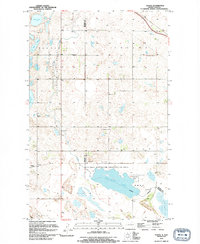
 1994 Carrington1994 Print · USGSCentral North Dakota's prairie pothole region comes alive in this mid-nineties survey, showing a landscape defined by expansive wetlands and small rail towns. Genealogists and researchers can trace the vicinity of Carrington and Sykeston, or locate remote landmarks like the Chase Lake National Wildlife Refuge and Lake Williams.
 - 1994 Map of Cando SE
 1994 Cando SE1994 Print · USGSThe prairie wetlands of Ramsey County are captured here in the mid-1990s, dominated by the intricate hydrology of the Chain Lakes. Researchers can locate rural landmarks like the Chain Lake Ch, the Almira Cem, and the small settlement of Townhall.
 - 1994 Map of Tilden
 1994 Tilden1994 Print · USGSThe Benson and Ramsey County borderlands are captured here in the mid-1990s, showcasing a landscape of sprawling wetlands and small prairie settlements. Genealogists and local historians can locate early community hubs like Tilden and Penn, or trace rural landmarks like Antiochia Ch and the townhall.
 - 1994 Map of Starkweather
 1994 Starkweather1994 Print · USGSThe town of Starkweather and the surrounding prairie potholes of the Devils Lake basin are captured in this mid-nineties survey. Genealogists and local historians can trace family roots through the Bergen Cem and explore the geography of Hammer and Klingstrup townships.
Showing maps 1-25 of 173
Top cities of North Dakota
- Fargo historical maps
- Bismarck historical maps
- Grand Forks historical maps
- West Fargo historical maps
- Minot historical maps
- Williston historical maps
See more
Top counties of North Dakota
- Cass County historical maps
- Burleigh County historical maps
- Ward County historical maps
- Grand Forks County historical maps
- Williams County historical maps
- Stark County historical maps
See more
Frequently asked questions
- What are the different types of historical maps available for North Dakota?
- What is the oldest map of North Dakota?
- Where can I purchase historical maps of North Dakota for my home or office?
- Where can I download high-res historical maps of North Dakota?
- Are there historical topographic maps available for North Dakota?
- Is there historical aerial imagery available for North Dakota?
- Where are historical maps of North Dakota sourced from?