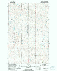
1994 Map of Derrick NW
USGS Topo · Published 1994About this map
Glacial prairie potholes and wetlands define this portion of Ramsey County as recorded in the early 1990s. The landscape is dominated by the National Waterfowl Production Area, a series of protected habitats that span across the township boundaries of Royal, Northfield, Sullivan, and Overland. This topography is characterized by intricate drainage patterns and small water bodies that underscore the importance of the region to migratory birds and local conservation efforts. Small sections of undeveloped land and section-line roads provide the primary framework for this rural northern landscape, where the interplay of water and prairie remains the most significant geographic feature.
Find a feature on this map
5 named features on this map. Tap any name to fly to it.
Don’t see what you’re looking for? This feature index may not catch every label — zoom into the map to look around manually.
Map Details
Editions of this 1994 Derrick NW Map
This is the sole edition of this map. No revisions or reprints were ever made.
Other maps of this area

1953 · Devils Lake
USGS Topo · 1:250,000

1956 · Devils Lake
USGS Topo · 1:250,000

1957 · Starkweather SE
USGS Topo · 1:24,000

1962 · Starkweather NE
USGS Topo · 1:24,000

1970 · Alsen SE
USGS Topo · 1:24,000

1970 · Hampden
USGS Topo · 1:24,000

1971 · Munich SE
USGS Topo · 1:24,000

1972 · Derrick NW
USGS Topo · 1:24,000

1972 · Derrick
USGS Topo · 1:24,000

1972 · Derrick SE
USGS Topo · 1:24,000