
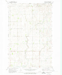
1972 Map of Derrick
USGS Topo · Published 1974About this map
Derrick sits at a rail intersection in the northern plains of Ramsey County, where the Burlington Northern line cuts across a landscape defined by seasonal wetlands and agricultural townships. This early 1970s survey illustrates a region shaped by prairie potholes, including a sprawling National Waterfowl Production Area that preserves the natural habitat amidst the grid of sections. Local governance and community life are anchored by the central townhall, while the historic boundaries of Northfield, Prospect, Overland, and Fancher townships organize the rural population. To the south, the meandering Edmore Coulee provides natural drainage for the surrounding fields. Genealogists will find interest in the documented Prospect Cem and another smaller Cem located near the tracks, marking the sites of early area families and the vanished proximity of the settlement near the railroad siding.
Find a feature on this map
15 named features on this map. Tap any name to fly to it.
Don’t see what you’re looking for? This feature index may not catch every label — zoom into the map to look around manually.
Map Details
Editions of this 1972 Derrick Map
This is the sole edition of this map. No revisions or reprints were ever made.
Other maps of this area

1953 · Devils Lake
USGS Topo · 1:250,000

1956 · Devils Lake
USGS Topo · 1:250,000

1970 · Alsen SE
USGS Topo · 1:24,000

1970 · Hampden
USGS Topo · 1:24,000

1972 · Derrick NW
USGS Topo · 1:24,000

1972 · Derrick SE
USGS Topo · 1:24,000
1972 · Derrick SW
USGS Topo · 1:24,000

1972 · Edmore SW
USGS Topo · 1:24,000

1972 · Edmore
USGS Topo · 1:24,000

1972 · Billings Lake
USGS Topo · 1:24,000