
1972 Map of Derrick SE
USGS Topo · Published 1974About this map
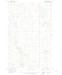
The glacial prairie of Ramsey County is defined by a dense network of small wetlands and depressions characteristic of the North Dakota pothole region in the early 1970s. Running through the northwest corner, Edmore Coulee provides the primary drainage through this agricultural landscape. The map highlights the township organization of the era, clearly delineating the boundaries of Overland, Fancher, Cato, Triumph, Noonan, and Newbore. Local history and genealogy are anchored by specific landmarks such as the Katthagen Cem and an additional unnamed Cem located near the southern boundary. Economic activity is represented by several small-scale excavations, including multiple Gravel Pit sites scattered across the sections, reflecting the local infrastructure and land use of this rural plains environment.
Find a feature on this map
10 named features on this map. Tap any name to fly to it.
Don’t see what you’re looking for? This feature index may not catch every label — zoom into the map to look around manually.
Map Details
Editions of this 1972 Derrick SE Map
This is the sole edition of this map. No revisions or reprints were ever made.
Other maps of this area

1953 · Devils Lake
USGS Topo · 1:250,000

1956 · Devils Lake
USGS Topo · 1:250,000

1971 · Southam
USGS Topo · 1:24,000
1971 · Crary NW
USGS Topo · 1:24,000

1971 · Lakota NW
USGS Topo · 1:24,000

1972 · Derrick NW
USGS Topo · 1:24,000

1972 · Derrick
USGS Topo · 1:24,000
1972 · Derrick SW
USGS Topo · 1:24,000

1972 · Edmore SW
USGS Topo · 1:24,000

1972 · Edmore
USGS Topo · 1:24,000