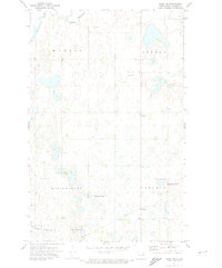
1971 Map of Crary NW
USGS Topo · Published 1974About this map
Rohrville sits as a quiet junction in the southeastern reaches of this Ramsey County landscape, situated along the tracks of the Soo Line. The 1971 survey illustrates a region defined by its wetland ecology and rural infrastructure, where numerous National Waterfowl Production Areas are interspersed among large township blocks like Morris and Ontario. This prairie terrain is shaped by the winding path of Edmore Coulee and dotted with small lakes and kettle ponds characteristic of the North Dakota plains.
Find a feature on this map
15 named features on this map. Tap any name to fly to it.
Don’t see what you’re looking for? This feature index may not catch every label — zoom into the map to look around manually.
Map Details
Editions of this 1971 Crary NW Map
This is the sole edition of this map. No revisions or reprints were ever made.
Other maps of this area

1931 · Devils Lake
USGS Topo · 1:62,500

1950 · Devils Lake
USGS Topo · 1:62,500

1951 · Crary
USGS Topo · 1:24,000

1951 · Devils Lake
USGS Topo · 1:24,000

1951 · Sweetwater
USGS Topo · 1:24,000

1953 · Devils Lake
USGS Topo · 1:250,000

1956 · Devils Lake
USGS Topo · 1:250,000

1957 · Starkweather SE
USGS Topo · 1:24,000

1971 · Southam
USGS Topo · 1:24,000
1971 · Doyon
USGS Topo · 1:24,000