Old Maps of Minot, North Dakota
Explore 30 old maps of Minot, spanning from 1928 to today. These high-resolution historic maps reveal how streets, neighborhoods, landmarks, and natural features evolved over time — perfect for genealogy, metal detecting, research, and local history exploration.
What you can do with these maps:
- See how Minot changed over time: Compare historical maps to modern-day views to trace roads, homesites, rail lines & more.
- View detailed metadata: Each map includes creators, publishers, year, scale, and archive source.
- Overlay maps with satellite & LiDAR: Visualize the past alongside modern tools to explore terrain & human change.
- Trusted historical sources: Maps sourced from the USGS, Library of Congress, and other archives.
- Access maps your way: View online, download high-res files, or order prints for personal or research use.
Start exploring old maps of Minot to uncover forgotten places, hidden landmarks, and the deep history beneath your feet.
Minot, ND maps
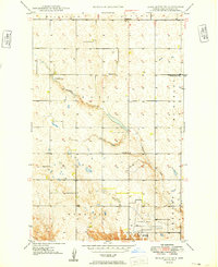
(30)- 1928 Map of Minot
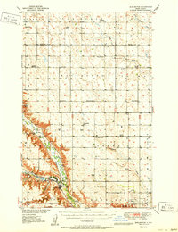
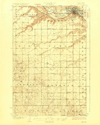 1928 Minot1928 Print · USGSThe growing rail hub of Minot emerges along the Souris River valley in the mid-1920s. Genealogists and historians can trace numerous rural schools across townships like Burt and Nedrose, alongside early rail sidings at Drady and Stringtown.3 unique versions available
 - 1929 Map of Sawyer
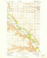
 1929 Sawyer1929 Print · USGSWard County's prairie and river valleys are captured here in the late 1920s as the rail-and-river economy flourished. Genealogists can trace rural school districts like School No 2 and School No 3 or locate early river crossings such as the Saugstad Bridge.2 unique versions available
 - 1948 Map of Burlington, 1968 Print
 1948 Burlington1968 Print · USGSWard County's river valleys and prairie townships are captured here at the close of the 1940s as the regional irrigation and rail networks matured. Genealogists can locate specific rural landmarks including Graham Sch, North Prairie Ch, and the many numbered schools of Eureka and Tatman.
 - 1948 Map of Surrey, 1981 Print
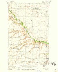
 1948 Surrey1981 Print · USGSWard County's prairie landscape is captured here in the mid-twentieth century as the rail lines and river valleys defined local life. Researchers can locate vanished landmarks like Bell Sch No 3, the Town Hall in Surrey, and trace the path of the Soo Line.
 - 1949 Map of Burlington SE
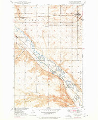
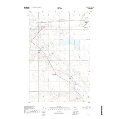
 1949 Burlington SE1949 Print · USGSThe northern outskirts of Minot and the Ruthville area are shown here in the late 1940s, a time of rural schoolhouses and established prairie farmsteads. Researchers can locate community centers like North Prairie Ch and local landmarks such as Port O' Minot Airport and Livingston Lake.
 - 1949 Map of Surrey
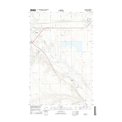
 1949 Surrey1949 Print · USGSSurrey and the surrounding Ward County prairies are shown here just after the war, as the Souris River valley supported a network of small schools. Genealogists and historians can trace the locations of Bell Sch No 2, Town Hall, and the Great Northern rail lines.
 - 1949 Map of Minot
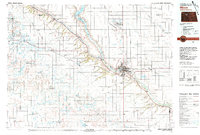
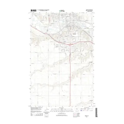
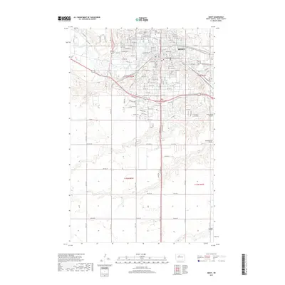
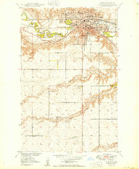 1949 Minot1949 Print · USGSMinot serves as a vital rail and educational center in the late 1940s, situated along the winding loops of the Souris River. Genealogists and historians can trace the early layouts of Minot State Teachers College, Rosehill Cemetery, and rural landmarks like Bell Sch No 4.
 - 1949 Map of Sawyer, 1959 Print
 1949 Sawyer1959 Print · USGSWard County in the late 1940s was defined by the winding Souris River and a robust network of rural schoolhouses and railroads. Family historians can trace local landmarks like Black Butte, search for ancestors at Sawyer Cem, and locate early community hubs like Bell Sch No 2.
 - 1951 Map of Burlington
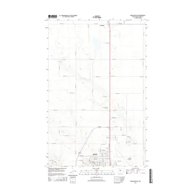
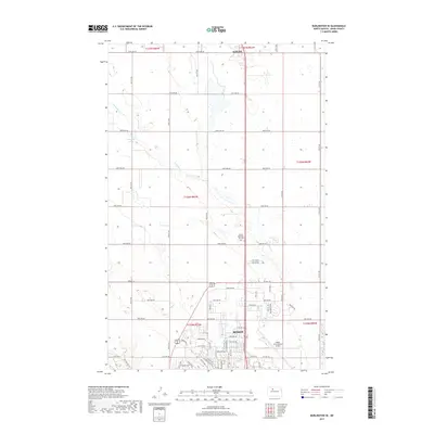
 1951 Burlington1951 Print · USGSWard County during the early 1950s shows a landscape defined by the confluence of the Souris and Des Lacs rivers and a growing rail network. Genealogists and local researchers can trace old school districts like Graham Sch and rural churches such as North Prairie Ch or the Evangelical Ch.
 - 1954 Map of Minot, 1964 Print
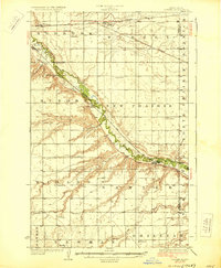
 1954 Minot1964 Print · USGSNorth Dakota's northern borderlands are captured here in the mid-fifties, showing a landscape defined by the winding Souris River and the rise of the Turtle Mountains. Genealogists can locate family-named sidings like Hurd Siding and Truro Siding alongside the vital Great Northern rail lines.3 unique versions available
 - 1958 Map of Minot
 1958 Minot1958 Print · USGSNorthern North Dakota is shown here during the mid-fifties, dominated by the rail-driven growth of Minot and the surrounding grain-farming prairie. Genealogists can trace family connections to border towns like Westhope or explore the vast reaches of the Turtle Mountains.
 - 1966 Map of Burlington SE
 1966 Burlington SE1966 Print · USGSWard County during the mid-sixties shows the steady expansion of northern Minot toward the wide prairie townships. Researchers can trace the development of the Minot International Airport or locate rural landmarks like Ruthville, School No 4, and North Prairie Ch.2 unique versions available
 - 1966 Map of Minot, 1968 Print
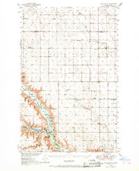
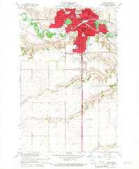 1966 Minot1968 Print · USGSMinot's mid-century development is centered on the Souris River and the crossroads of the Great Northern and Soo Line railroads. Researchers can trace the era's civic growth through Minot State College, local landmarks like Rosehill Cem, and the Agriculture Experimental Station.2 unique versions available
 - 1971 Map of Surrey
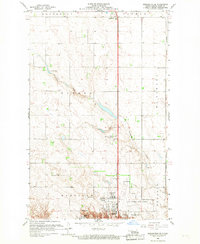
 1971 Surrey1971 Print · USGSSurrey and the surrounding Ward County prairie are captured here during the early 1970s, showcasing the area's vital rail and river networks. Genealogists and local historians can locate early rural landmarks like School No 1, Logan, and the banks of the Souris River.
 - 1980 Map of Minot
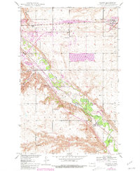
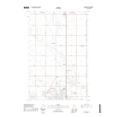
 1980 Minot1980 Print · USGSNorth Dakota's northern plains are shown at the start of the 1980s, centered on the strategic rail and river hub of Minot. Genealogists and local historians can trace the transition from rural grain stops like Berthold to the significant military presence at Minot Air Force Base.
 - 2011 Map of Minot, 2011 Print
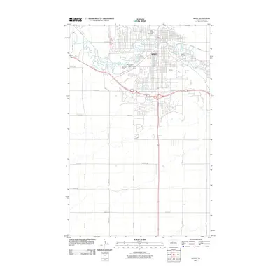 2011 Minot2011 Print · USGSCovers Minot, including Ward County, United States, and other nearby areas
 - 2011 Map of Burlington SE, 2011 Print
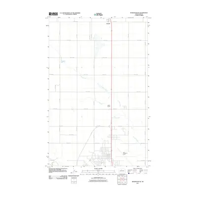 2011 Burlington SE2011 Print · USGSCovers Minot, including Ruthville, Ward County, and other nearby areas
 - 2011 Map of Surrey, 2011 Print
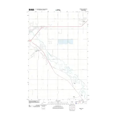 2011 Surrey2011 Print · USGSCovers Minot, including Surrey, Logan, and other nearby areas
 - 2014 Map of Surrey, 2014 Print
 2014 Surrey2014 Print · USGSCovers Minot, including Surrey, Logan, and other nearby areas
 - 2014 Map of Minot, 2014 Print
 2014 Minot2014 Print · USGSCovers Minot, including Ward County, United States, and other nearby areas
 - 2014 Map of Burlington SE, 2014 Print
 2014 Burlington SE2014 Print · USGSCovers Minot, including Ruthville, Ward County, and other nearby areas
 - 2017 Map of Burlington SE, 2017 Print
 2017 Burlington SE2017 Print · USGSCovers Minot, including Ruthville, Ward County, and other nearby areas
 - 2017 Map of Minot, 2017 Print
 2017 Minot2017 Print · USGSCovers Minot, including Ward County, United States, and other nearby areas
 - 2017 Map of Surrey, 2017 Print
 2017 Surrey2017 Print · USGSCovers Minot, including Surrey, Logan, and other nearby areas
 - 2020 Map of Burlington SE, 2020 Print
 2020 Burlington SE2020 Print · USGSCovers Minot, including Ruthville, Ward County, and other nearby areas
Showing maps 1-25 of 30
Top cities near Minot
Top neighborhoods of Minot
- Eastwood Park historical maps
- Nubbin Park historical maps
- West Minot historical maps
- Downtown historical maps
- Oak Park historical maps
- Upper Brooklyn historical maps
See more
Frequently asked questions
- What are the different types of historical maps available for Minot?
- What is the oldest map of Minot?
- Where can I purchase historical maps of Minot for my home or office?
- Where can I download high-res historical maps of Minot?
- Are there historical topographic maps available for Minot?
- Is there historical aerial imagery available for Minot?
- Where are historical maps of Minot sourced from?