Old Maps of Devils Lake, North Dakota
Explore 34 old maps of Devils Lake, spanning from 1931 to today. These high-resolution historic maps reveal how streets, neighborhoods, landmarks, and natural features evolved over time — perfect for genealogy, metal detecting, research, and local history exploration.
What you can do with these maps:
- See how Devils Lake changed over time: Compare historical maps to modern-day views to trace roads, homesites, rail lines & more.
- View detailed metadata: Each map includes creators, publishers, year, scale, and archive source.
- Overlay maps with satellite & LiDAR: Visualize the past alongside modern tools to explore terrain & human change.
- Trusted historical sources: Maps sourced from the USGS, Library of Congress, and other archives.
- Access maps your way: View online, download high-res files, or order prints for personal or research use.
Start exploring old maps of Devils Lake to uncover forgotten places, hidden landmarks, and the deep history beneath your feet.
Devils Lake, ND maps
(34)- 1931 Map of Devils Lake
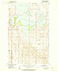
 1931 Devils Lake1931 Print · USGSThe North Dakota prairie and its complex lake systems are captured here in the late 1920s. Genealogists and historians can trace early rural life at Grand Harbor, the military grounds of CAMP GRAFTON, and numerous local sites like Consolidated School No 1.3 unique versions available
 - 1950 Map of Devils Lake, 1959 Print
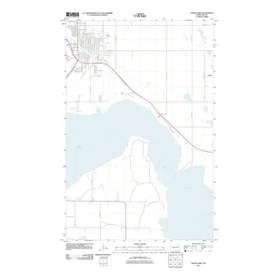
 1950 Devils Lake1959 Print · USGSDevils Lake and the surrounding North Dakota prairies are captured mid-century, showing a landscape shaped by rail lines and regional institutions. Genealogists can locate several schools and cemeteries, including the Grand Harbor Cem, Grove Sch, and the military grounds at Camp Grafton.2 unique versions available
 - 1951 Map of Devils Lake
 1951 Devils Lake1951 Print · USGSDevils Lake in the early fifties shows a thriving regional center defined by its institutions and the rail lines of the Great Northern. Researchers can trace the footprints of the Odd Fellows Home, St Marys Academy, and several rural sites like School No 1.2 unique versions available
 - 1951 Map of Grand Harbor
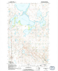
 1951 Grand Harbor1951 Print · USGSRamsey County's prairie and wetland landscape is captured here in the early fifties as the rail-driven economy of Grand Harbor remained central. Genealogists and historians can locate Grand Harbor Cem, School No 1, and the rail junction near Darby.2 unique versions available
 - 1951 Map of Camp Grafton
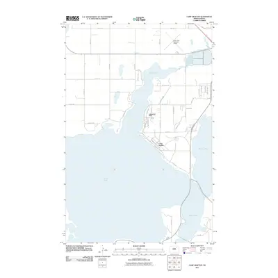
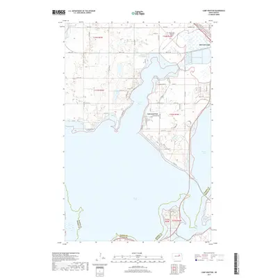
 1951 Camp Grafton1951 Print · USGSDevils Lake at the mid-century reveals a landscape of military training and conservation efforts on the shores of Ramsey and Benson counties. Researchers can trace the Great Northern rail line past Fort Totten Station and find local landmarks like Grove Sch and Camp Grafton.2 unique versions available
 - 1951 Map of Sweetwater
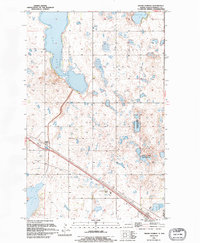
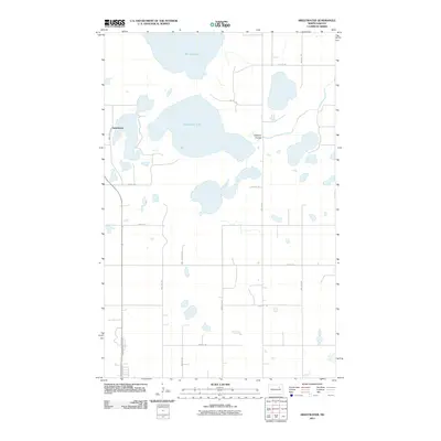
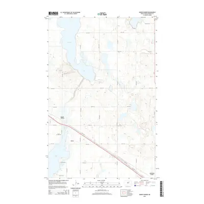
 1951 Sweetwater1951 Print · USGSRamsey County's prairie potholes and rail-line settlements are documented here in the early fifties during a period of Missouri River Basin development. Researchers can trace the path of the Great Northern railroad and find the locations of School No 21 and the lakeside Pumping Station.2 unique versions available
 - 1953 Map of Devils Lake, 1968 Print
 1953 Devils Lake1968 Print · USGSNorth Dakota's northern plains are captured here in the mid-fifties, showing a landscape of rail-fed grain elevators and prairie wetlands. Genealogists can locate family landmarks like Rose Hill School, Hurricane Lake Church, and the Turtle Mountain Indian Reservation.3 unique versions available
 - 1956 Map of Devils Lake
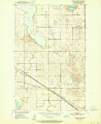
 1956 Devils Lake1956 Print · USGSNorthern North Dakota is shown at a mid-century peak of rail-driven agriculture, where the Soo Line and Great Northern railroads cross the prairie. Trace the borders of the Turtle Mountain Indian Reservation and locate local landmarks like Rose Hill School or Camp Grafton.
 - 1985 Map of Devils Lake
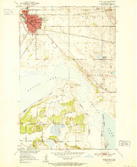
 1985 Devils Lake1985 Print · USGSThe Ramsey County lake region is captured here in the mid-1980s as a vital hub of wildlife management and grain transport. Researchers can trace the sprawling boundaries of the Fort Totten Indian Reservation and locate local landmarks like Lake Region Jr College and Whitman Dam.
 - 1993 Map of Devils Lake, 1994 Print
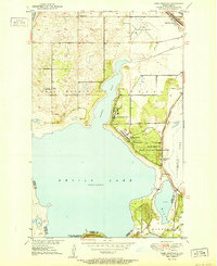
 1993 Devils Lake1994 Print · USGSThe Ramsey County prairie and the shores of Devils Lake are captured here during the 1990s as the region's agricultural and conservation landscapes were maturing. Genealogists and researchers can trace the rail-side growth of Lakota and Michigan or locate family lands near Camp Grafton and the Sullys Hills N W R.
 - 1994 Map of Sweetwater
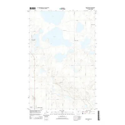
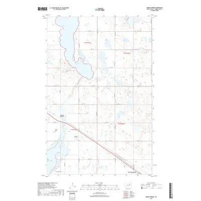
 1994 Sweetwater1994 Print · USGSRamsey County's prairie pothole region is captured in the early nineties, showing a landscape defined by its fluctuating water levels and small settlements. Trace the connections between Sweetwater Lake and Storman Lake, or locate the historic site of Sweetwater.
 - 1994 Map of Grand Harbor, 1995 Print
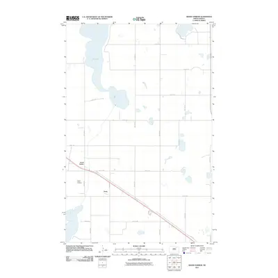
 1994 Grand Harbor1995 Print · USGSRamsey County's prairie wetland landscape is captured here in the mid-1990s, just as modern conservation and drainage patterns were firmly established. Genealogists and local historians can locate the Grand Harbor Cem and trace rural settlements like Grand Harbor and Darby.
 - 1994 Map of Camp Grafton, 1995 Print
 1994 Camp Grafton1995 Print · USGSDevils Lake and its surrounding military and tribal lands are shown here in the mid-nineties during a period of rising water levels. Researchers can trace the Old RR Grade and locate local landmarks like Camp Grafton, Lakewood Park, and First Baptist Ch.
 - 1994 Map of Devils Lake, 1995 Print
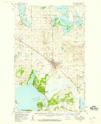
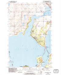
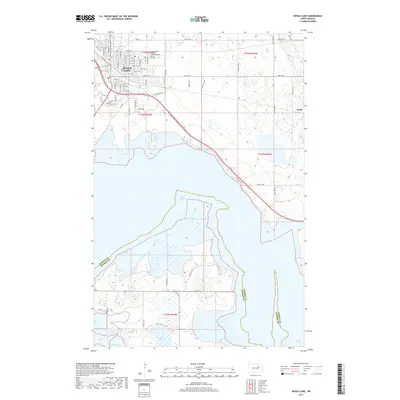
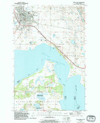 1994 Devils Lake1995 Print · USGSThe city of DEVILS LAKE and its surrounding shoreline are documented here in the mid-nineties. Researchers can locate civic landmarks like the State School for Deaf and G A R Cem, or trace the Old Railroad Grade near the lake.
 - 2011 Map of Sweetwater, 2011 Print
 2011 Sweetwater2011 Print · USGSCovers Devils Lake, including Sweetwater, Ramsey County, and other nearby areas
 - 2011 Map of Devils Lake, 2011 Print
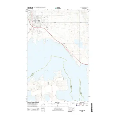
 2011 Devils Lake2011 Print · USGSCovers Devils Lake, including St. Michael District, Keith, and other nearby areas
 - 2011 Map of Grand Harbor, 2011 Print
 2011 Grand Harbor2011 Print · USGSCovers Devils Lake, including Grand Harbor, Darby, and other nearby areas
 - 2011 Map of Camp Grafton, 2011 Print
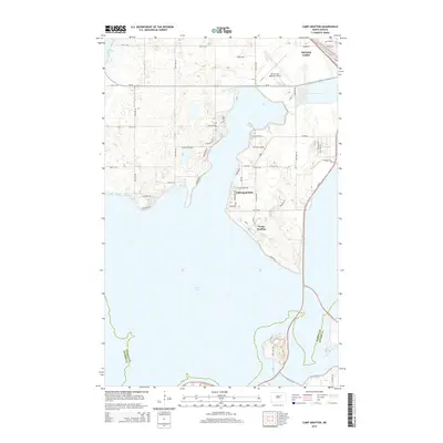
 2011 Camp Grafton2011 Print · USGSCovers Devils Lake, including St. Michael District, Lakewood Park, and other nearby areas
 - 2014 Map of Grand Harbor, 2014 Print
 2014 Grand Harbor2014 Print · USGSCovers Devils Lake, including Grand Harbor, Darby, and other nearby areas
 - 2014 Map of Sweetwater, 2014 Print
 2014 Sweetwater2014 Print · USGSCovers Devils Lake, including Sweetwater, Ramsey County, and other nearby areas
 - 2014 Map of Devils Lake, 2014 Print
 2014 Devils Lake2014 Print · USGSCovers Devils Lake, including St. Michael District, Keith, and other nearby areas
 - 2014 Map of Camp Grafton, 2014 Print
 2014 Camp Grafton2014 Print · USGSCovers Devils Lake, including St. Michael District, Lakewood Park, and other nearby areas
 - 2017 Map of Grand Harbor, 2017 Print
 2017 Grand Harbor2017 Print · USGSCovers Devils Lake, including Grand Harbor, Darby, and other nearby areas
 - 2017 Map of Camp Grafton, 2017 Print
 2017 Camp Grafton2017 Print · USGSCovers Devils Lake, including St. Michael District, Lakewood Park, and other nearby areas
 - 2017 Map of Devils Lake, 2017 Print
 2017 Devils Lake2017 Print · USGSCovers Devils Lake, including St. Michael District, Keith, and other nearby areas
Showing maps 1-25 of 34
Top cities near Devils Lake
Frequently asked questions
- What are the different types of historical maps available for Devils Lake?
- What is the oldest map of Devils Lake?
- Where can I purchase historical maps of Devils Lake for my home or office?
- Where can I download high-res historical maps of Devils Lake?
- Are there historical topographic maps available for Devils Lake?
- Is there historical aerial imagery available for Devils Lake?
- Where are historical maps of Devils Lake sourced from?