1960s Maps of North Dakota
Explore 385 historic maps of North Dakota from the 1960s. These maps offer a rare glimpse into what life looked like during the 1960s — showing old roads, neighborhoods, homes, and landmarks that have changed or disappeared over time.
Whether you're researching your family's past, planning a metal detecting trip, or studying how North Dakota's landscape evolved across the 1960s, these high-resolution maps are a powerful tool for exploring the history of this region.
- Focus on a specific era: All maps on this page are from the 1960s, giving you a focused view of this time period.
- See what’s changed: Compare century-old streets, trails, and buildings to today's modern landscape using overlays and satellite layers.
- Research with precision: Use these maps for genealogy, historical research, land use analysis, or educational projects.
- View, download, or print: Maps are fully viewable online in high resolution, and can be downloaded or printed for your own records.
Start exploring North Dakota's history through authentic maps from the 1960s. This is your window into the past.
North Dakota maps
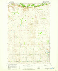
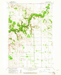
(385)- 1960 Map of Lincoln Valley SE, 1961 Print
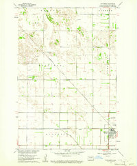
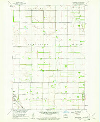
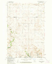
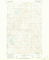 1960 Lincoln Valley SE1961 Print · USGSSheridan County's prairie landscape is captured here in the early sixties, showing a rural community organized around its local school districts. Genealogists and historians can trace the locations of the Advent Cem and numerous country schools like Schiller Sch No 3 and Hellman Sch No 4.
 - 1960 Map of Grafton, 1961 Print
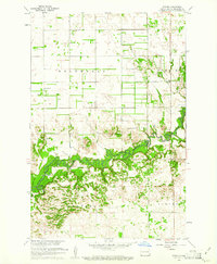
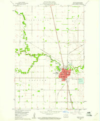 1960 Grafton1961 Print · USGSGrafton serves as a vital rail and medical hub in Walsh County during the early sixties. Genealogists and local historians can trace the town's institutional footprint through labels for St Johns Cem, the State Sch, and St Joseph Hospital.
 - 1960 Map of Galchutt, 1961 Print
 1960 Galchutt1961 Print · USGSRichland County, North Dakota, is captured here in the early sixties as a settled landscape of rail-side hamlets and meandering prairie rivers. Genealogists and historians can locate rural landmarks like Bethany Ch and trace the paths of the Great Northern and C M St P & P railroads.
 - 1960 Map of North Almont, 1961 Print
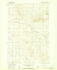
 1960 North Almont1961 Print · USGSMorton County in the early sixties shows a landscape of rail-driven prairie life and winding coulees. Genealogists and historians can trace local landmarks like Benson Sch, Peace Ch, and the defunct Old Railroad Grade.
 - 1960 Map of Wyndmere, 1961 Print
 1960 Wyndmere1961 Print · USGSRichland County at the start of the sixties reveals a thriving rail hub where the Northern Pacific meets the Soo Line. Genealogists and historians can trace the rural landscape of Homestead and Danton or locate the local Drive-in Theater.
 - 1960 Map of Dengate, 1961 Print
 1960 Dengate1961 Print · USGSMorton County in the early sixties is a landscape of rural schools and rail-side settlements along the Curlew Valley. Genealogists and historians can trace the foundations of Dengate, locate School No 4, or explore the coal-rich hills near a Strip Mine.2 unique versions available
 - 1960 Map of White Butte West, 1961 Print
 1960 White Butte West1961 Print · USGSHettinger County in the early sixties reveals a landscape of high prairie buttes and winding creek beds. Researchers can locate mid-century rural landmarks such as St Michael Ch, School No 1, and the townships of Madison and Acme.
 - 1960 Map of Horse Lake, 1961 Print
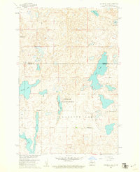
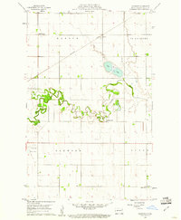
 1960 Horse Lake1961 Print · USGSThe prairie pothole region of North Dakota is captured here in the early sixties at the Sheridan and Burleigh County line. Genealogists can locate specific rural landmarks like Johns Lake Ch, Schrunk Sch No 1, and Johns Lake Sch No 3.2 unique versions available
 - 1960 Map of New Salem, 1961 Print
 1960 New Salem1961 Print · USGSNew Salem and the surrounding Morton County prairies are captured here in the early sixties as modern highways began to bypass the old rail towns. Genealogists and researchers can trace the Northern Pacific line, the Old Railroad Grade, and local landmarks like Graceland Cem and Klondike Butte.2 unique versions available
 - 1960 Map of Florence Lake, 1961 Print
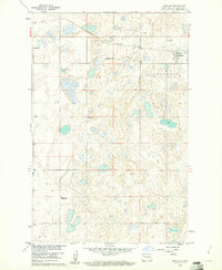
 1960 Florence Lake1961 Print · USGSThe prairie pothole region of Burleigh and Sheridan Counties comes to life in the early sixties, showing a landscape shaped by water and wind. Genealogists and local historians can locate early rural schools like Whittaker Sch and School No 2 among the shores of Salt Lake.
 - 1960 Map of Lisbon SE, 1961 Print
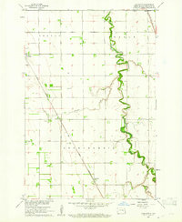
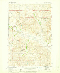
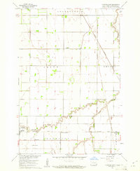
 1960 Lisbon SE1961 Print · USGSRansom and Sargent counties are shown here at the start of the 1960s, where the winding valley of the Sheyenne River meets the open prairie. Researchers can trace rural school and church sites like Aliceton Sch and Zion Ch along the Northern Pacific rail corridor.
 - 1960 Map of Denhoff, 1961 Print
 1960 Denhoff1961 Print · USGSSheridan County's prairie landscape is captured here in the early sixties, centered on the rail-side community of Denhoff. Researchers can trace the distribution of rural education through Whittaker Sch No 2 and locate the local Denhoff Cems.
 - 1960 Map of Power, 1961 Print
 1960 Power1961 Print · USGSThe rural prairie of Richland County is captured here in the early sixties as the Sheyenne River winds through a network of established townships. Researchers can trace the mid-century footprints of the Power settlement, several country churches like Zion Ch, and the local Town Hall.
 - 1960 Map of Barrie, 1961 Print
 1960 Barrie1961 Print · USGSRichland County, North Dakota, is documented here at the start of the sixties as the prairie townships remained deeply tied to the land. Genealogists and local historians can trace the Sheyenne River valley to find Gol Ch, Gol Cem, and the old School No 3.
 - 1960 Map of Wyndmere NW, 1961 Print
 1960 Wyndmere NW1961 Print · USGSRichland County's rural townships are preserved here during the mid-century, documenting a landscape of family farms and small country schools. Researchers can trace local heritage through landmarks like Nordmanna Cem, United Lutheran Ch, and School No 2.
 - 1960 Map of Mooreton West, 1961 Print
 1960 Mooreton West1961 Print · USGSRichland County at the start of the 1960s shows a landscape of precise township grids and prairie waterways. Genealogists and local researchers can trace the rail corridor of the Northern Pacific and locate rural landmarks like Antelope Sch and Antelope Cem.2 unique versions available
 - 1960 Map of Big Woods NW, 1961 Print
 1960 Big Woods NW1961 Print · USGSThe Red River Valley at the turn of the 1960s reveals a sparse but structured landscape of township schools and river crossings. Researchers can trace the boundaries of St Andrews and Acton, locating rural landmarks like St Joseph Ch and Zion Cem.2 unique versions available
 - 1960 Map of White Butte NW, 1961 Print
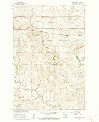
 1960 White Butte NW1961 Print · USGSThe rural borderlands between Stark and Hettinger Counties are captured here at the start of the 1960s. Researchers can locate township divisions in Madison and Campbell or trace the early paths of Plum Creek past local landmarks like School No 1.
 - 1960 Map of Wyndmere SE, 1961 Print
 1960 Wyndmere SE1961 Print · USGSRichland County at the start of the 1960s reveals a landscape shaped by competing rail lines and organized agriculture. Genealogists can trace family roots through markers at St John Cem or locate community centers like Homestead Ch and the village of Barney.
 - 1960 Map of Oakwood, 1961 Print
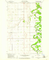
 1960 Oakwood1961 Print · USGSWalsh County's fertile river plains are captured here in the early sixties as the regional rail and water networks supported a thriving agricultural landscape. Researchers can locate specific rural landmarks like School No 59, the Northern Pacific depot at Cashel, and the winding Horseshoe Coulee.
 - 1960 Map of Mooreton East, 1961 Print
 1960 Mooreton East1961 Print · USGSRichland County's agricultural heartland is captured here during the mid-twentieth century, showing a landscape defined by rail lines and section roads. Genealogists and local historians can trace the foundations of Mooreton and Farmington or locate rural landmarks like St Paul Ch and Wahpeton School No 5.2 unique versions available
 - 1960 Map of Clark Butte NW, 1962 Print
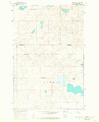
 1960 Clark Butte NW1962 Print · USGSStark and Hettinger Counties at the start of the 1960s reveal a landscape of dispersed prairie homesteads and rural school districts. Genealogists and local historians can locate specific landmarks like Heart River School No. 2, Bethesda Ch, and the rising waters of Lake Tschida.
 - 1960 Map of Glen Ullin, 1962 Print
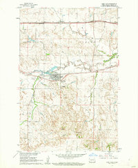 1960 Glen Ullin1962 Print · USGSThe Missouri River Basin development era finds Glen Ullin at a crossroads of classic rail and modern interstate expansion. Trace the community's mid-century landscape through the Northern Pacific line, Tavis Sch No 8, and landmarks like Horseshoe Butte.2 unique versions available
 - 1960 Map of Heart Butte NW, 1962 Print
 1960 Heart Butte NW1962 Print · USGSThe prairie of Morton and Grant counties is shown in the early 1960s as the Missouri River Basin development reshaped the landscape. Genealogy researchers can trace rural school districts like Heart Butte Sch No 5 and local burials at Koehler Cem.
 - 1960 Map of Clark Butte NE, 1962 Print
 1960 Clark Butte NE1962 Print · USGSThe North Dakota prairie near the intersection of Grant, Morton, and Stark counties is captured here in the early sixties. Researchers can find rural landmarks such as SS Peter and Paul Ch, Heart Butte School No 2, and the newly formed Lake Tschida.
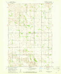
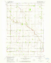
Showing maps 1-25 of 385
Top cities of North Dakota
- Fargo historical maps
- Bismarck historical maps
- Grand Forks historical maps
- West Fargo historical maps
- Minot historical maps
- Williston historical maps
See more
Top counties of North Dakota
- Cass County historical maps
- Burleigh County historical maps
- Ward County historical maps
- Grand Forks County historical maps
- Williams County historical maps
- Stark County historical maps
See more
Frequently asked questions
- What are the different types of historical maps available for North Dakota?
- What is the oldest map of North Dakota?
- Where can I purchase historical maps of North Dakota for my home or office?
- Where can I download high-res historical maps of North Dakota?
- Are there historical topographic maps available for North Dakota?
- Is there historical aerial imagery available for North Dakota?
- Where are historical maps of North Dakota sourced from?