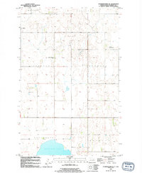
1994 Map of Starkweather SE
USGS Topo · Published 1994About this map
Morrison Lake and the drainage of Starkweather Coulee define the hydrology of this Ramsey County landscape. The area is organized around several distinct townships, including Webster, Sullivan, and Hammer, reflecting the systematic agricultural development of the North Dakota prairie. The small community of Garske serves as a primary local node, while SS Peter And Paul Ch stands as a focal point for the rural population in the western portion of the quadrangle.
Find a feature on this map
12 named features on this map. Tap any name to fly to it.
Don’t see what you’re looking for? This feature index may not catch every label — zoom into the map to look around manually.
Map Details
Editions of this 1994 Starkweather SE Map
This is the sole edition of this map. No revisions or reprints were ever made.
Other maps of this area

1931 · Devils Lake
USGS Topo · 1:62,500

1950 · Devils Lake
USGS Topo · 1:62,500

1951 · Grand Harbor
USGS Topo · 1:24,000

1951 · Sweetwater
USGS Topo · 1:24,000

1953 · Devils Lake
USGS Topo · 1:250,000

1956 · Devils Lake
USGS Topo · 1:250,000

1957 · Starkweather SE
USGS Topo · 1:24,000

1957 · Webster
USGS Topo · 1:24,000

1962 · Starkweather
USGS Topo · 1:24,000

1962 · Starkweather NE
USGS Topo · 1:24,000