Old Maps of Ardoch, North Dakota
Explore 12 old maps of Ardoch, spanning from 1926 to today. These high-resolution historic maps reveal how streets, neighborhoods, landmarks, and natural features evolved over time — perfect for genealogy, metal detecting, research, and local history exploration.
What you can do with these maps:
- See how Ardoch changed over time: Compare historical maps to modern-day views to trace roads, homesites, rail lines & more.
- View detailed metadata: Each map includes creators, publishers, year, scale, and archive source.
- Overlay maps with satellite & LiDAR: Visualize the past alongside modern tools to explore terrain & human change.
- Trusted historical sources: Maps sourced from the USGS, Library of Congress, and other archives.
- Access maps your way: View online, download high-res files, or order prints for personal or research use.
Start exploring old maps of Ardoch to uncover forgotten places, hidden landmarks, and the deep history beneath your feet.
Ardoch, ND maps
(12)- 1926 Map of Ardoch, 1944 Print
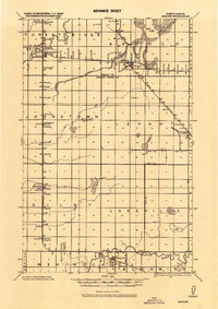 1926 Ardoch1944 Print · USGSWalsh and Grand Forks Counties at the peak of the rail era show a landscape shaped by steam and drainage. Trace the routes of three major railroads through Ardoch, find country schools, and locate early crossings like Public Xing.-865 and the Cem. near Forest River.
 - 1952 Map of Thief River Falls, 1967 Print
 1952 Thief River Falls1967 Print · USGSThe Red River Valley's agricultural and conservation landscape is captured in the mid-1950s, detailing a web of rail lines and international border crossings. Researchers can trace family roots in towns like Thief River Falls, locate the State School for Blind, and survey landmarks like the Agassiz National Wildlife Refuge.2 unique versions available
 - 1956 Map of Thief River Falls
 1956 Thief River Falls1956 Print · USGSThe Red River Valley in the mid-1950s is captured here as a sprawling network of rail corridors and wildlife refuges along the Canadian border. Trace the vanished transport routes of the Dismantled railroad and Abandoned railroad or locate local landmarks like the Herrick Elevator and State School for Blind.
 - 1957 Map of Thief River Falls
 1957 Thief River Falls1957 Print · USGSThe Red River Valley in the mid-fifties is captured here as a thriving network of rail towns and conservation lands. Genealogists and historians can trace family roots through settlements like Grafton, Pembina, and Hallock, or locate landmarks such as the State School for Blind and the Great Northern RR corridor.
 - 1967 Map of Thief River Falls
 1967 Thief River Falls1967 Print · USGSThe Red River Valley and the international border come alive in the 1960s, showing a landscape shaped by major rail lines and river commerce. Genealogists and historians can trace the paths of the Great Northern and Soo Line through towns like Thief River Falls, Grafton, and Hallock.
 - 1972 Map of Ardoch, 1975 Print
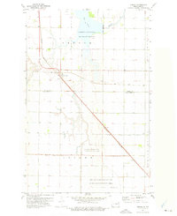 1972 Ardoch1975 Print · USGSArdoch and the surrounding prairie are captured here in the early seventies, a time when the rail intersection remained a vital landmark. Researchers can trace the path of the Soo Line, locate the Ardoch National Wildlife Refuge, and study the drainage of County Ditch No 12.
 - 1985 Map of Grafton
 1985 Grafton1985 Print · USGSThe Red River Valley at the mid-eighties shows a landscape of deep-rooted agriculture and rail-side towns. Genealogists and historians can trace family land near Grafton, Minto, or Lankin, and locate conservation landmarks like the Ardoch National Wildlife Refuge.2 unique versions available
 - 2011 Map of Ardoch, 2011 Print
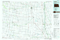
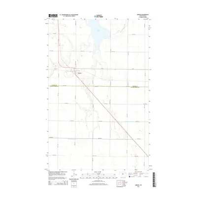
 2011 Ardoch2011 Print · USGSCovers Ardoch, including Grand Forks County, Walsh County, and other nearby areas
 - 2014 Map of Ardoch, 2014 Print
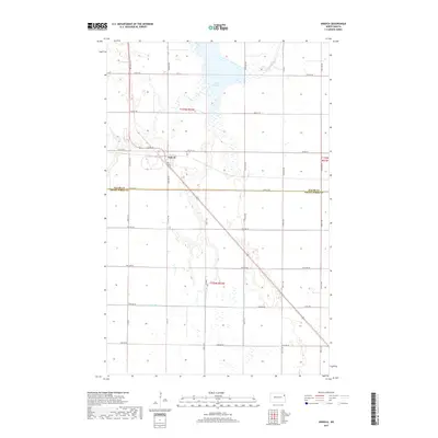
 2014 Ardoch2014 Print · USGSCovers Ardoch, including Grand Forks County, Walsh County, and other nearby areas
 - 2017 Map of Ardoch, 2017 Print
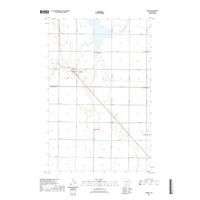
 2017 Ardoch2017 Print · USGSCovers Ardoch, including Grand Forks County, Walsh County, and other nearby areas
 - 2020 Map of Ardoch, 2020 Print
 2020 Ardoch2020 Print · USGSCovers Ardoch, including Grand Forks County, Walsh County, and other nearby areas
 - 2024 Map of Ardoch, 2024 Print
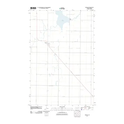
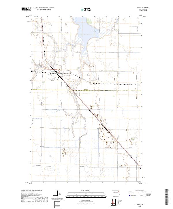 2024 Ardoch2024 Print · USGSIn the fertile plains of Walsh and Grand Forks counties, this contemporary survey captures the town of Ardoch and its surrounding wetlands. Genealogists can locate Saint John the Baptist Catholic Cem while explorers trace the bounds of the Ardoch National Wildlife Refuge.
End of results
Showing maps 1-12 of 12
Top cities near Ardoch
- Grafton historical maps
- Mekinock historical maps
- Minto historical maps
- Oslo historical maps
- Manvel historical maps
- Gilby historical maps
See more
Frequently asked questions
- What are the different types of historical maps available for Ardoch?
- What is the oldest map of Ardoch?
- Where can I purchase historical maps of Ardoch for my home or office?
- Where can I download high-res historical maps of Ardoch?
- Are there historical topographic maps available for Ardoch?
- Is there historical aerial imagery available for Ardoch?
- Where are historical maps of Ardoch sourced from?