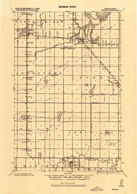
1926 Map of Ardoch
USGS Topo · Published 1944About this map
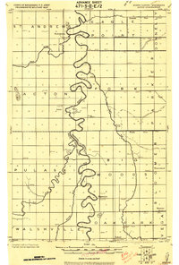
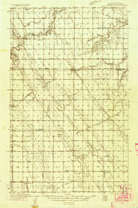
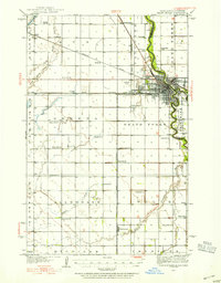
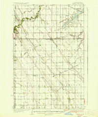
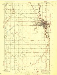
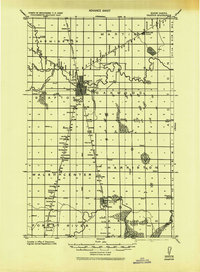
Forest River and Ardoch serve as central nodes in this rural agricultural landscape during the mid-1920s. The region is defined by a dense grid of township lines and a highly organized system of water management, evidenced by the presence of Ditch No. 1. and Ditch No. 2. which cut across the plains. Three major railroads—the Great Northern, Northern Pacific, and Minn. St. Paul—dictate the placement of settlements like Johnstown and Gilby, showing how vital rail connectivity was for grain transport and local growth.
Find a feature on this map
34 named features on this map. Tap any name to fly to it.
Don’t see what you’re looking for? This feature index may not catch every label — zoom into the map to look around manually.
Map Details
Editions of this 1926 Ardoch Map
This is the sole edition of this map. No revisions or reprints were ever made.
Other maps of this area
1918 · Acton
USGS Topo · 1:62,500
1934 · Emerado
USGS Topo · 1:48,000
1934 · Grand Forks
USGS Topo · 1:62,500
1936 · Emerado
USGS Topo · 1:62,500

1936 · Larimore
USGS Topo · 1:62,500
1938 · Grand Forks
USGS Topo · 1:62,500
1943 · Grafton
USGS Topo · 1:62,500

1952 · Grand Forks
USGS Topo · 1:250,000

1952 · Thief River Falls
USGS Topo · 1:250,000

1956 · Thief River Falls
USGS Topo · 1:250,000