Old Maps of Manchester, Ohio for Hiking & Exploration
Hike through history with 21 historic maps of Manchester. Explore old trails, ghost towns, and forgotten backroads — perfect for outdoor adventurers and local explorers.
- Rediscover forgotten places: Map out old mining camps, roads, and footpaths that no longer exist on modern maps.
- Layer with modern tools: Combine with LiDAR or satellite views to plan hikes through historical terrain.
- Made for exploration: Popular among hikers, overlanders, and local history lovers.
Use these maps to find adventure and explore the hidden past of Manchester.
Manchester, OH maps
(21)- 1929 Map of Springdale
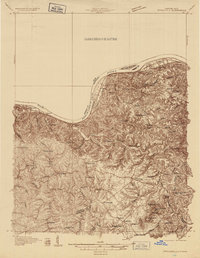 1929 Springdale1929 Print · USGSThe Ohio River valley and Kentucky's northern hills are captured here in the late twenties, showing a landscape defined by the Chesapeake and Ohio railroad. Genealogists can trace early homesteads and landmarks near Tollesboro, Ruggles Camp, and the many rural sites like Ebenezer Ch.2 unique versions available
 - 1935 Map of Springdale
 1935 Springdale1935 Print · USGSThe Ohio River valley at the height of the mid-1930s reveals a landscape shaped by river commerce and the Chesapeake and Ohio railroad. Researchers can locate numerous vanished country schools like Hamilton School, the infrastructure of Dam 33, and rural centers such as Tollesboro.
 - 1952 Map of Maysville East, 1953 Print
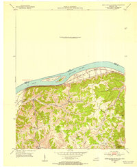
 1952 Maysville East1953 Print · USGSThe Ohio River valley near the Mason County line is captured here in the early fifties, showing the vital river-and-rail corridor. Researchers can trace the riverfront development of Maysville or locate landmarks near Sand Hill and the Chesapeake and Ohio railroad.
 - 1952 Map of Manchester Islands, 1954 Print
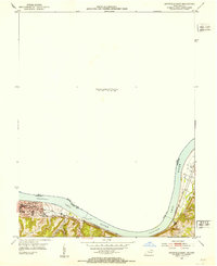
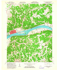
 1952 Manchester Islands1954 Print · USGSThe Ohio River shoreline and the timbered heights of Lewis County come alive in this early 1950s survey. Researchers can trace family-named landmarks and rural hubs like Trinity Station, Covedale, and the remote Sulphur Knob Lookout Tower.
 - 1957 Map of Huntington, 1966 Print
 1957 Huntington1966 Print · USGSThe industrial heart of the Ohio River valley is captured here in the mid-sixties, showing the growth of Huntington and Ashland. Researchers can trace the extensive rail networks of the Chesapeake and Ohio RR and locate sites like the Chief Cornstalk Hunting Ground.3 unique versions available
 - 1960 Map of Huntington
 1960 Huntington1960 Print · USGSThe tri-state river valley thrived in the late fifties as a hub of heavy industry and Appalachian rail transit. Genealogists and historians can trace the connection between river towns like Ashland and Portsmouth or locate family homesteads near Coleman Ridge.
 - 1961 Map of Maysville East, 1963 Print
 1961 Maysville East1963 Print · USGSThe Ohio River valley and the Kentucky-Ohio border come into focus in this early 1960s survey. Genealogists can trace local roots through numerous family and church landmarks like Hiett Chapel Cem, Ravenscroft Chapel, and the community at Beetle.4 unique versions available
 - 1961 Map of Manchester Islands, 1963 Print
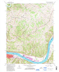
 1961 Manchester Islands1963 Print · USGSThe Ohio River valley at the start of the sixties reveals a landscape shaped by river commerce and the Chesapeake and Ohio railroad. Trace family roots and local history through the streets of Manchester or rural landmarks like Quinn Chapel and Bentonville Cem.4 unique versions available
 - 1986 Map of Maysville
 1986 Maysville1986 Print · USGSThe Ohio River valley in the mid-eighties reveals a landscape of industrial river towns and sprawling public lands spanning the Kentucky and Ohio border. Researchers can trace the rail corridors of the Chesapeake and Ohio Railway or locate landmarks like Confidence Cemetery and the Fleming-Mason Airport.
 - 1991 Map of Maysville
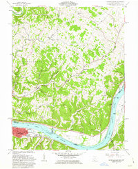
 1991 Maysville1991 Print · USGSThe Ohio River valley at the turn of the nineties reveals a landscape of river-bend towns and dense forest preserves. Trace local history through landmark sites like Confidence Cemetery, the small-town streets of Ripley, and the river reaches of Manchester Island No 1.
 - 1992 Map of Maysville East, 1997 Print
 1992 Maysville East1997 Print · USGSThe riverfront at Maysville and the surrounding hill country are captured here in the early 1990s as the river economy transitioned. Researchers can locate family landmarks such as Hiett Chapel, Ellis Grove Cem, and the riverside Roadside Park.
 - 2010 Map of Manchester Islands, 2010 Print
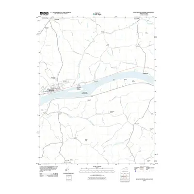 2010 Manchester Islands2010 Print · USGSCovers Manchester, including Trinity, Bentonville, and other nearby areas
 - 2010 Map of Maysville East, 2010 Print
 2010 Maysville East2010 Print · USGSCovers Manchester, including Maysville, Aberdeen, and other nearby areas
 - 2013 Map of Manchester Islands, 2013 Print
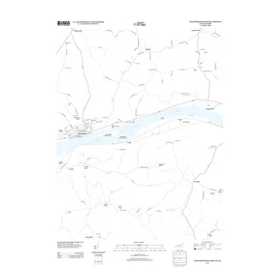 2013 Manchester Islands2013 Print · USGSCovers Manchester, including Trinity, Bentonville, and other nearby areas
 - 2013 Map of Maysville East, 2013 Print
 2013 Maysville East2013 Print · USGSCovers Manchester, including Maysville, Aberdeen, and other nearby areas
 - 2016 Map of Manchester Islands, 2016 Print
 2016 Manchester Islands2016 Print · USGSCovers Manchester, including Trinity, Bentonville, and other nearby areas
 - 2016 Map of Maysville East, 2016 Print
 2016 Maysville East2016 Print · USGSCovers Manchester, including Maysville, Aberdeen, and other nearby areas
 - 2019 Map of Manchester Islands, 2019 Print
 2019 Manchester Islands2019 Print · USGSCovers Manchester, including Trinity, Bentonville, and other nearby areas
 - 2019 Map of Maysville East, 2019 Print
 2019 Maysville East2019 Print · USGSCovers Manchester, including Maysville, Aberdeen, and other nearby areas
 - 2022 Map of Maysville East, 2022 Print
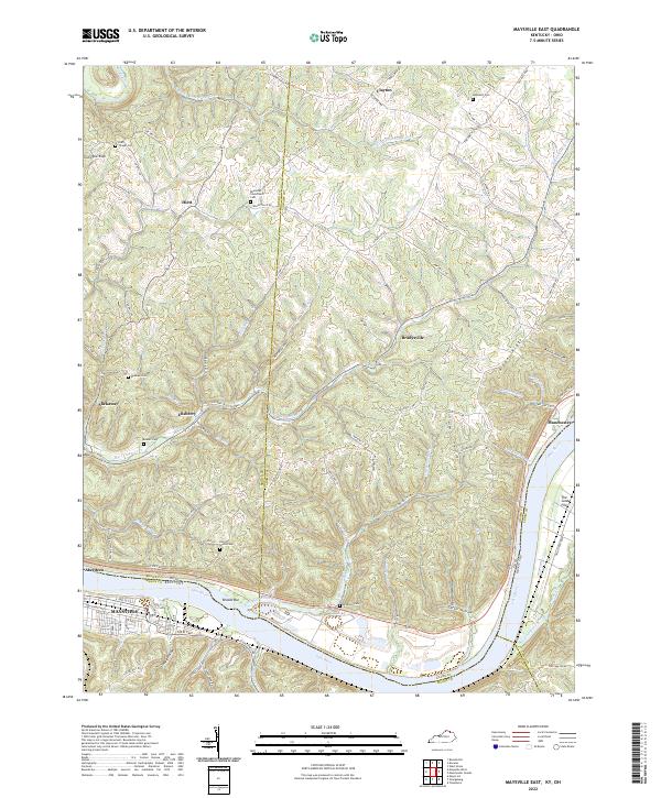 2022 Maysville East2022 Print · USGSThe riverfronts of Kentucky and Ohio meet along the Ohio River in the early 2020s, revealing a landscape of steep ridges and deep hollows. Researchers can locate several ancestral burial sites including Beasley Cem and Hopewell Cem or trace the old paths of Lick Skillet Loop.
 - 2022 Map of Manchester Islands, 2022 Print
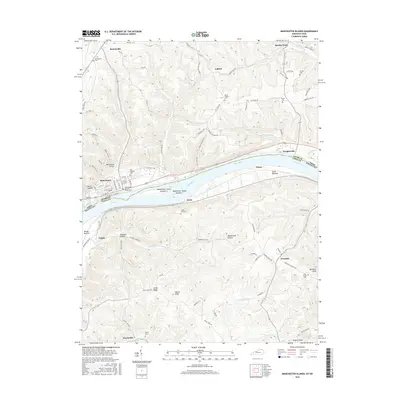
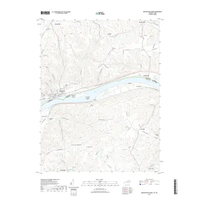
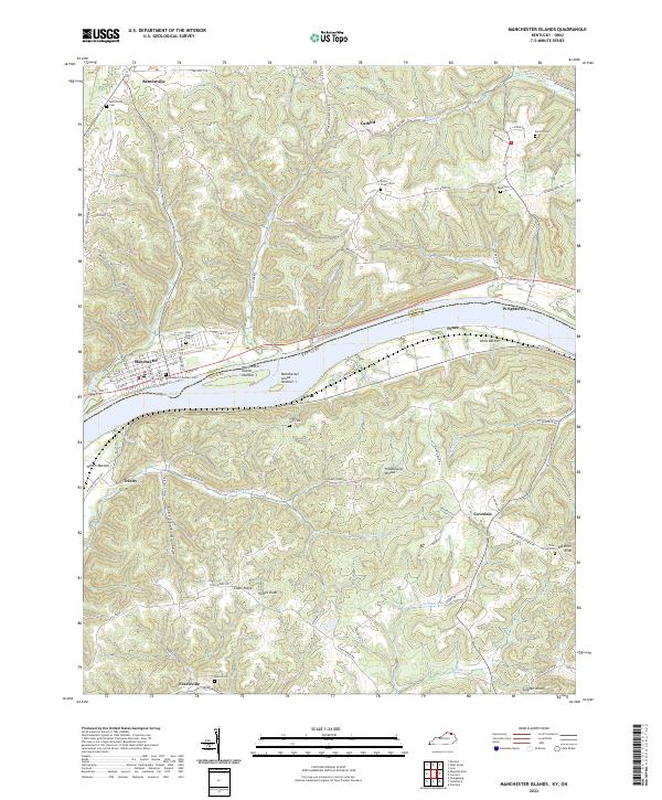 2022 Manchester Islands2022 Print · USGSThe Ohio River dominates this riverfront corridor in the early 2020s, anchoring settlements like Manchester and Trinity. Genealogists can trace family names at Manchester Founders Cem, Bentonville Cem, and Cedar Leaf Cem.
End of results
Showing maps 1-21 of 21
Top cities near Manchester
- Maysville historical maps
- West Union historical maps
- Ripley historical maps
- Aberdeen historical maps
- Russellville historical maps
- Cherry Fork historical maps
See more
Frequently asked questions
- What are the different types of historical maps available for Manchester?
- What is the oldest map of Manchester?
- Where can I purchase historical maps of Manchester for my home or office?
- Where can I download high-res historical maps of Manchester?
- Are there historical topographic maps available for Manchester?
- Is there historical aerial imagery available for Manchester?
- Where are historical maps of Manchester sourced from?