Old Maps of Barton, Ohio
Explore 13 old maps of Barton, spanning from 1905 to today. These high-resolution historic maps reveal how streets, neighborhoods, landmarks, and natural features evolved over time — perfect for genealogy, metal detecting, research, and local history exploration.
What you can do with these maps:
- See how Barton changed over time: Compare historical maps to modern-day views to trace roads, homesites, rail lines & more.
- View detailed metadata: Each map includes creators, publishers, year, scale, and archive source.
- Overlay maps with satellite & LiDAR: Visualize the past alongside modern tools to explore terrain & human change.
- Trusted historical sources: Maps sourced from the USGS, Library of Congress, and other archives.
- Access maps your way: View online, download high-res files, or order prints for personal or research use.
Start exploring old maps of Barton to uncover forgotten places, hidden landmarks, and the deep history beneath your feet.
Barton, OH maps
(13)- 1905 Map of St. Clairsville, 1942 Print
 1905 St. Clairsville1942 Print · USGSBelmont County at the start of the twentieth century was a landscape of steep ridges and vital transportation corridors. Researchers can trace the path of the National Road and locate early settlements and rail junctions like Fairpoint, Colerain, and Harrisville.2 unique versions available
 - 1951 Map of Canton
 1951 Canton1951 Print · USGSThe industrial heartland of Ohio and Pennsylvania reached its mid-century peak during this era of heavy rail and river transit. Genealogists and historians can trace the development of steel towns like Aliquippa and Weirton alongside the Ohio River and major lines of the Pennsylvania RR.
 - 1953 Map of Canton
 1953 Canton1953 Print · USGSThe industrial heartland of Ohio and Pennsylvania is captured at its mid-century peak in this detailed regional survey. Genealogists and historians can trace the vast rail networks of the Pennsylvania RR and find local landmarks like Nimisila Reservoir and Tappan Reservoir.
 - 1957 Map of Canton, 1971 Print
 1957 Canton1971 Print · USGSThe industrial heartland of eastern Ohio and western Pennsylvania comes alive in this mid-century survey of the Ohio River Valley. Trace the heritage of rail and river commerce through Pittsburgh, the massive steel towns along the Ohio River, and major junctions on the Pennsylvania RR.3 unique versions available
 - 1960 Map of Lansing, 1961 Print
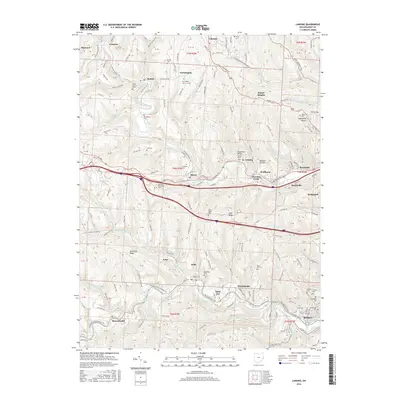
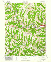 1960 Lansing1961 Print · USGSBelmont County in the early sixties reveals a landscape shaped by coal mining and historic transit routes. Genealogists and historians can trace family plots at Linwood Cemetery or High Ridge Cem and follow the old National Road through Lansing and Blaine.5 unique versions available
 - 1962 Map of Canton
 1962 Canton1962 Print · USGSThe industrial heartland of Eastern Ohio and Western Pennsylvania thrives in the early sixties as steel mills and rail lines dominate the river valleys. Genealogists and historians can trace local landmarks like McKinley National Memorial, Malone College, and industrial sites such as Republic Steel Corp.2 unique versions available
 - 1986 Map of Pittsburgh West
 1986 Pittsburgh West1986 Print · USGSThe Tri-State region's coal and rail corridors are captured in the mid-eighties as industry and aviation expanded. Trace the legacy of extraction at Nelms Mine No 1, locate Short Creek PO, or follow the Chessie System tracks along the Ohio River.3 unique versions available
 - 1994 Map of Lansing, 1998 Print
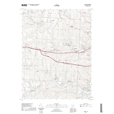
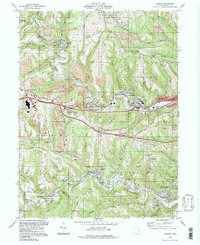 1994 Lansing1998 Print · USGSBelmont County as it appeared in the late twentieth century shows an area shaped by coal and commerce. Trace the legacy of industrial hamlets and family cemeteries from Stewartsville to Barton, or locate landmarks like Lancaster Chapel and the National Road.
 - 2010 Map of Lansing, 2010 Print
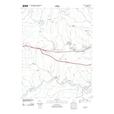 2010 Lansing2010 Print · USGSCovers Barton, including Bellaire, Brookside, and other nearby areas
 - 2013 Map of Lansing, 2013 Print
 2013 Lansing2013 Print · USGSCovers Barton, including Bellaire, Brookside, and other nearby areas
 - 2016 Map of Lansing, 2016 Print
 2016 Lansing2016 Print · USGSCovers Barton, including Bellaire, Brookside, and other nearby areas
 - 2019 Map of Lansing, 2019 Print
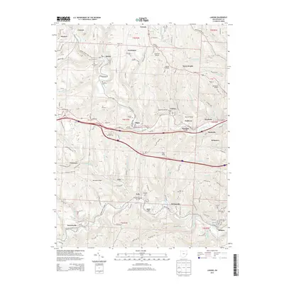
 2019 Lansing2019 Print · USGSCovers Barton, including Bellaire, Brookside, and other nearby areas
 - 2023 Map of Lansing, 2023 Print
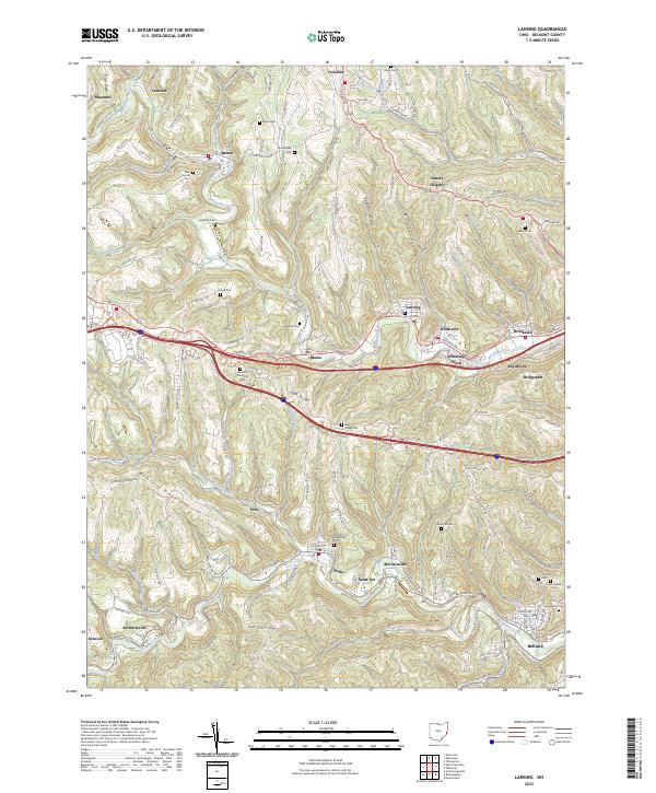 2023 Lansing2023 Print · USGSBelmont County’s deep valleys and high ridges are shown here in the 2020s, tracing a landscape defined by historic coal towns and transit routes. Genealogists can locate numerous burial sites, including Linwood Cem and Mount Calvary Cem, alongside old settlements like Neffs and Barton.
End of results
Showing maps 1-13 of 13
Top cities near Barton
- Wheeling historical maps
- Steubenville historical maps
- Moundsville historical maps
- Martins Ferry historical maps
- Saint Clairsville historical maps
- St. Clairsville historical maps
See more
Frequently asked questions
- What are the different types of historical maps available for Barton?
- What is the oldest map of Barton?
- Where can I purchase historical maps of Barton for my home or office?
- Where can I download high-res historical maps of Barton?
- Are there historical topographic maps available for Barton?
- Is there historical aerial imagery available for Barton?
- Where are historical maps of Barton sourced from?