Old Maps of Upper Arlington Historic District, Upper Arlington
Explore 29 old maps of Upper Arlington Historic District, spanning from 1901 to today. These high-resolution historic maps reveal how streets, neighborhoods, landmarks, and natural features evolved over time — perfect for genealogy, metal detecting, research, and local history exploration.
What you can do with these maps:
- See how Upper Arlington Historic District changed over time: Compare historical maps to modern-day views to trace roads, homesites, rail lines & more.
- View detailed metadata: Each map includes creators, publishers, year, scale, and archive source.
- Overlay maps with satellite & LiDAR: Visualize the past alongside modern tools to explore terrain & human change.
- Trusted historical sources: Maps sourced from the USGS, Library of Congress, and other archives.
- Access maps your way: View online, download high-res files, or order prints for personal or research use.
Start exploring old maps of Upper Arlington Historic District to uncover forgotten places, hidden landmarks, and the deep history beneath your feet.
Upper Arlington Historic District, Upper Arlington maps
(29)- 1901 Map of Dublin, 1955 Print
 1901 Dublin1955 Print · USGSCentral Ohio at the turn of the century reveals a landscape of independent agricultural villages and busy rail corridors long before the suburban expansion. Trace early property and settlement patterns in Dublin, Worthington, and Hilliard, and locate vanished rail stops along the Pennsylvania System and the Columbus Delaware and Marion Electric Ry.
 - 1903 Map of Dublin, 1939 Print
 1903 Dublin1939 Print · USGSCentral Ohio at the turn of the century is captured here as a landscape of river valleys and emerging railroad towns. Genealogists can trace early homesteads and routes between established centers like Worthington and smaller rural stops such as Amlin and Powell.2 unique versions available
 - 1923 Map of West Columbus, 1955 Print
 1923 West Columbus1955 Print · USGSFranklin County in the early twenties shows the growing western edge of Columbus and its surrounding rural townships. Genealogists and historians can trace the paths of the National Road and find landmarks like Camp Chase, Urbancrest, and Pisgah School.
 - 1925 Map of West Columbus, 1946 Print
 1925 West Columbus1946 Print · USGSFranklin and Pickaway counties are shown here in the mid-twenties, when the growing state capital met a landscape of electric railways and rural schoolhouses. Researchers can trace the National Road and locate sites like the Pisgah School, Mt Calvary Cemetery, and the State Hospital.
 - 1947 Map of Columbus, 1948 Print
 1947 Columbus1948 Print · USGSCentral Ohio in the late 1940s is captured in this survey, showing the post-war transition of its rail hubs and military airfield expansions. Genealogists and historians can trace the paths of the Ohio Canal, the Pennsylvania RR lines, and the Camp Sherman Military Reservation.
 - 1950 Map of Marion
 1950 Marion1950 Print · USGSCentral Ohio was a powerhouse of rail and river industry at the mid-century point, serving as a vital corridor between the Great Lakes and the Ohio River valley. Genealogists and rail historians can trace the paths of the Erie RR and Nickel Plate Road through towns like Bucyrus, Galion, and Upper Sandusky.
 - 1955 Map of Northwest Columbus, 1956 Print
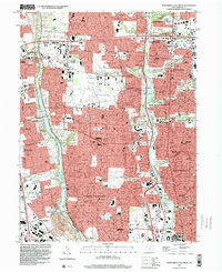
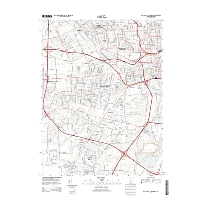
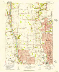 1955 Northwest Columbus1956 Print · USGSMid-century Columbus and its northern reaches reveal a landscape of rapid suburban growth and established institutions. Researchers can trace the development of Upper Arlington and Worthington alongside landmarks like Don Scott Field and the Griggs Reservoir.2 unique versions available
 - 1955 Map of Southwest Columbus, 1956 Print
 1955 Southwest Columbus1956 Print · USGSMid-century Franklin County is captured here during a period of significant urban growth and industrial activity. Researchers can trace the development of neighborhoods like Grove City and Urbancrest, or locate family landmarks at Greenlawn Cemetery and Salem Ch.
 - 1961 Map of Columbus
 1961 Columbus1961 Print · USGSCentral and Southern Ohio are captured here in the early sixties, as the region's industrial rail hubs and military bases reached their peak. Genealogists and historians can trace the transition from urban Columbus to rural townships along the Scioto River, locating Lockbourne USAF and old junctions like Washington Court House.
 - 1962 Map of Columbus
 1962 Columbus1962 Print · USGSCentral Ohio during the early sixties reveals a transition from the industrial corridors of Columbus to the forested ridges of the south. Genealogists and historians can trace the rail networks of the Baltimore & Ohio RR and find local landmarks like Washington Court House and Camp Sherman Military Reservation.
 - 1962 Map of Marion
 1962 Marion1962 Print · USGSCentral Ohio during the post-war era showcases a dense network of railroad towns and emerging interstate highways. Genealogists can trace family roots in smaller settlements like Houcktown and Marseilles or locate landmarks near Indian Lake.
 - 1965 Map of Northwest Columbus, 1967 Print
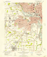
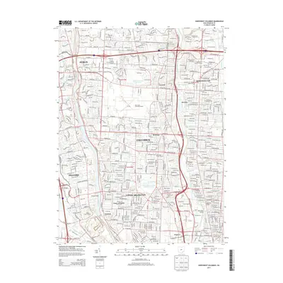
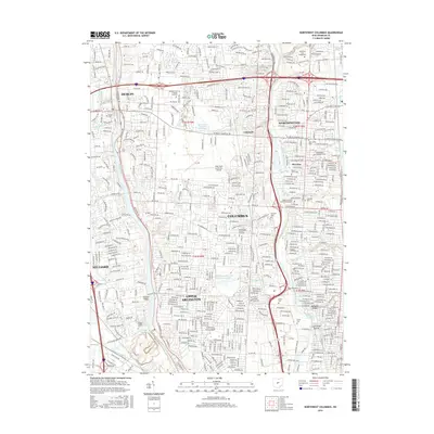
 1965 Northwest Columbus1967 Print · USGSFranklin County in the mid-sixties reveals the rapid post-war growth of Columbus and its northern suburbs along the river corridors. Researchers can trace the development of Upper Arlington, locate the Stadium at Ohio State University, and find historic burial grounds like Union Cemetery.3 unique versions available
 - 1965 Map of Southwest Columbus, 1967 Print
 1965 Southwest Columbus1967 Print · USGSSouthwest Columbus and Grove City are shown here during a period of rapid mid-century expansion along the Scioto River. Genealogists and researchers can trace family landmarks like Greenlawn Cemetery, Beulah Park, and the Ohio State Penitentiary.5 unique versions available
 - 1966 Map of Marion, 1968 Print
 1966 Marion1968 Print · USGSCentral Ohio in the mid-sixties is captured during a period of rapid highway expansion and industrial connectivity. Genealogists and historians can trace rail-and-river networks through towns like Marion, Urbana, and Mount Vernon, or locate landmarks such as Malabar Farm and Black Hand Rock.3 unique versions available
 - 1967 Map of Columbus, 1969 Print
 1967 Columbus1969 Print · USGSCentral Ohio during the late sixties serves as a vital corridor of rail and aviation, from the industrial streets of Springfield to the hangar lines of Lockbourne Air Force Base. Genealogists and researchers can trace the growth of towns like Circleville and London or locate rural landmarks such as St Paul church and the London Correctional Institution.2 unique versions available
 - 1986 Map of Bellefontaine
 1986 Bellefontaine1986 Print · USGSWest Central Ohio in the mid-1980s reveals a landscape of growing metropolitan fringes and established rural centers. Researchers can trace historic cemeteries and civic institutions from Oak Grove Cem to the State Reformatory For Women and Cedar Bog State Nature Preserve.
 - 1986 Map of Springfield
 1986 Springfield1986 Print · USGSCentral Ohio in the mid-1980s shows the bustling rail-and-road network connecting Springfield and Xenia to the western outskirts of Columbus. Researchers can trace old family sites and transit routes through Glen Haven Mem Cem, Madison Lake State Park, and the CONRAIL line.2 unique versions available
 - 1992 Map of Bellefontaine
 1992 Bellefontaine1992 Print · USGSWest-central Ohio in the early nineties reveals a blend of high-plateau geography and growing suburban corridors near the state capital. Genealogists can trace family connections to landmarks like Mount Tabor Church, Oak Grove Cemetery, and the high ground of Campbell Hill.
 - 1995 Map of Northwest Columbus, 1999 Print
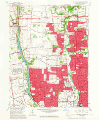
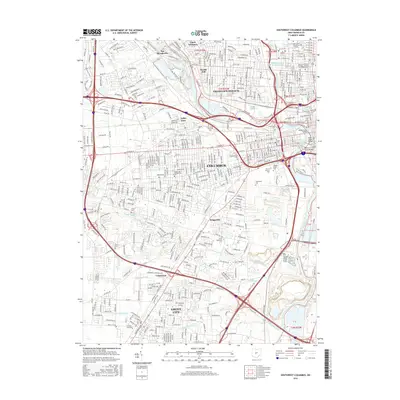
 1995 Northwest Columbus1999 Print · USGSNorth Columbus and its river corridors show extensive suburban development in the mid-nineties. Researchers can locate long-standing institutions like the State School for the Deaf, the RR Museum, and the historic Union Cemetery.2 unique versions available
 - 2010 Map of Southwest Columbus, 2010 Print
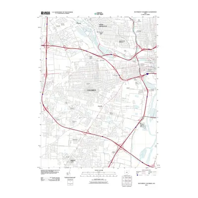 2010 Southwest Columbus2010 Print · USGSCovers Upper Arlington Historic District, including Columbus, Upper Arlington, and other nearby areas
 - 2010 Map of Northwest Columbus, 2010 Print
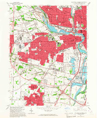
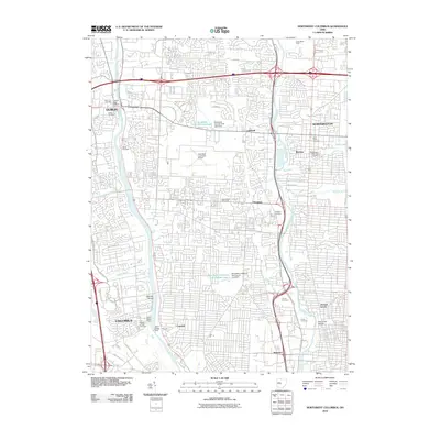 2010 Northwest Columbus2010 Print · USGSCovers Upper Arlington Historic District, including Columbus, Dublin, and other nearby areas
 - 2013 Map of Northwest Columbus, 2013 Print
 2013 Northwest Columbus2013 Print · USGSCovers Upper Arlington Historic District, including Columbus, Dublin, and other nearby areas
 - 2013 Map of Southwest Columbus, 2013 Print
 2013 Southwest Columbus2013 Print · USGSCovers Upper Arlington Historic District, including Columbus, Upper Arlington, and other nearby areas
 - 2016 Map of Northwest Columbus, 2016 Print
 2016 Northwest Columbus2016 Print · USGSCovers Upper Arlington Historic District, including Columbus, Dublin, and other nearby areas
 - 2016 Map of Southwest Columbus, 2016 Print
 2016 Southwest Columbus2016 Print · USGSCovers Upper Arlington Historic District, including Columbus, Upper Arlington, and other nearby areas
Showing maps 1-25 of 29
Frequently asked questions
- What are the different types of historical maps available for Upper Arlington Historic District?
- What is the oldest map of Upper Arlington Historic District?
- Where can I purchase historical maps of Upper Arlington Historic District for my home or office?
- Where can I download high-res historical maps of Upper Arlington Historic District?
- Are there historical topographic maps available for Upper Arlington Historic District?
- Is there historical aerial imagery available for Upper Arlington Historic District?
- Where are historical maps of Upper Arlington Historic District sourced from?