1960s Maps of Clay Township, Ohio
Explore 5 historic maps of Clay Township from the 1960s. These maps offer a rare glimpse into what life looked like during the 1960s — showing old roads, neighborhoods, homes, and landmarks that have changed or disappeared over time.
Whether you're researching your family's past, planning a metal detecting trip, or studying how Clay Township's landscape evolved across the 1960s, these high-resolution maps are a powerful tool for exploring the history of this region.
- Focus on a specific era: All maps on this page are from the 1960s, giving you a focused view of this time period.
- See what’s changed: Compare century-old streets, trails, and buildings to today's modern landscape using overlays and satellite layers.
- Research with precision: Use these maps for genealogy, historical research, land use analysis, or educational projects.
- View, download, or print: Maps are fully viewable online in high resolution, and can be downloaded or printed for your own records.
Start exploring Clay Township's history through authentic maps from the 1960s. This is your window into the past.
Clay Township, OH maps
(5)- 1960 Map of Huntington
 1960 Huntington1960 Print · USGSThe tri-state river valley thrived in the late fifties as a hub of heavy industry and Appalachian rail transit. Genealogists and historians can trace the connection between river towns like Ashland and Portsmouth or locate family homesteads near Coleman Ridge.
 - 1961 Map of Mercerville, 1963 Print
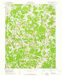 1961 Mercerville1963 Print · USGSGallia County at the start of the sixties reveals a landscape of Appalachian ridges shaped by both agriculture and industry. Researchers can trace the many rural congregations at Lincoln Chapel and Bethesda Ch, or locate family sites near Saundersville and Leaper.4 unique versions available
 - 1961 Map of Rodney, 1963 Print
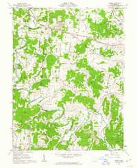 1961 Rodney1963 Print · USGSGallia County's rural townships are documented in the early sixties, showing a landscape defined by the winding Raccoon Creek. Genealogists and historians can trace family locations through numerous sites like Hulbert Cem, Asbury Ch, and the small settlement of Northup.3 unique versions available
 - 1968 Map of Gallipolis, 1970 Print
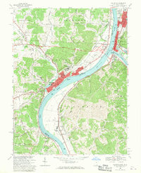 1968 Gallipolis1970 Print · USGSThe Ohio and Kanawha Rivers converge in the late sixties at the border of Ohio and West Virginia. Trace local history through the rail lines of the Baltimore and Ohio, the historic Gallia Academy, and old cemeteries like Mound Hill Cemetery.
 - 1968 Map of Apple Grove, 1970 Print
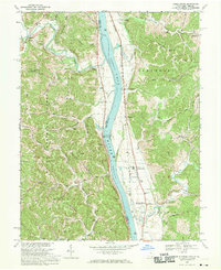 1968 Apple Grove1970 Print · USGSThe Ohio River valley in the late sixties shows a landscape defined by the Baltimore and Ohio railroad and river navigation. Genealogists can locate family landmarks like Beale Chapel, Mercers Bottom, and the Clay Sch near Ben Lomond.3 unique versions available
End of results
Showing maps 1-5 of 5
Top cities near Clay Township
- Point Pleasant historical maps
- Gallipolis historical maps
- Addison historical maps
- Buffalo historical maps
- Rio Grande historical maps
- Crown City historical maps
See more
Top neighborhoods of Clay Township
- Raccoon Island historical maps
- Eureka historical maps
- Thivener historical maps
- Clipper Mills historical maps
- Holiday Hills historical maps
Frequently asked questions
- What are the different types of historical maps available for Clay Township?
- What is the oldest map of Clay Township?
- Where can I purchase historical maps of Clay Township for my home or office?
- Where can I download high-res historical maps of Clay Township?
- Are there historical topographic maps available for Clay Township?
- Is there historical aerial imagery available for Clay Township?
- Where are historical maps of Clay Township sourced from?