1960s Maps of Bainbridge Township, Ohio
Explore 5 historic maps of Bainbridge Township from the 1960s. These maps offer a rare glimpse into what life looked like during the 1960s — showing old roads, neighborhoods, homes, and landmarks that have changed or disappeared over time.
Whether you're researching your family's past, planning a metal detecting trip, or studying how Bainbridge Township's landscape evolved across the 1960s, these high-resolution maps are a powerful tool for exploring the history of this region.
- Focus on a specific era: All maps on this page are from the 1960s, giving you a focused view of this time period.
- See what’s changed: Compare century-old streets, trails, and buildings to today's modern landscape using overlays and satellite layers.
- Research with precision: Use these maps for genealogy, historical research, land use analysis, or educational projects.
- View, download, or print: Maps are fully viewable online in high resolution, and can be downloaded or printed for your own records.
Start exploring Bainbridge Township's history through authentic maps from the 1960s. This is your window into the past.
Bainbridge Township, OH maps
(5)- 1962 Map of Cleveland
 1962 Cleveland1962 Print · USGSNortheast Ohio and the Pennsylvania borderlands appear here during the industrial peak of the early sixties. Genealogists and historians can trace the expansive rail lines of the Nickel Plate Road and the growth of suburbs from Parma to Lyndhurst.
 - 1962 Map of Aurora, 1964 Print
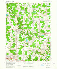 1962 Aurora1964 Print · USGSPortage County is seen here in the early sixties as recreation and new highways began to transform rural landscapes. Genealogists and local researchers can trace Taborville, find the Mennonite Ch, or locate the White Sch and Geauga Lake resort area.5 unique versions available
 - 1963 Map of Twinsburg, 1964 Print
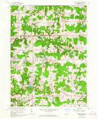
 1963 Twinsburg1964 Print · USGSNortheastern Ohio is shown in the early sixties as industrial rail corridors met growing suburban neighborhoods. Trace the grounds of the Amusement Park at Geauga Lake, find the Cleveland Boys Sch, or locate the Crown Hill Cemetery.4 unique versions available
 - 1963 Map of Chagrin Falls, 1964 Print
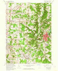 1963 Chagrin Falls1964 Print · USGSThe Chagrin River valley and its surrounding townships are shown here in the early sixties as suburban growth moved eastward. Researchers can trace family sites at Woodland Cem or locate old landmarks like the Solon Airport and Ursuline Academy.6 unique versions available
 - 1963 Map of South Russell, 1964 Print
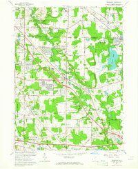
 1963 South Russell1964 Print · USGSGeauga County in the early sixties reveals a landscape of growing lakeside communities and historic crossroads. Genealogists and researchers can trace local family roots through sites like Morton Cem, Novelty PO, and the Westwood Sch.5 unique versions available
End of results
Showing maps 1-5 of 5
Top cities near Bainbridge Township
- Cleveland historical maps
- Akron historical maps
- Cuyahoga Falls historical maps
- Euclid historical maps
- Cleveland Heights historical maps
- Stow historical maps
See more
Top neighborhoods of Bainbridge Township
- Chagrin Falls Park historical maps
- Beacon Hill historical maps
- McFarlands Corners historical maps
- Spring Valley historical maps
Frequently asked questions
- What are the different types of historical maps available for Bainbridge Township?
- What is the oldest map of Bainbridge Township?
- Where can I purchase historical maps of Bainbridge Township for my home or office?
- Where can I download high-res historical maps of Bainbridge Township?
- Are there historical topographic maps available for Bainbridge Township?
- Is there historical aerial imagery available for Bainbridge Township?
- Where are historical maps of Bainbridge Township sourced from?