1950s Maps of Elyria, Ohio
Explore 3 historic maps of Elyria from the 1950s. These maps offer a rare glimpse into what life looked like during the 1950s — showing old roads, neighborhoods, homes, and landmarks that have changed or disappeared over time.
Whether you're researching your family's past, planning a metal detecting trip, or studying how Elyria's landscape evolved across the 1950s, these high-resolution maps are a powerful tool for exploring the history of this region.
- Focus on a specific era: All maps on this page are from the 1950s, giving you a focused view of this time period.
- See what’s changed: Compare century-old streets, trails, and buildings to today's modern landscape using overlays and satellite layers.
- Research with precision: Use these maps for genealogy, historical research, land use analysis, or educational projects.
- View, download, or print: Maps are fully viewable online in high resolution, and can be downloaded or printed for your own records.
Start exploring Elyria's history through authentic maps from the 1950s. This is your window into the past.
Elyria, OH maps
(3)- 1953 Map of Grafton, 1955 Print
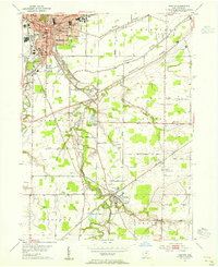 1953 Grafton1955 Print · USGSMid-century Lorain County reveals a landscape shaped by glacial ridges and the growing suburbs of Elyria. Genealogists can locate family sites near Butternut Ridge Cem or trace rural landmarks like the Grafton State Farm and the WEOL Radio Towers.
 - 1953 Map of Avon, 1955 Print
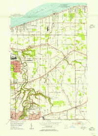 1953 Avon1955 Print · USGSCoastal Lorain County in the mid-fifties reveals a landscape of growing lakefront towns and historic ridgeline roads. Genealogists and local historians can trace the foundations of Avon Lake, the rural reaches of Shawville, and parish sites like St Teresa Ch.
 - 1956 Map of Toledo, 1968 Print
 1956 Toledo1968 Print · USGSNorthwest Ohio and the Lake Erie shoreline are shown in detail during the late fifties, showcasing a landscape of heavy industry, railroads, and island communities. Genealogists and historians can trace rail networks like the Chesapeake & Ohio RR or locate landmarks such as the Erie Proving Ground and Kelleys Island.4 unique versions available
End of results
Showing maps 1-3 of 3
Top cities near Elyria
- Lorain historical maps
- North Ridgeville historical maps
- Westlake historical maps
- North Olmsted historical maps
- Medina historical maps
- Avon historical maps
See more
Top neighborhoods of Elyria
- Washington Heights historical maps
- Washington Village historical maps
- Fieldstone Lakes historical maps
- Four Seasons at Chestnut Ridge historical maps
- Hunters Crossing historical maps
- Hunters Ridge historical maps
See more
Frequently asked questions
- What are the different types of historical maps available for Elyria?
- What is the oldest map of Elyria?
- Where can I purchase historical maps of Elyria for my home or office?
- Where can I download high-res historical maps of Elyria?
- Are there historical topographic maps available for Elyria?
- Is there historical aerial imagery available for Elyria?
- Where are historical maps of Elyria sourced from?