Old Maps of McConnelsville Historic District, McConnelsville
Explore 13 old maps of McConnelsville Historic District, spanning from 1910 to today. These high-resolution historic maps reveal how streets, neighborhoods, landmarks, and natural features evolved over time — perfect for genealogy, metal detecting, research, and local history exploration.
What you can do with these maps:
- See how McConnelsville Historic District changed over time: Compare historical maps to modern-day views to trace roads, homesites, rail lines & more.
- View detailed metadata: Each map includes creators, publishers, year, scale, and archive source.
- Overlay maps with satellite & LiDAR: Visualize the past alongside modern tools to explore terrain & human change.
- Trusted historical sources: Maps sourced from the USGS, Library of Congress, and other archives.
- Access maps your way: View online, download high-res files, or order prints for personal or research use.
Start exploring old maps of McConnelsville Historic District to uncover forgotten places, hidden landmarks, and the deep history beneath your feet.
McConnelsville Historic District, McConnelsville maps
(13)- 1910 Map of Mc Connelsville, 1948 Print
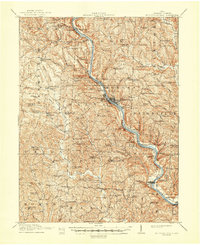 1910 Mc Connelsville1948 Print · USGSAlong the Muskingum River in the early 1900s, river navigation and rural commerce define the landscape. Genealogists can trace family roots through numerous country schools and churches like Mt Carmel Church and Rokeby Lock.
 - 1949 Map of Clarksburg
 1949 Clarksburg1949 Print · USGSThe upper Ohio River valley and the industrial heart of West Virginia come into focus during this post-war period. Genealogists and researchers can trace the rail corridors of the Baltimore and Ohio and locate centers like Fairmont, Grafton, and Waynesburg.
 - 1956 Map of Clarksburg, 1966 Print
 1956 Clarksburg1966 Print · USGSThe Ohio River valley and the industrial heart of West Virginia are seen here in the mid-1950s as rail and river commerce thrived. Researchers can trace historic transport lines like the Baltimore and Ohio RR and locate ancestral homes in Clarksburg, Moundsville, or Parkersburg.2 unique versions available
 - 1961 Map of Clarksburg
 1961 Clarksburg1961 Print · USGSThe mid-century industrial and river landscapes of West Virginia and Ohio are detailed here, centered on the Ohio River. Researchers can trace the Baltimore and Ohio rail lines connecting towns like Parkersburg, Clarksburg, and Monongah.
 - 1961 Map of Mc Connelsville, 1962 Print
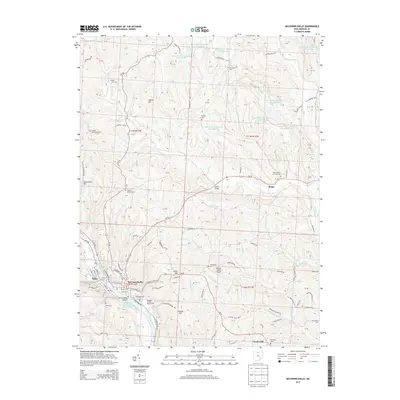
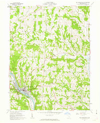 1961 Mc Connelsville1962 Print · USGSThe riverfront towns of Mc Connelsville and Malta anchor this early 1960s survey of the Muskingum valley. Researchers can trace rural life through McKendree Ch, Jackpot Cem, and the industry of local Strip Mines.4 unique versions available
 - 1980 Map of Senecaville, 1983 Print
 1980 Senecaville1983 Print · USGSEastern Ohio at the start of the eighties reveals a complex landscape of coal extraction and river commerce. Genealogists and historians can trace rail lines like the Conrail and Baltimore and Ohio RR connecting towns like Byesville and Woodsfield.2 unique versions available
 - 1988 Map of Clarksburg, 1989 Print
 1988 Clarksburg1989 Print · USGSThe central Appalachians are documented in detail during the late eighties, showing the industrial and river-based economies of West Virginia, Ohio, and Pennsylvania. Researchers can trace historic rail routes like the B & O RR and locate river towns from St Marys to Parkersburg.
 - 1994 Map of Mc Connelsville, 1998 Print
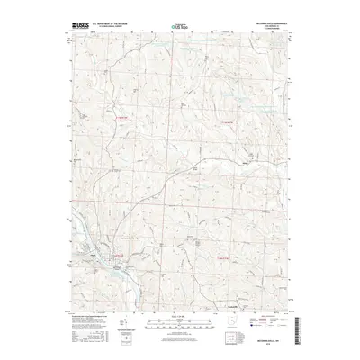
 1994 Mc Connelsville1998 Print · USGSThe Muskingum River valley in the mid-nineties shows a landscape of recovery where extractive industries meet small-town Ohio life. Genealogists and historians can trace family roots at Mc Connelsville, the Neelysville Sch, or McKendree Ch.
 - 2010 Map of McConnelsville, 2010 Print
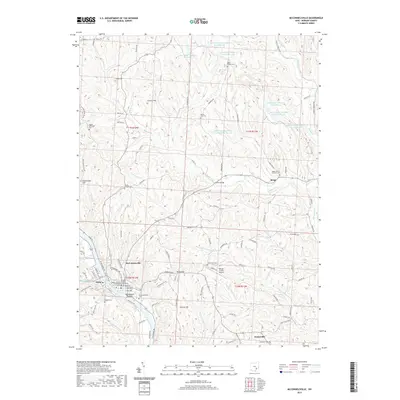
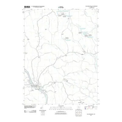 2010 McConnelsville2010 Print · USGSCovers McConnelsville Historic District, including McConnelsville, Malta, and other nearby areas
 - 2013 Map of McConnelsville, 2013 Print
 2013 McConnelsville2013 Print · USGSCovers McConnelsville Historic District, including McConnelsville, Malta, and other nearby areas
 - 2016 Map of McConnelsville, 2016 Print
 2016 McConnelsville2016 Print · USGSCovers McConnelsville Historic District, including McConnelsville, Malta, and other nearby areas
 - 2019 Map of McConnelsville, 2019 Print
 2019 McConnelsville2019 Print · USGSCovers McConnelsville Historic District, including McConnelsville, Malta, and other nearby areas
 - 2023 Map of McConnelsville, 2023 Print
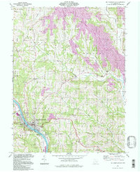
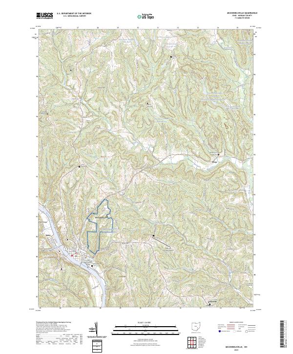 2023 McConnelsville2023 Print · USGSThe riverfront communities of McConnelsville and Malta thrive along the Muskingum in this modern-era study. Researchers can trace family history through numerous landmarks like the Morgan County Courthouse and rural burial sites such as Wesley Chapel Cem and Salem Cem.
End of results
Showing maps 1-13 of 13
Frequently asked questions
- What are the different types of historical maps available for McConnelsville Historic District?
- What is the oldest map of McConnelsville Historic District?
- Where can I purchase historical maps of McConnelsville Historic District for my home or office?
- Where can I download high-res historical maps of McConnelsville Historic District?
- Are there historical topographic maps available for McConnelsville Historic District?
- Is there historical aerial imagery available for McConnelsville Historic District?
- Where are historical maps of McConnelsville Historic District sourced from?