Old Maps of Bennington Township, Ohio for Metal Detecting
Plan your next treasure hunt with 31 historic maps of Bennington Township. Find old homesites, ghost towns, trails, and gathering spots that may be lost to time — perfect for identifying promising metal detecting locations.
- Locate forgotten sites: Uncover places like long-lost settlements, abandoned rail lines, or gathering spots.
- Plan better hunts: Use map overlays combined with LiDAR or satellite views to narrow in on historically rich areas.
- Made for detectorists: Thousands of hobbyists use these maps to discover relics, coins, and hidden history.
Use these historic maps to boost your research and find new opportunities beneath the surface of Bennington Township.
Bennington Township, OH maps
(31)- 1915 Map of Marengo, 1946 Print
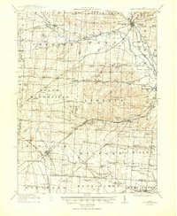
 1915 Marengo1946 Print · USGSMorrow and Delaware counties are shown in detail during the heyday of the steam railroad and the one-room schoolhouse. Genealogists and historians can locate vanished local landmarks like Swamp Angel School, the County Infirmary, and the Treaty Line.
 - 1915 Map of Fredericktown, 1950 Print
 1915 Fredericktown1950 Print · USGSKnox and Morrow Counties are shown here during the height of the steam-rail era. Genealogists can locate dozens of country schoolhouses like Salem and Updike, alongside family landmarks such as Braddock Mound and the County Infirmary.
 - 1943 Map of Marengo
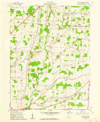
 1943 Marengo1943 Print · USGSCentral Ohio's agricultural heartland is documented here during the early war years, showing a landscape defined by small-town rail hubs and a dense network of rural schoolhouses. Researchers can trace family history through dozens of named sites like Chestnut Grove Sch, the County Infirmary, and settlements such as Westfield and Fulton.
 - 1943 Map of Fredericktown
 1943 Fredericktown1943 Print · USGSRural Knox County is captured here in the 1940s, showing a landscape of small townships connected by the Baltimore and Ohio RR and local schoolhouse districts. Genealogists can trace family footprints at Woodland Hall Sch, Bethel Ch, and ancient landmarks like Raleigh Mound.
 - 1950 Map of Marion
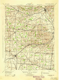
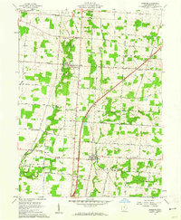
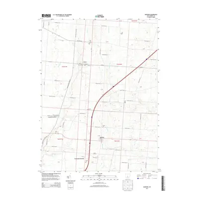
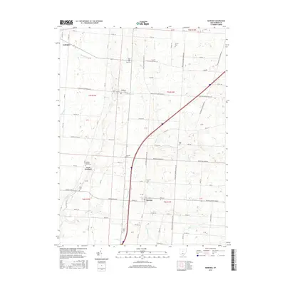
 1950 Marion1950 Print · USGSCentral Ohio was a powerhouse of rail and river industry at the mid-century point, serving as a vital corridor between the Great Lakes and the Ohio River valley. Genealogists and rail historians can trace the paths of the Erie RR and Nickel Plate Road through towns like Bucyrus, Galion, and Upper Sandusky.
 - 1961 Map of Chesterville, 1962 Print
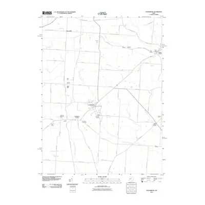
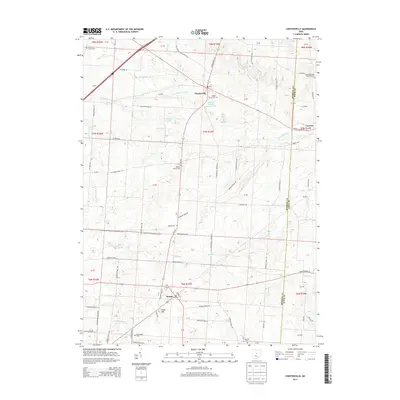
 1961 Chesterville1962 Print · USGSMorrow and Knox counties are shown here in the early 1960s, documenting a landscape of rural crossroads and river valleys. Researchers can trace ancestral locations through several family-named junctions like Bowen Corners and old church sites such as Harmony Chapel.2 unique versions available
 - 1961 Map of Centerburg, 1962 Print
 1961 Centerburg1962 Print · USGSKnox County is captured at the start of the 1960s, centered on the strategic rail junction at Centerburg. Genealogists and local historians can trace family plots at Houck Cem and Moreland Cem or locate old community landmarks like Milford Ch and Rich Hill.3 unique versions available
 - 1961 Map of Olive Green, 1962 Print
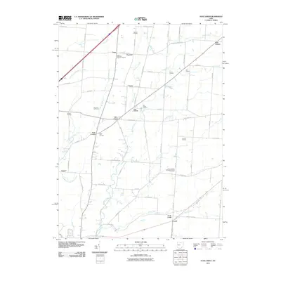
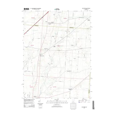
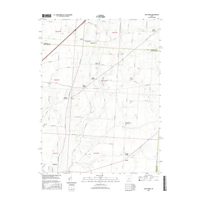
 1961 Olive Green1962 Print · USGSCentral Ohio farm country comes to life in the early 1960s, showing a landscape of small crossroads and creek-side settlements. Researchers can trace the path of the Pennsylvania railroad or locate rural landmarks like the Covered Bridge and Pagetown Cem.3 unique versions available
 - 1961 Map of Marengo, 1962 Print
 1961 Marengo1962 Print · USGSMorrow County is captured in the early sixties as a patchwork of productive farmland and timbered creek bottoms. Researchers can trace the path of the New York Central railroad and locate family landmarks like Benedict Church and Marengo Cem.2 unique versions available
 - 1962 Map of Marion
 1962 Marion1962 Print · USGSCentral Ohio during the post-war era showcases a dense network of railroad towns and emerging interstate highways. Genealogists can trace family roots in smaller settlements like Houcktown and Marseilles or locate landmarks near Indian Lake.
 - 1966 Map of Marion, 1968 Print
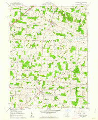
 1966 Marion1968 Print · USGSCentral Ohio in the mid-sixties is captured during a period of rapid highway expansion and industrial connectivity. Genealogists and historians can trace rail-and-river networks through towns like Marion, Urbana, and Mount Vernon, or locate landmarks such as Malabar Farm and Black Hand Rock.3 unique versions available
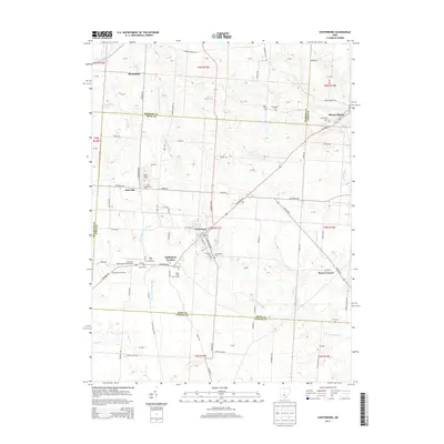
 - 2010 Map of Chesterville, 2010 Print
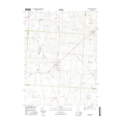
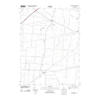 2010 Chesterville2010 Print · USGSCovers Bennington Township, including Chesterville, Sparta, and other nearby areas
 - 2010 Map of Marengo, 2010 Print
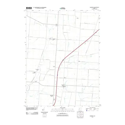 2010 Marengo2010 Print · USGSCovers Bennington Township, including Cardington, Marengo, and other nearby areas
 - 2010 Map of Olive Green, 2010 Print
 2010 Olive Green2010 Print · USGSCovers Bennington Township, including Sunbury, Peru Township, and other nearby areas
 - 2010 Map of Centerburg, 2010 Print
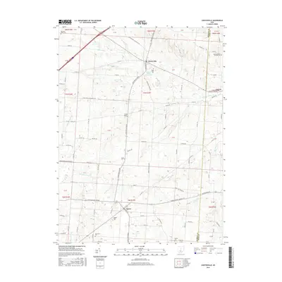
 2010 Centerburg2010 Print · USGSCovers Bennington Township, including Centerburg, Hedington Corners, and other nearby areas
 - 2013 Map of Centerburg, 2013 Print
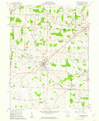
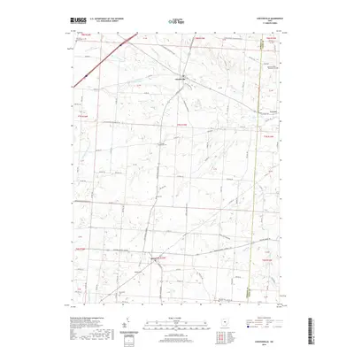
 2013 Centerburg2013 Print · USGSCovers Bennington Township, including Centerburg, Hedington Corners, and other nearby areas
 - 2013 Map of Marengo, 2013 Print
 2013 Marengo2013 Print · USGSCovers Bennington Township, including Cardington, Marengo, and other nearby areas
 - 2013 Map of Olive Green, 2013 Print
 2013 Olive Green2013 Print · USGSCovers Bennington Township, including Sunbury, Peru Township, and other nearby areas
 - 2013 Map of Chesterville, 2013 Print
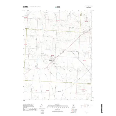
 2013 Chesterville2013 Print · USGSCovers Bennington Township, including Chesterville, Sparta, and other nearby areas
 - 2016 Map of Marengo, 2016 Print
 2016 Marengo2016 Print · USGSCovers Bennington Township, including Cardington, Marengo, and other nearby areas
 - 2016 Map of Olive Green, 2016 Print
 2016 Olive Green2016 Print · USGSCovers Bennington Township, including Sunbury, Peru Township, and other nearby areas
 - 2016 Map of Centerburg, 2016 Print
 2016 Centerburg2016 Print · USGSCovers Bennington Township, including Centerburg, Hedington Corners, and other nearby areas
 - 2016 Map of Chesterville, 2016 Print
 2016 Chesterville2016 Print · USGSCovers Bennington Township, including Chesterville, Sparta, and other nearby areas
 - 2019 Map of Chesterville, 2019 Print
 2019 Chesterville2019 Print · USGSCovers Bennington Township, including Chesterville, Sparta, and other nearby areas
 - 2019 Map of Centerburg, 2019 Print
 2019 Centerburg2019 Print · USGSCovers Bennington Township, including Centerburg, Hedington Corners, and other nearby areas
Showing maps 1-25 of 31
Top cities near Bennington Township
- Delaware historical maps
- Johnstown historical maps
- Berkshire historical maps
- Mount Gilead historical maps
- Sunbury historical maps
- Claridon historical maps
See more
Top neighborhoods of Bennington Township
Frequently asked questions
- What are the different types of historical maps available for Bennington Township?
- What is the oldest map of Bennington Township?
- Where can I purchase historical maps of Bennington Township for my home or office?
- Where can I download high-res historical maps of Bennington Township?
- Are there historical topographic maps available for Bennington Township?
- Is there historical aerial imagery available for Bennington Township?
- Where are historical maps of Bennington Township sourced from?