Old Maps of Maysville, Ohio for Hiking & Exploration
Hike through history with 13 historic maps of Maysville. Explore old trails, ghost towns, and forgotten backroads — perfect for outdoor adventurers and local explorers.
- Rediscover forgotten places: Map out old mining camps, roads, and footpaths that no longer exist on modern maps.
- Layer with modern tools: Combine with LiDAR or satellite views to plan hikes through historical terrain.
- Made for exploration: Popular among hikers, overlanders, and local history lovers.
Use these maps to find adventure and explore the hidden past of Maysville.
Maysville, OH maps
(13)- 1910 Map of Zanesville, 1939 Print
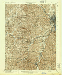 1910 Zanesville1939 Print · USGSMuskingum and Perry counties are shown here in the early twentieth century as Zanesville emerged as a powerhouse of rail and river commerce. Researchers can trace historic transport routes like the National Road or locate local landmarks such as Moxahala Park and the Fultonham (Axline PO).2 unique versions available
 - 1947 Map of Columbus, 1948 Print
 1947 Columbus1948 Print · USGSCentral Ohio in the late 1940s is captured in this survey, showing the post-war transition of its rail hubs and military airfield expansions. Genealogists and historians can trace the paths of the Ohio Canal, the Pennsylvania RR lines, and the Camp Sherman Military Reservation.
 - 1961 Map of Columbus
 1961 Columbus1961 Print · USGSCentral and Southern Ohio are captured here in the early sixties, as the region's industrial rail hubs and military bases reached their peak. Genealogists and historians can trace the transition from urban Columbus to rural townships along the Scioto River, locating Lockbourne USAF and old junctions like Washington Court House.
 - 1961 Map of Zanesville West, 1962 Print
 1961 Zanesville West1962 Print · USGSZanesville and its river valleys are captured here in the early sixties as the city expanded alongside its industrial and rail hubs. Researchers can trace local lineage through numerous burial grounds like United Jewish Cem or explore the New York Central rail lines and early Strip Mine sites.4 unique versions available
 - 1962 Map of Columbus
 1962 Columbus1962 Print · USGSCentral Ohio during the early sixties reveals a transition from the industrial corridors of Columbus to the forested ridges of the south. Genealogists and historians can trace the rail networks of the Baltimore & Ohio RR and find local landmarks like Washington Court House and Camp Sherman Military Reservation.
 - 1967 Map of Columbus, 1969 Print
 1967 Columbus1969 Print · USGSCentral Ohio during the late sixties serves as a vital corridor of rail and aviation, from the industrial streets of Springfield to the hangar lines of Lockbourne Air Force Base. Genealogists and researchers can trace the growth of towns like Circleville and London or locate rural landmarks such as St Paul church and the London Correctional Institution.2 unique versions available
 - 1984 Map of Lancaster, 1985 Print
 1984 Lancaster1985 Print · USGSCentral Ohio and the Hocking Valley come into focus during the mid-eighties as suburban growth meets the wooded ridges of the southeast. Researchers can trace transportation networks through Buckeye Lake or locate landmarks like Flint Ridge State Memorial and Moxahala Park.
 - 1992 Map of Zanesville West, 1995 Print
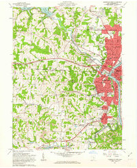
 1992 Zanesville West1995 Print · USGSZanesville and the Muskingum River valley are shown in the early nineties, documenting the city's growth and its industrial periphery. Researchers can locate numerous family landmarks like Wesley Union Cem, Williams Cem, and schools such as Norval Park Sch.
 - 2010 Map of Zanesville West, 2010 Print
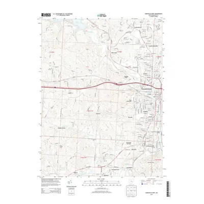
 2010 Zanesville West2010 Print · USGSCovers Maysville, including Zanesville, South Zanesville, and other nearby areas
 - 2013 Map of Zanesville West, 2013 Print
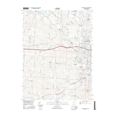
 2013 Zanesville West2013 Print · USGSCovers Maysville, including Zanesville, South Zanesville, and other nearby areas
 - 2016 Map of Zanesville West, 2016 Print
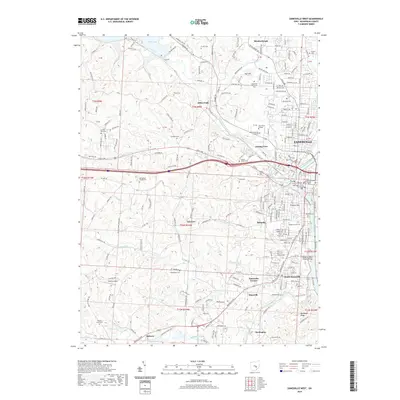
 2016 Zanesville West2016 Print · USGSCovers Maysville, including Zanesville, South Zanesville, and other nearby areas
 - 2019 Map of Zanesville West, 2019 Print
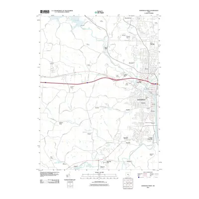
 2019 Zanesville West2019 Print · USGSCovers Maysville, including Zanesville, South Zanesville, and other nearby areas
 - 2023 Map of Zanesville West, 2023 Print
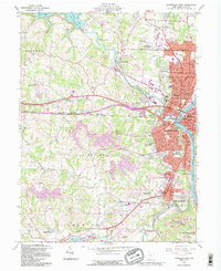
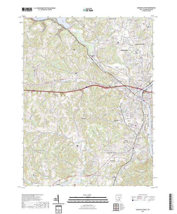 2023 Zanesville West2023 Print · USGSZanesville and its river confluence appear here in the early twenty-first century, showing the urban evolution of this Muskingum County hub. Researchers can locate family sites at Mount Calvary Cem and trace historic neighborhoods near the Muskingum County Courthouse.
End of results
Showing maps 1-13 of 13
Top cities near Maysville
- Zanesville historical maps
- New Lexington historical maps
- Hopewell historical maps
- Crooksville historical maps
- South Zanesville historical maps
- McConnelsville historical maps
See more
Frequently asked questions
- What are the different types of historical maps available for Maysville?
- What is the oldest map of Maysville?
- Where can I purchase historical maps of Maysville for my home or office?
- Where can I download high-res historical maps of Maysville?
- Are there historical topographic maps available for Maysville?
- Is there historical aerial imagery available for Maysville?
- Where are historical maps of Maysville sourced from?