1990s Maps of Noble County, Ohio
Explore 16 historic maps of Noble County from the 1990s. These maps offer a rare glimpse into what life looked like during the 1990s — showing old roads, neighborhoods, homes, and landmarks that have changed or disappeared over time.
Whether you're researching your family's past, planning a metal detecting trip, or studying how Noble County's landscape evolved across the 1990s, these high-resolution maps are a powerful tool for exploring the history of this region.
- Focus on a specific era: All maps on this page are from the 1990s, giving you a focused view of this time period.
- See what’s changed: Compare century-old streets, trails, and buildings to today's modern landscape using overlays and satellite layers.
- Research with precision: Use these maps for genealogy, historical research, land use analysis, or educational projects.
- View, download, or print: Maps are fully viewable online in high resolution, and can be downloaded or printed for your own records.
Start exploring Noble County's history through authentic maps from the 1990s. This is your window into the past.
Noble County, OH maps
(16)- 1994 Map of Macksburg, 1998 Print
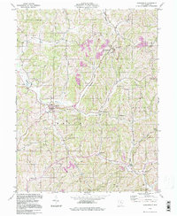
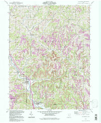 1994 Macksburg1998 Print · USGSSoutheastern Ohio’s ridge-and-valley landscape is documented here in the 1990s as the communities of the Noble and Washington county border maintained their rural character. Researchers can pinpoint several family burial sites like Hesson Cem and Rado Cem or trace the early paths through South Olive and Middleburg.
 - 1994 Map of Dalzell, 1998 Print
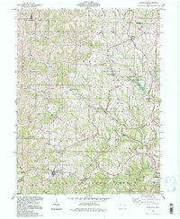
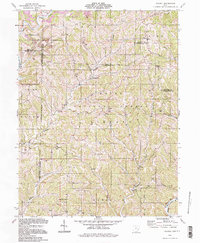 1994 Dalzell1998 Print · USGSSoutheast Ohio's deeply wooded ridges and hollows appear in the 1990s as a landscape of small hamlets and resource extraction. Genealogists can trace family names and local landmarks at Masterton Cem, Waxler Ch, and the settlement of Germantown.
 - 1994 Map of Quaker City, 1998 Print
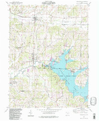
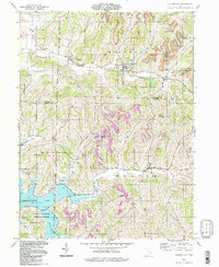 1994 Quaker City1998 Print · USGSEastern Ohio hill country in the mid-nineties shows a landscape defined by pioneer survey lines and mineral extraction. Trace family sites near Salesville, Batesville, and the Richland Meetinghouse or follow the waters of Senecaville Lake.
 - 1994 Map of Cumberland, 1998 Print
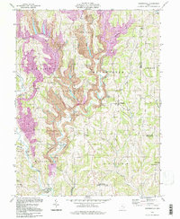
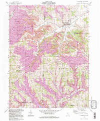 1994 Cumberland1998 Print · USGSSoutheastern Ohio's hill country is captured here during the 1990s as it transitioned through large-scale land reclamation. Genealogists and local historians can trace family locations near Young Hickory, Cumberland, and rural landmarks like Mt Zion Cem or the Township Sch.
 - 1994 Map of Reinersville, 1998 Print
 1994 Reinersville1998 Print · USGSThe rugged hills of Morgan and Noble counties are captured here in a period of heavy industry and rural settlement. Trace family roots at Lebanon Ch or find old school sites like Bristol Sch among the sprawling Strip Mines.
 - 1994 Map of Byesville, 1998 Print
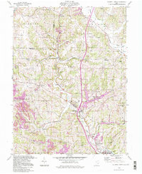
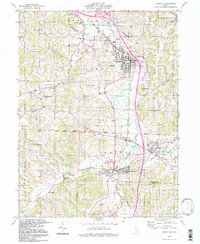 1994 Byesville1998 Print · USGSByesville and Pleasant City appear here in the mid-1990s, surrounded by an active landscape of extraction and deep-rooted community ties. Researchers can trace family history through sites like Greenwood Cemetery, Beech Grove Sch, and the Old Railroad Grade.
 - 1994 Map of Caldwell South, 1998 Print
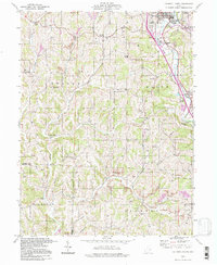 1994 Caldwell South1998 Print · USGSSoutheastern Ohio's Noble and Morgan Counties show a landscape shaped by coal mining and rail transport in the mid-1990s. Genealogists and historians can locate numerous rural burial sites like Sailor Cem and Swickard Cem alongside the CONRAIL corridor.
 - 1994 Map of Barnesville, 1998 Print
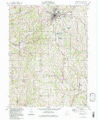 1994 Barnesville1998 Print · USGSBelmont County in the late twentieth century reveals a transition from traditional agriculture to a landscape of mining and rural industry. Genealogists can locate family names and burial sites at Old Quaker Cem, while historians can trace community growth through Olney Sch and the Howell Airport.
 - 1994 Map of Sarahsville, 1998 Print
 1994 Sarahsville1998 Print · USGSNoble County's ridge-and-hollow landscape in the late twentieth century reveals a community deeply tied to its geography and resource extraction. Genealogists can trace family roots through landmarks like Archer Cem, Green Valley Ch, and the small settlement of Mt Ephraim.
 - 1994 Map of Lewisville, 1998 Print
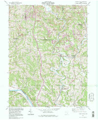
 1994 Lewisville1998 Print · USGSMonroe County's rugged ridge-and-valley landscape is documented here in the 1990s, showing a region defined by rural settlements and early oil exploration. Researchers can trace ancestral locations from Lewisville to Malaga, or locate remote sites like the Free Burial Ground and St Johns Ch.
 - 1994 Map of Lowell, 1998 Print
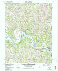 1994 Lowell1998 Print · USGSThe Muskingum River valley in the 1990s remains a landscape of river-bend hamlets and deep-rooted family landmarks. Genealogists and local historians can trace legacy sites like the Old German Cem, Our Lady of Mercy Ch, and the riverside community of Coal Run.
 - 1994 Map of Caldwell North, 1998 Print
 1994 Caldwell North1998 Print · USGSSoutheast Ohio’s rural and industrial character is preserved here in the late twentieth century, before further changes altered the landscape. Researchers can trace old family sites and mining operations near Belle Valley, Hoskinsville, and the McElroy Cem.
 - 1994 Map of Senecaville, 1998 Print
 1994 Senecaville1998 Print · USGSSoutheastern Ohio's Guernsey and Noble counties appear here during the late twentieth century, centered on the waters of Senecaville Lake. Researchers can trace the Baltimore and Ohio rail line or locate rural landmarks like Kings Mine and St Patricks Cem.
 - 1994 Map of Lower Salem, 1998 Print
 1994 Lower Salem1998 Print · USGSWashington County’s ridge-and-valley landscape is documented here in the 1990s, where the confluence of the Duck Creek forks defines the local geography. Genealogists can locate family sites at Flanders Cem, Mt Ephraim Ch, or the small community of Whipple along the river.
 - 1994 Map of Summerfield, 1998 Print
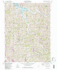 1994 Summerfield1998 Print · USGSSoutheastern Ohio's ridge country is beautifully detailed here in the mid-1990s, centering on the village of Summerfield and the waters of Senecaville Lake. Genealogists and hikers can locate numerous hillside burial grounds like Calais Cem and Bracken Cem, or trace the winding Little Muskingum River.
 - 1994 Map of Stafford, 1998 Print
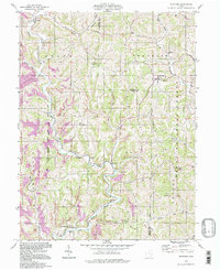 1994 Stafford1998 Print · USGSThe Noble and Monroe county borderlands appear in the mid-nineties as a landscape of deep valleys and forested ridges. Genealogists and historians can trace old homesteads and landmarks like Mt Tabor Ch, Township Sch, and the Zion Cem.
End of results
Showing maps 1-16 of 16
Top cities of Noble County
- Caldwell historical maps
- Sharon historical maps
- Elk historical maps
- Summerfield historical maps
- Belle Valley historical maps
- Sarahsville historical maps
See more
Frequently asked questions
- What are the different types of historical maps available for Noble County?
- What is the oldest map of Noble County?
- Where can I purchase historical maps of Noble County for my home or office?
- Where can I download high-res historical maps of Noble County?
- Are there historical topographic maps available for Noble County?
- Is there historical aerial imagery available for Noble County?
- Where are historical maps of Noble County sourced from?